- Knoxville Downtown Island Airport
-
Knoxville Downtown Island Airport
Knoxville Downtown Island Home AirportIATA: none – ICAO: KDKX – FAA LID: DKX Summary Airport type Public Owner Knoxville Metropolitan Airport Authority Serves Knoxville, Tennessee Elevation AMSL 833 ft / 254 m Coordinates 35°57′50″N 083°52′25″W / 35.96389°N 83.87361°W Runways Direction Length Surface ft m 8/26 3,499 1,066 Asphalt Statistics (2008) Aircraft operations 82,456 Based aircraft 111 Source: Federal Aviation Administration[1] Knoxville Downtown Island Airport[1] or Knoxville Downtown Island Home Airport[2] (ICAO: KDKX, FAA LID: DKX), often referred to as Island Home Airport, is a general aviation airport located approximately one-half mile east of downtown Knoxville, in Knox County, Tennessee, United States.
Although most U.S. airports use the same three-letter location identifier for the FAA and IATA, this airport is assigned DKX by the FAA but has no designation from the IATA.[3]
The airport has one 3,500-ft runway running east and west and on average has 312 aircraft operations per day. DKX operates as an uncontrolled field. Up until 2007, a tower existed at the field. The tower was in service during World War II but due to asbestos in the cab it was permanently quarantined and it is never to be used again. The airport authorities demolished the tower and may consider building a new one.
Contents
History
Downtown Island Airport has a rich history rooted in Knoxville aviation that dates back to the early 1930’s. The Island Airport was opened in 1930 by one of Knoxville’s earliest aviators, Tom Kesterson. The makeshift airport, located on Dickinson’s Island had a 4,000-foot runway and was intended to be the first home of commercial air service in Knoxville. Shortly after its introduction, airline service came to Knoxville in July 1934 when American began flying a mail route through Island Airport and on to Washington D.C. and New York. Two daily flights were also offered between Knoxville and Washington D.C. with up to eight passengers on each flight. At this time, Gus Gremiliam was the only employee at the airport.
Regular airline service to Knoxville did not occur until January 15, 1936, after many temporary setbacks and start-ups. This event was celebrated by City Manager, Knoxville officials, and residents of the area marking the beginning of many aviation endeavors in Knoxville’s future.
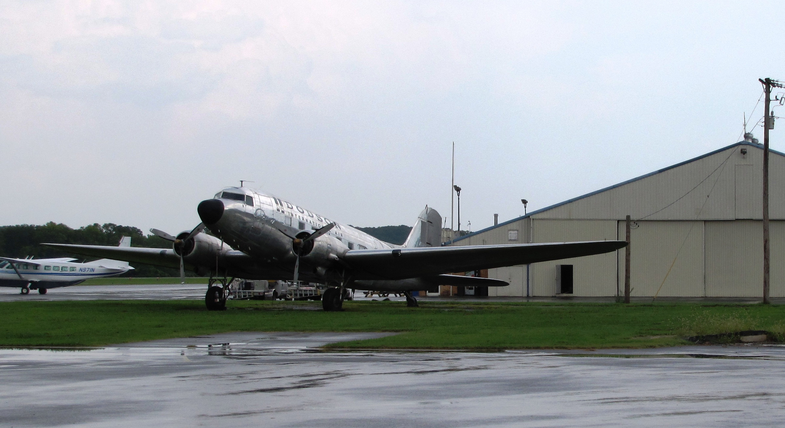
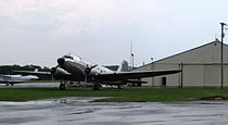 Aircraft and hangar at the Island Home Airport
Airport ownership changed hands several times in the 1940’s. Ferris Thomas bought the hangar in the spring of 1941, when the airport was privately owned. Ownership changed again in 1942 when operations were sold to Elmer Wood. Again in 1943, H.F. Wattenbarger purchased the Island Airport property and wanted to use it primarily as a farm. During the 1930’s and 1940’s both farming and flying existed at Island Airport. In 1943, Wattenbarger began leasing the airport for the training of three hundred Army Air Cadets in a War Training Service program. When training was completed, Wattenbarger resumed full operation as a private airport and farm. During the late 1940’s, Robert Campbell, owner and operator of Campbell’s Aero Service at Island Airport, became the primary operator and FBO for almost 20 years.
Evelyn "Mama Bird" Bryant Johnson, Evelyn Johnson who in 2010 is 100 years old and the holder of the Guinness Book of Records "most hours logged by a woman pilot" started flying at Knoxville Island Home Airport. She says "She first flew in a barnstormers biplane in 1929, but got serious about flying after seeing a three inch square ad in the Sunday paper while waiting for church. It said “Learn to fly!” so the next Sunday “I took the train, rode a bus, walked a mile and rowed a boat across a river to get to Knoxville Island Home Airport for my first lesson on October 1, 1944 and after eight hours I soloed on November 8, 1944 in a J-3 (Piper Cub} aircraft." (from phone interview, March, 2010)
Facilities and aircraft
Knoxville Downtown Island Airport covers an area of 200 acres (81 ha) at an elevation of 833 feet (254 m) above mean sea level. It has one asphalt paved runway designated 8/26 which measures 3,499 by 74 feet (1,066 x 23 m).[1]
For the 12-month period ending December 22, 2008, the airport had 82,456 aircraft operations, an average of 225 per day: 99% general aviation, <1% air taxi and <1% military. At that time there were 137 aircraft based at this airport: 78% single-engine, 15% multi-engine, 5% helicopter and 2% glider.[1]
References
- ^ a b c d FAA Airport Master Record for DKX (Form 5010 PDF), effective 2009-07-02.
- ^ Airport page at City of Knoxville website
- ^ Great Circle Mapper: KDKX - Knoxville, Tennessee - Knoxville Downtown Island Airport
External links
- FAA Terminal Procedures for DKX, effective 20 October 2011
- Resources for this airport:
- AirNav airport information for DKX
- FlightAware airport information and live flight tracker
- SkyVector aeronautical chart for DKX
Categories:- Airports in Tennessee
- Buildings and structures in Knoxville, Tennessee
- Economy of Knoxville, Tennessee
- Transportation in Knoxville, Tennessee
Wikimedia Foundation. 2010.