- Briar Hill-Belgravia
Infobox City
official_name = Briar Hill-Belgravia
subdivision_type2 = Country
subdivision_name2 =Canada
subdivision_type1 = Province
subdivision_name1 =Ontario
subdivision_type = City
subdivision_name =Toronto 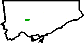
mapsize=150px
map_caption=Location of Briar Hill-Belgravia within TorontoBriar Hill-Belgravia is a neighbourhood in the city of
Toronto . It is bounded on the south by Eglinton Avenue West, on the west by the CN Railway tracks, on the north by a line north of Roselawn Avenue/Castlefield Avenue, ultimately running between Briar Hill Avenue and Stayner Avenue, and on the east by a line between Farleigh Crescent and Marlee Avenue. A second CNR rail alignment cuts east-west through the middle of the neighbourhood known as the Belt Line, although the tracks have been removed as of 2008 as part of the "York Beltline Trail".The area is modest with house values and average incomes in the lower quadrant compared with the Toronto average. The area's inhabitants are diverse; there is a very large Roman Catholic base, and Italin, Russian, and Portuguese are widely spoken as home languages. More than half of the immigrant population of Briar Hill-Belgravia arrived after 1981, with a majority of immigrants in 1996 and 2001 arriving from the Philippines, with Tagalog becoming a major immigrant language of the neighbourhood.
Toronto Neighbourhood Geography
North =Yorkdale-Glen Park
East = Forest Hill North
South = Oakwood-Vaughan;Caledonia-Fairbank
West =Beechborough-Greenbrook
Center = Briar Hill-BelgraviaExternal links
* [http://www.toronto.ca/demographics/cns_profiles/cns108.htm City of Toronto - Briar Hill-Belgravia Neighbourhood Profile]
Wikimedia Foundation. 2010.