- Mackenzie Basin
-
For the basin of the Canadian river, see Mackenzie River.
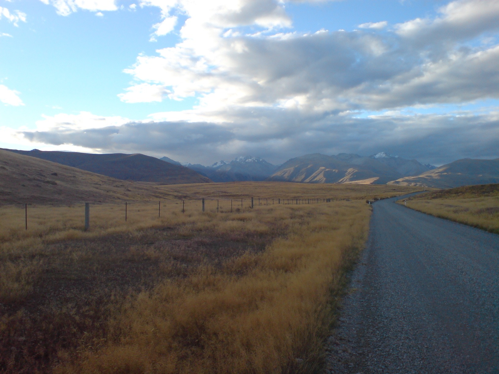
 The Mackenzie Country's typical autumn colouration.
The Mackenzie Basin (popularly and traditionally known as the Mackenzie Country), is an elliptical intermontane basin, located in the Mackenzie and Waitaki Districts, near the centre of the South Island of New Zealand. It is the largest such basin in New Zealand.[1] Historically famous mainly for sheep farming, the sparsely populated area is now also a popular tourism destination.
The basin was named in the 1850s by and after James Mckenzie (or in his native Scottish Gaelic: Seumas MacCoinneach), a shepherd and sheep thief of Scottish origin,[2] who herded his stolen flocks in what was then an area almost totally empty of any human habitation, though Māori previously lived there intermittently.[3] After his capture, the area was soon divided up amongst new sheep pasture stations in 1857.[4]
Contents
Geography
 The Southern Alps form the northern and western boundaries of the basin.
 The Ben Ohau Range from the eastern shore of Tekapo B hydrogenerator station headgate pond.
The basin extends approximately 100 kilometers (62 mi) north to south, and 40 kilometers (25 mi) east to west. The Southern Alps constitute its western edge. The majority of the Mackenzie Basin is within Canterbury, although the area to the south of the Waitaki River is in Otago.
Using State Highway 8, it can be accessed via Burkes Pass (elevation 709m / 2,326 ft) from the north and the Lindis Pass (elevation 965m / 3,166 ft) from the south, or via State Highway 83 through the Waitaki Valley from the east. Aside from these passes, the terrain is generally highest at the northern end and gradually descends in a southward direction.
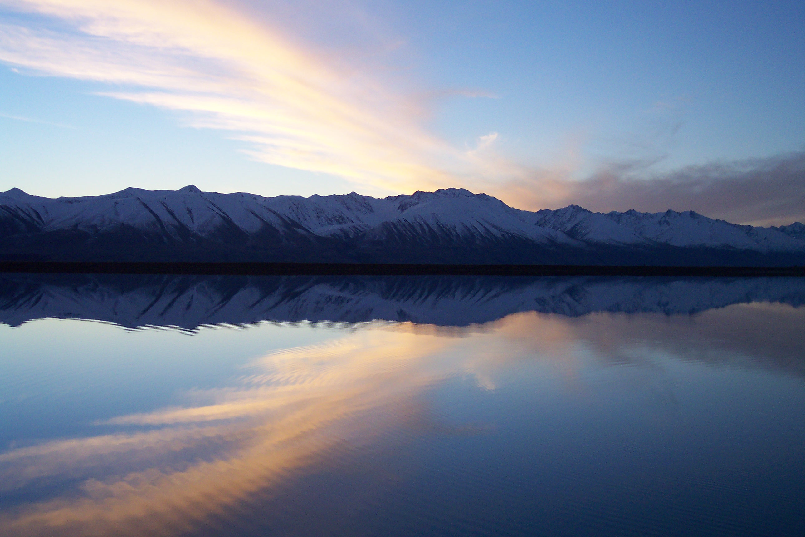
Prominent rivers crossing the Mackenzie Basin include the Waitaki, the Ahuriri, the Hakataramea and the Tekapo Rivers. Lakes Ohau, Pukaki, Alexandrina and Tekapo lie within the Mackenzie Basin, as do the artificial hydroelectric lakes of Ruataniwha, Benmore and Aviemore.
Settlement and activities
Sparsely populated, and with only five settlements (Lake Tekapo, population <500; Mount Cook Village, population <150; Twizel, population <1,000; Omarama, population <400 and Fairlie, population <800), the Mackenzie Country comprises an area of huge glacial lakes and snow-capped mountains, particularly favoured by tourists and skiers.
The Ohau skifield near Omarama, and Roundhill and Mount Dobson Ski Areas at Lake Tekapo, are small commercial skifields popular amongst many living in Canterbury and Otago. Roundhill and Ohau have invested in (or are considering investing in) snowmaking equipment to ensure fields can always open during the seasons. The fields had 14,000 (Roundhill) and 12,083 (Ohau) skier days in 2004, with Roundhill also noting that 85% of its guests came from NZ.[5] The smaller skifields of the area are less crowded than those in the Queenstown area,[6] with an official report also noting that part of the attraction of the fields lies in the "alternative and relaxed experience [compared] to those offered by larger fields closer to Christchurch and Queenstown".[5]
The Mackenzie Country is frequently utilised as the principal and second-unit location for television commercials, documentaries, and motion pictures, including much of Peter Jackson's epic Lord of the Rings film trilogy.
Gliding is another common activity within the Mackenzie Basin, and the area was host to a Gliding World Cup event in 1995, as well as being the home of several gliding clubs, airfields, and numerous private glider pilots, of both amateur and professional status.
Due to its clean, dry and dark sky, the Mackenzie Basin serves as an important area for New Zealand-based astronomy, with a number of related facilities located there, including the nation's premier astronomical observatory, the University of Canterbury's Mount John University Observatory, and several amateur observatories. Astronomy-related tourism is an increasing contributor to the area's economy, with more astro-tourism ventures in development near Lake Tekapo, Mount Cook village (planetarium) and Omarama.[7]
Plans are currently well-progressed to have the Mackenzie Basin designated as a Dark Sky Reserve, possibly the World's first,[8] that will probably result in strengthening local ordinances to prevent light pollution. A recent World Heritage Committee meeting in Seville in 2009 was positive about the proposed project.[9]
Environmental issues
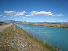 Many canals have been built in the Basin, diverting water to generate hydroelectricity.
The original vegetation cover prior to human settlement has been completely transformed in the basin and indeed most of the surrounding Canterbury-Otago tussock grasslands ecoregion, initially due fires lit by Maori and European settlers, and in more recent times by farming activity and by pests. A relatively weakly settled area, in recent times (late 2000s), numerous proposals for new farming operations have locals fearing that the agriculture will be transformed from often family-held farms to large agribusiness operations causing increased local ecologic damage and siphoning off capital overseas. The effluent from proposed factory farming schemes, one proposed set of which would release sewage the equivalent of the city of Christchurch, is also feared to put further pressure on the ecosystems of local lakes and rivers.[10] Over 5,000 submissions have been received in opposition to the dairy farming proposals, including from tourism associations, which fear that the industrial agriculture will damage the reputation of the area as well as its ecosystems.[11]
The extensive network of canals for hydroelectric schemes posed a threat to the Black Stilt (or kaki), an endangered river wading bird. A captive breeding programme was set up and it is administered by the Department of Conservation.[12]
The MacKenzie Basin is one of the areas where wilding conifers proliferate. These weed trees cover large areas sometimes to a very high density and therefore excluding native vegetation and reducing the amount of available pasture. Some areas have control measures in place to prevent the trees from spreading.
Rabbits are a common invasive species in the area affect both agricultural production and biodiversity. Rabbit numbers dropped after the introduction of rabbit haemorrhagic disease virus (RCD) but are now increasing. The Department of Conservation has plans to drop sodium fluoroacetate (1080) laced poison bait to control the rabbit numbers. This is seen as necessary due to the disproportionally high number of threatened plant species in the Mackenzie Basin. The plan attracted opposition at submission hearings.[13]
There is currently a high demand for water to irrigate the MacKenzie Basin, with 126 resource consents from 36 applicants before Environment Canterbury as of mid 2009. The water would be used to irrigate an area of 27,125 hectares (67,030 acres), but the schemes are opposed by many locals and the Department of Conservation for the potential ecological effects, and since it may clash with a proposed MacKenzie Basin Drylands Park.[14] Forest and Bird are also opposed to the irrigation for a variety of conservation reasons.[15]
References
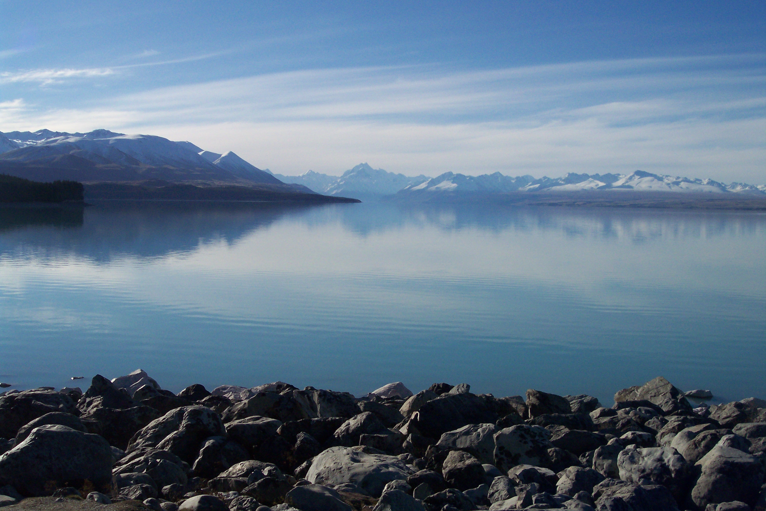
 Mount Cook from the southern shore of Lake Pukaki.
- ^ Mackenzie Basin routes (from the DOC website. Retrieved 2007-12-06.)
- ^ "Save our Mackenzie Country". Royal Forest and Bird Protection Society of New Zealand. http://www.forestandbird.org.nz/what-we-do/campaigns/save-the-mackenzie. Retrieved 27 January 2011.
- ^ History of the Lake Tekapo Area (from the Lake Tekapo Tourism website. Accessed 2008-02-12.)
- ^ James Mckenzie (from the Te Ara Encyclopedia of New Zealand website)
- ^ a b Waitaki Catchment Recreation and Tourism Activities - Skiing Summary (Ministry for the Environment, Wellington, New Zealand, December 2004. Accessed 2008-12-21.)
- ^ Delightful despite weather gods - The New Zealand Herald, Travel: NZ Special Issue, Tuesday 06 November 2007, Page D6
- ^ Edmund Hillary Alpine Centre Planetarium (from the Hermitage Hotel's website. Retrieved 2007-11-06.)
- ^ Bruce, David (19 November 2008). "World Heritage status likely for Mackenzie basin". Otago Daily Times. http://www.odt.co.nz/the-regions/north-otago/32364/world-heritage-status-likely-mackenzie-basin/. Retrieved 19 October 2011.
- ^ "Residents want night sky protected". The New Zealand Herald. Newstalk ZB. 11 July 2009. http://www.nzherald.co.nz/nz/news/article.cfm?c_id=1&objectid=10583861. Retrieved 19 October 2011.
- ^ "A national treasure is being squandered". The New Zealand Herald. 2010-02-08. http://www.nzherald.co.nz/nz/news/article.cfm?c_id=1&objectid=10624719. Retrieved 2010-02-08.
- ^ "Movie star fights cows coming home". The New Zealand Herald. 10 March 2010. http://www.nzherald.co.nz/nz/news/article.cfm?c_id=1&objectid=10631033. Retrieved 10 March 2010.
- ^ Department of Conservation - Black Stilt
- ^ Williams, David (2009-05-26). "Plan for 1080 drops in MacKenzie Basin". The Press. http://www.stuff.co.nz/the-press/news/2441711/Mackenzie-1080-drop-plan. Retrieved 2009-06-14.
- ^ Williams, David (2009-05-30). "MacKenzies Basin 'water grab' opposed". The Press. http://www.stuff.co.nz/the-press/news/2458741/Mackenzie-Basin-water-grab-opposed. Retrieved 2009-06-05.
- ^ Forest and Bird "Don’t turn the Mackenzie Basin green, Forest & Bird warns". Royal Forest and Bird Protection Society of New Zealand. 2009-05-31. http://forestandbird.colo.onesquared.net/what-we-do/publications/media-releases/don%E2%80%99t-turn-the-mackenzie-basin-green-forest-bird-warns Forest and Bird. Retrieved 2010-02-08.
External links
- Aoraki Mt Cook Mackenzie District Council
- Twizel Te Manahuna area at the Department of Conservation
- Omarama Gliding Club
- List of local and national ski areas
- Observatories
- Mackenzie Guardians - a lobby group advocating for protection of the Mackenzie Basin
- Mackenzie Basin campaign at Forest and Bird
- Ecological threats to The MacKenzie country - Nicola Vallance, Forest and Bird advocate, explains
Categories:- Geography of the Canterbury Region
- Drainage basins of New Zealand


Wikimedia Foundation. 2010.