Lake Chemong

Lake Chemong
Lake Chemong
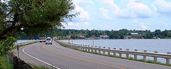
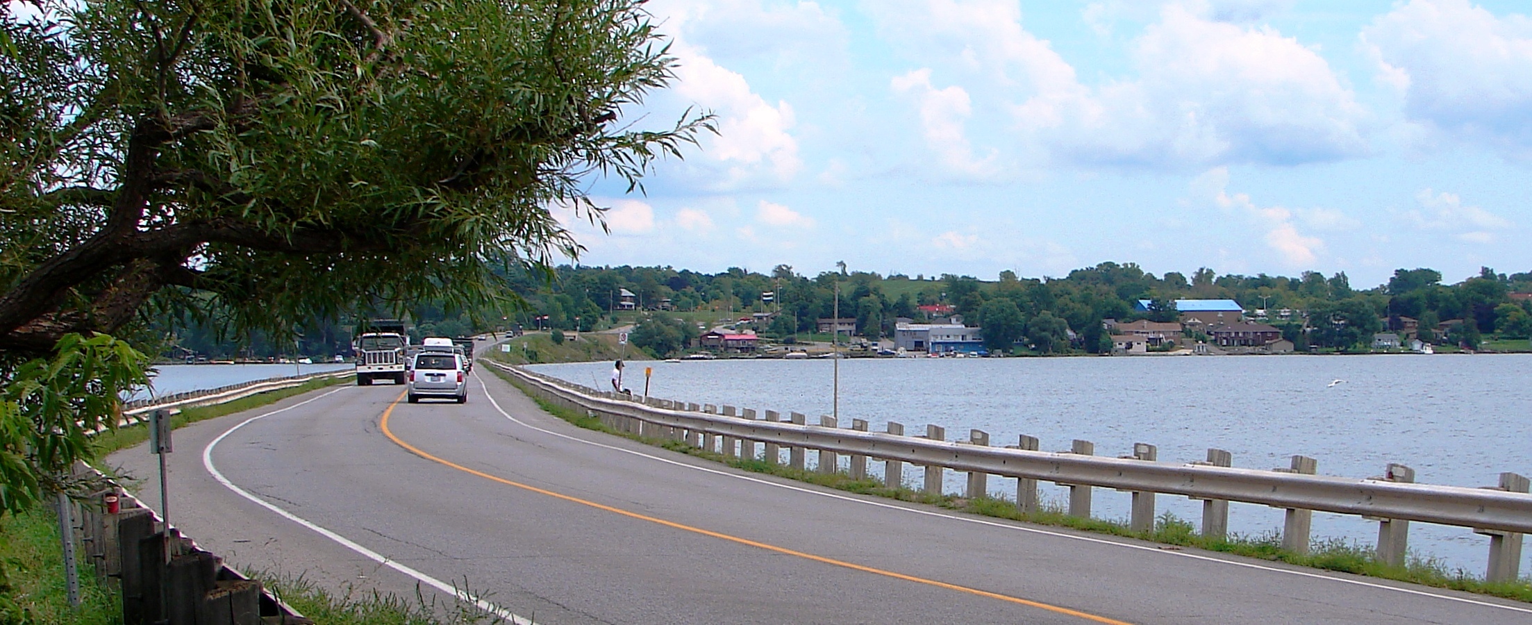
J. A. Gifford Causeway with Bridgenorth on opposite shore
Location Ontario
Group Kawartha lakes
Coordinates 44°24′N 78°23′W / 44.4°N 78.383°W / 44.4; -78.383Coordinates: 44°24′N 78°23′W / 44.4°N 78.383°W / 44.4; -78.383
Primary outflows Harrington Narrows to Buckhorn Lake
Basin countries Canada
Max. length 14 km (8.7 mi)
Max. width 1 km (0.62 mi)
Islands Big Island, Goat Island, Kelly Island

Lake Chemong, or Chemong Lake, (pronounced "shi-MONG)" is a lake 8 km NW of Peterborough, Ontario near the town of Bridgenorth. The lake extends from near Fowlers Corners north to near Curve Lake. Lake Chemong has a length of 14 km and a width of 1 km.

Communities along and near the lakeshore include Bridgenorth, Selwyn on the east, and Ennismore on the west. There is a causeway which crosses the lake, connecting Bridgenorth and Ennismore by road. This causeway is called the James A. Gifford Causeway.

Chemong Lake is part of a tri-lake water system consisting of Chemong Lake, Buckhorn Lake, and Pigeon Lake. The tri-lake area is host to several popular fishing tournaments throughout the open fishing season. The most common game fish in the lake are smallmouth bass, largemouth bass, walleye, yellow perch, Carp, Muskellunge as well as a number of Panfish. Commercial and recreational fishing has caused the introduction of Zebra mussels, which change the ecosystem by filtering the water and making it clearer. Some fish, such as Walleye, dislike the clear water and have become less abundant.

Chemong is also a part of the Kawartha lakes water system and the Trent-Severn Waterway.

There are a number of small islands on the lake, including Big Island (actually is located on Pigeon Lake), Goat Island and Kelly Island. Most of the islands have cottages or are commonly used as impromptu campsites. Rocky shoals surround these islands, boaters should approach with care.

Although still commonly called 'Chemong Lake', the official spelling has been changed to the more accurate 'Chemung' at the request of members of the local native community.[citation needed] The name means "Mud Lake", referring to the swampy conditions of the area before it was intentionally flooded during the creation of the Trent-Severn Waterway.


Wikimedia Foundation. 2010.

Игры ⚽ Поможем написать реферат

Look at other dictionaries:

  • Lake Chemong — Geographische Lage Ontario (Kanada) Zuflüsse Trent Severn Waterway …   Deutsch Wikipedia

  • Curve Lake First Nation 35, Ontario — Coordinates: 44°27′33″N 78°22′16″W / 44.459113°N 78.371058°W / 44.459113; 78.371058 …   Wikipedia

  • Bridgenorth, Ontario — Bridgenorth is a community that is part of Smith Ennismore Lakefield, Ontario, previously Smith Township. It sits on the eastern shore of Lake Chemong. It is located north of Peterborough, east of Lindsay, south of Buckhorn and west of Lakefield …   Wikipedia

  • Big Island — The term Big Island can be:In CanadaPlaces* Big Island, Ontario, the name of a place in Ontario, CanadaIslands* Big Island in Nunavut ** Big Island (Kimmirut), the largest of the three ** Big Island (Hudson Bay) ** Big Island (James Bay) * Big… …   Wikipedia

  • List of lakes in Ontario — This is an incomplete list of lakes in Ontario, a province of Canada.A*Lake Abitibi *Agnew Lake *Ahmic Lake *Allumette Lake *Arrowhead Lake *Astrolabe Lake *Attawapiskat LakeB*Balsam Lake *Bamaji Lake *Bark Lake *Bass Lake *Belwood Lake *Lake… …   Wikipedia

  • Liste der Seen in Kanada — Diese Liste enthält die 69 vom kanadischen Umweltministerium Natural Resources Canada als hauptsächliche Seen in Kanada bezeichneten Gewässer, die größer als 400 km² sind. Name Höhe Fläche Provinz Koordinaten Smallwood Reservoir 471 6527… …   Deutsch Wikipedia

  • List of islands of Ontario — This is a list of islands of Ontario.Lake Abitibi*Black Island *Kenosha Island *Mistaken Islands =Balsam Lake= *Grand IslandBig Rideau Lake*Grindstone IslandBuckhorn Lake*Emerald Isle *Fox Island *Nichol IslandCataraqui River*Isle of… …   Wikipedia

  • Kawartha Lakes — Die Kawartha Lakes Die Kawartha Lakes sind eine Seengruppe in Ontario, Kanada. Zu ihnen gehören die Seen nördlich des Ontario und östlich des Simcoesees Die Stadt Kawartha Lakes wurde nach den Seen benannt. Sie befindet sich im Westen der… …   Deutsch Wikipedia

  • Big Island — ist der Name folgender Orte in dem Vereinigten Staaten: Big Island (Baldwin County, Alabama) Big Island (Mobile County, Alabama) Big Island (Craighead County, Arkansas) Big Island (Greene County, Arkansas) Big Island (Mississippi County,… …   Deutsch Wikipedia

  • Ennismore Township, Ontario — Ennismore Township is a geographic township and former municipality located in Peterborough County, Ontario, Canada. The Township, located approx. 20 km north of Peterborough, was first surveyed in 1823. Farming is the primary industry with… …   Wikipedia

Share the article and excerpts

Direct link
Do a right-click on the link above
and select “Copy Link”