- Chippewa Township, Wayne County, Ohio
-
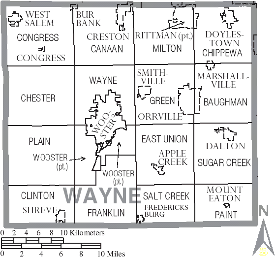
Chippewa Township, Ohio — Township — Municipalities and townships of Wayne County.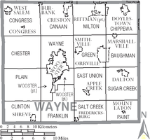
Coordinates: 40°57′3″N 81°42′16″W / 40.95083°N 81.70444°WCoordinates: 40°57′3″N 81°42′16″W / 40.95083°N 81.70444°W Country United States State Ohio County Wayne Area - Total 36.1 sq mi (93.4 km2) - Land 35.9 sq mi (93.0 km2) - Water 0.2 sq mi (0.4 km2) Elevation[1] 1,201 ft (366 m) Population (2000) - Total 10,085 - Density 280.9/sq mi (108.5/km2) Time zone Eastern (EST) (UTC-5) - Summer (DST) EDT (UTC-4) FIPS code 39-14240[2] GNIS feature ID 1087151[1] Chippewa Township is one of the sixteen townships of Wayne County, Ohio, United States. The 2000 census found 7,078 people in the township.[3]
Contents
Geography
Located in the northeastern corner of the county, it borders the following townships and cities:
- Wadsworth Township, Medina County - north
- Norton - northeast
- New Franklin - east
- Lawrence Township, Stark County - southeast
- Baughman Township - south
- Green Township - southwest corner
- Milton Township - west
Three municipalities are located in Chippewa Township:
- The village of Doylestown, in the north
- Part of the village of Marshallville, in the south
- Part of the city of Rittman, in the northwest
Name and history
It is the only Chippewa Township statewide.[4]
Government
The township is governed by a three-member board of trustees, who are elected in November of odd-numbered years to a four-year term beginning on the following January 1. Two are elected in the year after the presidential election and one is elected in the year before it. There is also an elected township fiscal officer,[5] who serves a four-year term beginning on April 1 of the year after the election, which is held in November of the year before the presidential election. Vacancies in the fiscal officership or on the board of trustees are filled by the remaining trustees.
References
- ^ a b "US Board on Geographic Names". United States Geological Survey. 2007-10-25. http://geonames.usgs.gov. Retrieved 2008-01-31.
- ^ "American FactFinder". United States Census Bureau. http://factfinder.census.gov. Retrieved 2008-01-31.
- ^ Wayne County, Ohio — Population by Places Estimates Ohio State University, 2007. Accessed 15 May 2007.
- ^ "Detailed map of Ohio" (PDF). United States Census Bureau. 2000. http://www2.census.gov/geo/maps/general_ref/cousub_outline/cen2k_pgsz/oh_cosub.pdf. Retrieved 2007-02-16.
- ^ §503.24, §505.01, and §507.01 of the Ohio Revised Code. Accessed 4/30/2009.
External links
Municipalities and communities of Wayne County, Ohio Cities 
Villages Apple Creek | Burbank | Congress | Creston‡ | Dalton | Doylestown | Fredericksburg | Marshallville | Mount Eaton | Shreve | Smithville | West Salem
Townships Baughman | Canaan | Chester | Chippewa | Clinton | Congress | East Union | Franklin | Green | Milton | Paint | Plain | Salt Creek | Sugar Creek | Wayne | Wooster
Unincorporated
communitiesFootnotes ‡This populated place also has portions in an adjacent county or counties
Categories:- Townships in Wayne County, Ohio

Wikimedia Foundation. 2010.