- Mumpf
-
Mumpf Country Switzerland 
Canton Aargau District Rheinfelden 47°33′N 7°55′E / 47.55°N 7.917°ECoordinates: 47°33′N 7°55′E / 47.55°N 7.917°E Population 1,310 (Dec 2010)[1] - Density 419 /km2 (1,084 /sq mi) Area 3.13 km2 (1.21 sq mi) Elevation 287 m (942 ft) Postal code 4322 SFOS number 4255 Surrounded by Bad Säckingen (DE-BW), Obermumpf, Stein, Wallbach, Zeiningen, Zuzgen Website www.mumpf.ch
SFSO statistics
 Mumpf
MumpfView map of Mumpf Mumpf is a municipality in the district of Rheinfelden in the canton of Aargau in Switzerland.
Contents
History
The area around Mumpf was prehistorically settled. In 1991 a mid to late neolithic fortified settlement was excavated on the Kapf/Chapf hill. This settlement was surrounded by a huge moat, and presumably protected by palisades. Inside the settlement wooden beams, fire pits, a clay pit and numerous stone tools were found. In addition, many individual Stone and Bronze Age objects have been found throughout the municipality. An Iron Age midden heap was found at Rifeld. Below the Gasthaus (combination hotel and restaurant) Anker are the foundations of a Roman small fort from the second half of the 4th Century and a nearby soldier's grave from the same period. Between Mumpf and Stein, a fragment of a milestone, with an inscription, from the time of Antoninus Pius (139 AD) was discovered.[2]
Mumpf is first mentioned in 1218 as Mumpher. In 1278 it was mentioned as Nider-Mumpfe. It was known as Nieder-Mumpf until 1803.[2] It was first mentioned as being part of the lands ruled by the Counts of Homburg. It later came to be under the Habsburg urbarium (a collection of regulations, which related nobleman and peasants and their mutual obligations) and their high court as part of the Säckingen district. Under the Habsburgs, Wallbach and Mumpf formed at vogtei in the landschaft Möhlinbach under the Herrschaft of Rheinfelden. The low court rights were originally held by manor house Stein which was owned by Säckingen Abbey. In 1463 these rights went to the Austrian-appointed vogt. The village laws were first handed down in 1535. Then, in 1612 a general assembly of the Rhine region adopted a notice of appeal on the ever-increasing taxes and increasing impoverishment. This document led to the Rappenkrieg, a peasant uprising that lasted from 1612 until 1614. During the Thirty Years War Mumpf was looted several times. Following the Act of Mediation in 1803, the entire Fricktal, including Mumpf, joined the new Canton of Aargau.[2]
St. Martin's church in Mumpf is first mentioned in 1441. It was renovated and expanded in 1541 and in 1741 the choir was rebuilt. The most recent renovation and reconstruction took place in 1957. The rights to collect church taxes were held by Säckingen Abbey until 1802 or 1803. The Mumpf parish included Wallbach until 1938.
Until the 19th Century fishing, timber rafting and grain production were the main sources of income in the village. Therefore, Mumpf and Wallbach were major members of the Rhine association. Although the Rhine ferry (which has operated since the Middle Ages) is still in operation, most traffic now uses either the old bridge, the railway bridge which opened in 1875 or the A3 motorway bridge from the 1970s.[2]
A large proportion of the population works in the Fricktaler chemical company and in the agglomeration of Basel.
Geography
Mumpf has an area, as of 2009[update], of 3.1 square kilometers (1.2 sq mi). Of this area, 0.84 km2 (0.32 sq mi) or 27.1% is used for agricultural purposes, while 1.33 km2 (0.51 sq mi) or 42.9% is forested. Of the rest of the land, 0.69 km2 (0.27 sq mi) or 22.3% is settled (buildings or roads), 0.26 km2 (0.10 sq mi) or 8.4% is either rivers or lakes.[3]
Of the built up area, housing and buildings made up 7.4% and transportation infrastructure made up 13.5%. Out of the forested land, 41.3% of the total land area is heavily forested and 1.6% is covered with orchards or small clusters of trees. Of the agricultural land, 11.3% is used for growing crops and 14.2% is pastures, while 1.6% is used for orchards or vine crops. All the water in the municipality is in rivers and streams.[3]
The municipality is located in the Rheinfelden district, between the Rhine river and the edge of the Jura Mountains. It consists of the linear village of Mumpf and the hamlet of Oberberg and the manor house at Schönegg.
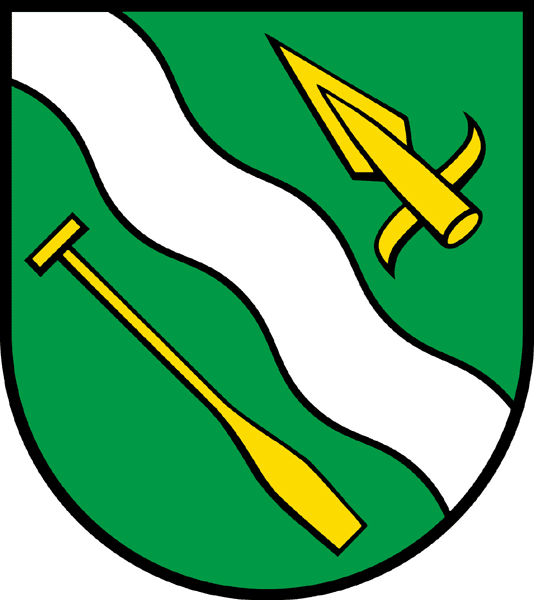
Coat of arms
The blazon of the municipal coat of arms is Vert a Bend wavy Argent between a Spearhead and an Oar both Or.[4]
Demographics
Mumpf has a population (as of December 2010[update]) of 1,310[1] As of June 2009[update], 32.0% of the population are foreign nationals.[5] Over the last 10 years (1997–2007) the population has changed at a rate of 30.2%. Most of the population (as of 2000[update]) speaks German (87.3%), with Albanian being second most common (4.5%) and Serbo-Croatian being third (2.9%).[6]
The age distribution, as of 2008[update], in Mumpf is: 154 children or 11.8% of the population are between 0 and 9 years old and 140 teenagers or 10.7% are between 10 and 19. Of the adult population, 168 people or 12.8% of the population are between 20 and 29 years old. 203 people or 15.5% are between 30 and 39, 251 people or 19.2% are between 40 and 49, and 171 people or 13.1% are between 50 and 59. The senior population distribution is 120 people or 9.2% of the population are between 60 and 69 years old, 75 people or 5.7% are between 70 and 79, there are 25 people or 1.9% who are between 80 and 89,and there is 1 person who is between 90 and older.[7]
As of 2000[update] the average number of residents per living room was 0.59 which is about equal to the cantonal average of 0.57 per room. In this case, a room is defined as space of a housing unit of at least 4 m2 (43 sq ft) as normal bedrooms, dining rooms, living rooms, kitchens and habitable cellars and attics.[8] About 58.1% of the total households were owner occupied, or in other words did not pay rent (though they may have a mortgage or a rent-to-own agreement).[9]
As of 2000[update], there were 31 homes with 1 or 2 persons in the household, 236 homes with 3 or 4 persons in the household, and 151 homes with 5 or more persons in the household.[10] As of 2000[update], there were 429 private households (homes and apartments) in the municipality, and an average of 2.5 persons per household.[6] In 2008[update] there were 232 single family homes (or 41.9% of the total) out of a total of 554 homes and apartments.[11] There were a total of 6 empty apartments for a 1.1% vacancy rate.[11] As of 2007[update], the construction rate of new housing units was 4.8 new units per 1000 residents.[6]
In the 2007 federal election the most popular party was the SVP which received 35.21% of the vote. The next three most popular parties were the SP (17.4%), the CVP (15.92%) and the FDP (15.66%). In the federal election, a total of 243 votes were cast, and the voter turnout was 32.5%.[12]
The historical population is given in the following table:[2][7]
year population 1768 319 1850 448 1900 492 1950 598 1990 795 2000 1,084 Heritage sites of national significance
The prehistoric settlement known as Chapf and the Gasthaus (combination hotel and restaurant) Anker, which was built on the site of a late-Roman Rhine fort, are listed as Swiss heritage sites of national significance.[13]
Economy
As of 2007[update], Mumpf had an unemployment rate of 2.83%. As of 2005[update], there were 16 people employed in the primary economic sector and about 6 businesses involved in this sector. 43 people are employed in the secondary sector and there are 12 businesses in this sector. 75 people are employed in the tertiary sector, with 28 businesses in this sector.[6]
In 2000[update] there were 569 workers who lived in the municipality. Of these, 469 or about 82.4% of the residents worked outside Mumpf while 72 people commuted into the municipality for work. There were a total of 172 jobs (of at least 6 hours per week) in the municipality.[14] Of the working population, 19.2% used public transportation to get to work, and 53.6% used a private car.[6]
Religion
From the 2000 census[update], 535 or 49.4% were Roman Catholic, while 248 or 22.9% belonged to the Swiss Reformed Church. Of the rest of the population, there were 18 individuals (or about 1.66% of the population) who belonged to the Christian Catholic faith.[10]
Education
In Mumpf about 65.1% of the population (between age 25-64) have completed either non-mandatory upper secondary education or additional higher education (either university or a Fachhochschule).[6] Of the school age population (in the 2008/2009 school year[update]), there are 101 students attending primary school, there are 151 students attending secondary school in the municipality.[10]
References
- ^ a b Canton of Aargau Statistical Office, MS Excel document – Bevölkerungsbestand per 31.12.2010 nach Gemeinde, Geschlecht u. Nationalität (German) accessed 11 May 2011
- ^ a b c d e Mumpf in German, French and Italian in the online Historical Dictionary of Switzerland.
- ^ a b Swiss Federal Statistical Office-Land Use Statistics 2009 data (German) accessed 25 March 2010
- ^ Flags of the World.com accessed 28-May-2010
- ^ Statistical Department of Canton Aargau -Bereich 01 -Bevölkerung (German) accessed 20 January 2010
- ^ a b c d e f Swiss Federal Statistical Office accessed 28-May-2010
- ^ a b Statistical Department of Canton Aargau -Bevölkerungsdaten für den Kanton Aargau und die Gemeinden (Archiv) (German) accessed 20 January 2010
- ^ Eurostat. "Housing (SA1)" (pdf). Urban Audit Glossary. 2007. p. 18. http://www.bfs.admin.ch/bfs/portal/en/index/international/22/lexi.Document.116365.pdf. Retrieved 12 February 2010.
- ^ Urban Audit Glossary pg 17
- ^ a b c Statistical Department of Canton Aargau - Aargauer Zahlen 2009 (German) accessed 20 January 2010
- ^ a b Statistical Department of Canton Aargau (German) accessed 20 January 2010
- ^ Swiss Federal Statistical Office, Nationalratswahlen 2007: Stärke der Parteien und Wahlbeteiligung, nach Gemeinden/Bezirk/Canton (German) accessed 28 May 2010
- ^ "Kantonsliste A-Objekte: Aargau" (in German). KGS Inventar. Federal Office of Civil Protection. 2009. http://www.bevoelkerungsschutz.admin.ch/internet/bs/de/home/themen/kgs/kgs_inventar/a-objekte.html. Retrieved 28 May 2010.
- ^ Statistical Department of Canton Aargau-Bereich 11 Verkehr und Nachrichtenwesen (German) accessed 21 January 2010
Hellikon | Kaiseraugst | Magden | Möhlin | Mumpf | Obermumpf | Olsberg | Rheinfelden | Schupfart | Stein | Wallbach | Wegenstetten | Zeiningen | Zuzgen
Aargau | Districts of Canton Aargau | Municipalities of the canton of Aargau
 Categories:
- Municipalities of Aargau
- Municipalities of Switzerland
- Cultural property of national significance in the canton of Aargau

Wikimedia Foundation. 2010.