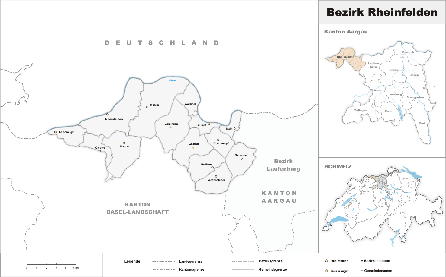
- Rheinfelden District
-
Rheinfelden District
Bezirk Rheinfelden— District — 
Country  Switzerland
Canton  Aargau
Capital Rheinfelden Area – Total 138.96 km2 (53.7 sq mi) Population (2010) – Total 43,889 – Density 315.8/km2 (818/sq mi) Time zone CET (UTC+1) – Summer (DST) CEST (UTC+2) Municipalities 20 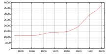 Population
Rheinfelden District lies in the northwest of the canton of Aargau in Switzerland, in the Fricktal region. Its capital is Rheinfelden. Around 88% of the population live in the conurbation of Basel. There are 14 municipalities, with a population of 43,889 (as of 31 December 2010)[1] living in an area of 112.09 km². The population density is around 355 persons per square kilometre.
Contents
Geography
The Rheinfelden district has an area, as of 2009[update], of 111.98 square kilometres (43.24 sq mi). Of this area, 49.26 km2 (19.02 sq mi) or 44.0% is used for agricultural purposes, while 44.45 km2 (17.16 sq mi) or 39.7% is forested. Of the rest of the land, 14.96 km2 (5.78 sq mi) or 13.4% is settled (buildings or roads).[2]
Demographics
Rheinfelden district has a population (as of December 2010[update]) of 43,889.[1] As of June 2009[update], 21.3% of the population are foreign nationals.[3]
Economy
In 2000[update] there were 19,081 workers who lived in the district. Of these, 13,553 or about 71.0% of the residents worked outside the Rheinfelden district while 8,272 people commuted into the district for work. There were a total of 13,800 jobs (of at least 6 hours per week) in the district.[4]
Religion
From the 2000 census[update], 14,982 or 40.2% were Roman Catholic, while 11,153 or 29.9% belonged to the Swiss Reformed Church. Of the rest of the population, there were 2 474 who belonged to the Christian Catholic faith.[2]
Education
The entire Swiss population is generally well educated. Of the school age population (in the 2008/2009 school year[update]), there are 3,090 students attending primary school, there are 1,111 students attending secondary school, there are 734 students attending tertiary or university level schooling, and there are 32 students who are seeking a job after school in the municipality.[2]
Municipalities
Coat of arms Municipality Population
(31 December 2010)[1]Area, km²[5] 
Hellikon 782 7.05 
Kaiseraugst 5,242 4.91 
Magden 3,628 11.01 
Möhlin 10,025 18.79 
Mumpf 1,310 3.1 
Obermumpf 1,020 5.03 
Olsberg 370 4.62 
Rheinfelden 11,960 16.03 
Schupfart 769 7.04 
Stein 2,818 2.81 
Wallbach 1,818 4.51 
Wegenstetten 1,081 7.13 
Zeiningen 2,218 11.37 
Zuzgen 848 8.39 References
- ^ a b c Canton of Aargau Statistical Office, MS Excel document – Bevölkerungsbestand per 31.12.2010 nach Gemeinde, Geschlecht u. Nationalität (German) accessed 11 May 2011
- ^ a b c Statistical Department of Canton Aargau - Aargauer Zahlen 2009 (German) accessed 20 January 2010
- ^ Statistical Department of Canton Aargau -Bereich 01 -Bevölkerung (German) accessed 20 January 2010
- ^ Statistical Department of Canton Aargau-Bereich 11 Verkehr und Nachrichtenwesen (German) accessed 21 January 2010
- ^ Swiss Federal Statistical Office-Land Use Statistics 2009 data (German) accessed 25 March 2010
Categories:- Districts of the canton of Aargau
- Switzerland geography stubs

Wikimedia Foundation. 2010.