- County of Dun Laoghaire-Rathdown
Infobox Irish Place
name = County of Dun Laoghaire-Rathdown
gaeilge = Contae Dhún Laoghaire-Ráth an Dúin
crest
map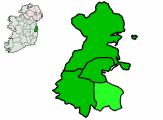
area = 127.31 km²
county town =Dún Laoghaire
code = D (DR proposed)
dailconstituency=Dún Laoghaire
Dublin South
population = 193,688
census yr = 2006
province =Leinster
web = www.dlrcoco.ie
|The County of Dun Laoghaire–Rathdown [http://www.irishstatutebook.ie/1993/en/act/pub/0031/sec0009.html Local Government (Dublin) Act, 1993 - Section 9 (2c)] ] ( _ga. Contae Dhún Laoghaire–Ráth an Dúin) is a county in Ireland formed from part of the old county of Dublin. Dun Laoghaire-Rathdown is located to the south-east of the City of Dublin, and has its administrative centre in the town of
Dún Laoghaire .In
1994 , the area of the Corporation of Dún Laoghaire and the south-east part of County Dublin were merged to create the county of Dun Laoghaire-Rathdown (the powers of the formerDeansgrange Joint Burial Board were also subsumed into the new authority).Dun Laoghaire-Rathdown is bordered by the Irish Sea and City of Dublin, as well as the counties of
South Dublin and Wicklow.University College Dublin andDún Laoghaire Institute of Art, Design and Technology are located in the county.The motto on the coat of arms of Dun Laoghaire-Rathdown reads "Ó Chuan go Sliabh", meaning "From the Harbour to the Mountain". The crown in the shield is that of King Laoghaire, the High King of Ireland in the fifth century, who resided in the area.
Name
Now the smallest county in Ireland in terms of area, Dun Laoghaire-Rathdown is also the county with the longest name. Further, the official legal name of the county, in English, is spelt "without" a síneadh fada on the "u" in "’s own reorganisation report published in 1992 concluded that the name Dun Laoghaire-Rathdown was “unacceptable”. A one year proviso contained in the "1993 Local Government (Dublin) Act" for changing the name of the county at local level was allowed to expire by the new council. The elected members of the council are still in a position to make representations for additional legislation altering the name of the county.
Transport
The
Dublin Area Rapid Transit system runs through the eastern coast of the county and connects to the centre to the north as well as other points north and south on theIarnród Éireann railway system with connections toIntercity .The greenLuas line runs through the centre of the county.There is a medium-sized
ferry port at Dún Laoghaire, with ferry crossings to and fromHolyhead in NorthWales ; this is a popular route for tourists travelling across theIrish Sea from Britain. With the advent of faster boats, day trips using the Dún Laoghaire port have become more popular.Electoral structure
The six
Local Electoral Areas (LEAs) or wards forDún Laoghaire-Rathdown County Council divide up the election of its 28 councillors as follows:Ballybrack (6), Blackrock (4), Dundrum (6),Dún Laoghaire (6),Glencullen (3),Stillorgan (3).Dun Laoghaire-Rathdown towns and villages, and Dublin suburbs
Dún Laoghaire town itself is becoming popular with young peopleFact|date=February 2008 because of the cinema and shops situated there; other important centres of population in the county include
Goatstown ,Dalkey , Dundrum,Glenageary ,Killiney andSandyford .A full listing of areas follows:
*Ballinteer ,Ballybrack , Blackrock,Booterstown
*Cabinteely ,Carrickmines ,Cherrywood , Churchtown
*Dalkey , Dundrum,Deansgrange
*Foxrock
*Goatstown ,Glasthule ,Glenageary ,Glencullen
*Johnstown
*Killiney ,Kilmacud ,Kilternan
*Leopardstown ,Loughlinstown
*Monkstown
*Rathfarnham
*Sandyford ,Sandycove ,Sallynoggin , Shankill
*Stepaside,Stillorgan Footnotes
External links
* [http://www.dlrcoco.ie/ Dún Laoghaire-Rathdown County Council]
* [http://www.dlrceb.ie/ Dún Laoghaire-Rathdown County Enterprise Board]
* [http://www.dlrtourism.com/ Dún Laoghaire-Rathdown Tourism]
Wikimedia Foundation. 2010.