- Historic Villages of Shirakawa-gō and Gokayama
-
Historic Villages of Shirakawa-go and Gokayama * UNESCO World Heritage Site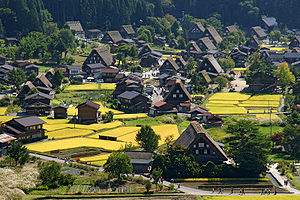
Country Japan Type Cultural Criteria iv, v Reference 734 Region ** Asia-Pacific Inscription history Inscription 1995 (19th Session) * Name as inscribed on World Heritage List
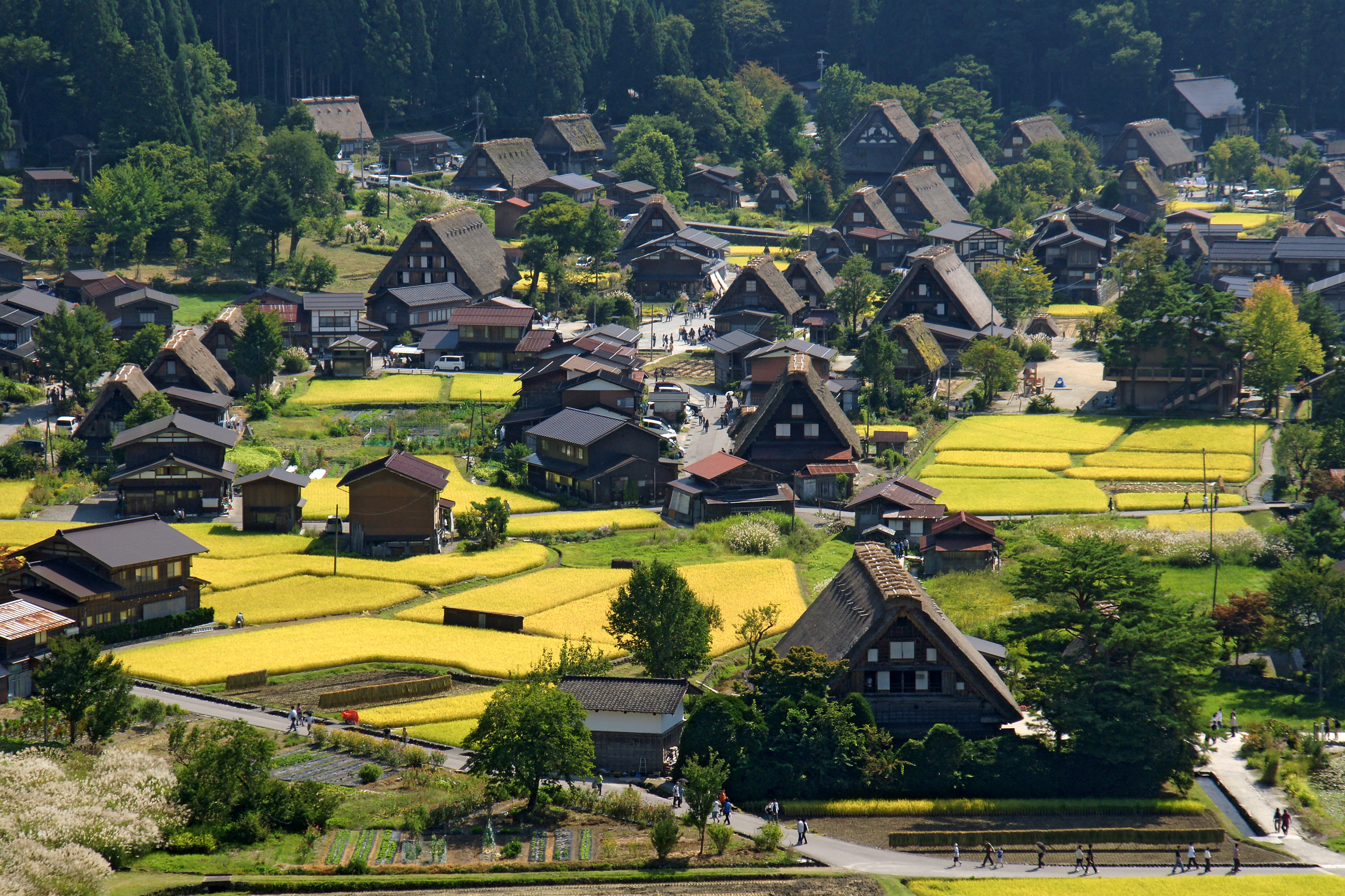
** Region as classified by UNESCOThe Historic Villages of Shirakawa-gō and Gokayama are one of Japan's UNESCO World Heritage Sites. The site is located in the Shogawa river valley stretching across the border of Gifu and Toyama Prefectures in northern Japan. Shirakawa-gō (白川郷, "White River Old-District") is located in the village of Shirakawa in Gifu Prefecture. The Gokayama (五箇山, "Five Mountains") area is divided between the former villages of Kamitaira and Taira in Nanto, Toyama Prefecture.
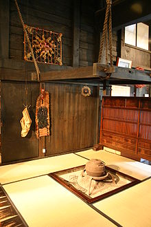 Fireplace of Shirakawa-gō.
These villages are well known for their houses constructed in the architectural style known as gasshō-zukuri (合掌造り). The Gasshō-zukuri, "prayer-hands construction" style is characterized by a thatched and steeply slanting roof resembling two hands joined in prayer. The design is exceptionally strong and, in combination with the unique properties of the thatching, allow the houses to withstand and shed the weight of the region's heavy snowfalls in winter.
The houses are large, with three to four storeys encompassed between the low eaves, and historically intended to house large extended families and a highly-efficient space for a variety of industries. The densely-forested mountains of the region still occupy 96% of all land in the area, and prior to the introduction of heavy earth-moving machinery, the narrow bands of flat lands running the length of the river valley limited the area available for agriculture and homestead development. The upper storeys of the gasshō houses were usually set aside for sericulture, while the areas below the first (ground) floor were often used for the production of nitre, one of the raw materials needed for the production of gunpowder.
See also
- Tourism in Japan
- List of World Heritage Sites in Japan
- Minka
- Shirakawa, Gifu (village)
External links
- UNESCO entry on Shirakawa-go and Gokayama
- Gokayama (Ainokura) photo gallery
- Stay overnight in a Gassho-Zukuri in Shirakawago
- Gassho-Zukuri villages
World Heritage Sites in Japan Hokkaidō 
Tōhoku Shirakami-Sanchi · Historic Monuments and Sites of Hiraizumi
Kantō Shrines and Temples of Nikkō · Ogasawara Islands
Chūbu Historic Villages of Shirakawa-gō and Gokayama · Sacred Sites and Pilgrimage Routes in the Kii Mountain Range1
Kansai Buddhist Monuments in the Hōryū-ji Area · Himeji Castle · Historic Monuments of Ancient Kyoto (Kyoto, Uji and Otsu Cities) · Historic Monuments of Ancient Nara · Sacred Sites and Pilgrimage Routes in the Kii Mountain Range1
Chūgoku Kyūshū Gusuku Sites and Related Properties of the Kingdom of Ryukyu · Yakushima
1 Shared with other region/sCoordinates: 36°15′25″N 136°54′23″E / 36.25694°N 136.90639°E
Categories:- World Heritage Sites in Japan
- Villages in Gifu Prefecture
- Villages in Toyama Prefecture
- Visitor attractions in Gifu Prefecture
- Visitor attractions in Toyama Prefecture

Wikimedia Foundation. 2010.