- Manasquan Reservoir
-
Manasquan Reservoir 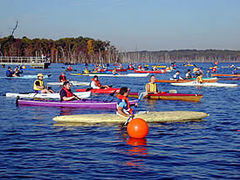
A quadrathlon occurring at the reservoir Location Monmouth County, New Jersey Coordinates 40°10′44″N 74°12′26″W / 40.178775°N 74.207239°WCoordinates: 40°10′44″N 74°12′26″W / 40.178775°N 74.207239°W Lake type reservoir Primary inflows Timber Swamp Brook Primary outflows Timber Swamp Brook Basin countries United States The Manasquan Reservoir is a source of water for municipalities and utilities, as well as a 1,204-acre (4.87 km²) park located in Howell Township, in Monmouth County, New Jersey, United States. The park is part of the Monmouth County Park System.
Contents
Trails
The Manasquan Reservoir Park features a five-mile (8 km) multi-use perimeter trail which surrounds the perimeter of the reservoir. The trail is marked with mileposts, and starts in the vicinity of the visitors parking area. There are also a number of shorter trails, but these have no milepost markings. Unlike the perimeter trail, the shorter trails are also considerably narrower. The width of the perimeter trail fluctuates between 8 and 24 feet (7.3 m), whereas that of the side trails is usually no greater than 3 feet (0.91 m).
A secondary trail, called the Cove Trail, features 1.1 miles (1.8 km) of nature that explores the lakeshore near the nature center. The trail starts off the main Perimeter Trail, about 1/4 mile from the Nature Center. Binoculars are recommended for sightseeing of wildlife in this area.[1]
Course of the Perimeter Trail
The perimeter trail leads to the Environmental Center, located near milepost 1.3. Passed the Environmental Center the trail continues until it reaches a county road (George Tavern Rd) that roughly serves as the western boundary of the Park. Here the trail continues parallel to the road leading to Chesnut Point where parking is available for nearby recreational fishing. Past milepost 3 (and roughly around mile 3.3) the trail crosses the main utility service road of the Manasquan Water Supply System, and then it becomes a considerably narrower trail until its end at milepost 5 in the area of the visitors parking lot. Mileposts are marked to the mile.
The following table lists the main facilities, services, and features along the perimeter trail (except for posted milepost markings, all others mileage shown are approximations):
Milepost Facility, Service, or Feature 0.0 MILEPOST MARKER (START) 0.6 bridges (2) 0.7 bench 0.8 dike/bridge 1.0 MILEPOST MARKER 1.1 bench 1.2 Cove Trail entrance 1.3 Environmental Center 1.4 George Tavern Rd 1.5 dike/fishing pier 1.7 Chesnut Pt/toilet 1.8 dike 1.9 bench 2.0 MILEPOST MARKER 2.2 yield sign 2.4 Wildlife Obs. Blind 2.5 bench 3.0 MILEPOST MARKER 3.5 dam road crossing 3.7 steel bridge 3.8 portable toilet 3.9 bench 4.0 MILEPOST MARKER 4.5 Secondary service driveway 4.8 bench/dike/bridge 4.9 wildlife obs. blind 5.0 MILEPOST MARKER (END) Environmental Center
The Environmental Center is reachable by car and has its own parking lot. It contains displays of the fauna and fishery of the area, related instructional materials, and overlook windows to the surrounding land area and lake. There are restroom facilities at the Center, but the center closes much earlier than the park itself. There is also a hidden loop trail nearby leading to the lake.
Recreational Activities
Visitors can bring in their own water crafts, such as boats, kayak, canoes, etc., or they can avail themselves of the rowboat and group boat rides available to park visitors.
There are boat launching piers for entry into the lake. Fishing is permitted on the lake, and there are several great fishing spots. Horseback riding and biking is also permitted on the trails. The park also has a playground for children near the visitors center.
Visitors Center
A visitors center features restroom facilities, vending machines, park literature, and a small shop to purchase fishing supplies (a bait shop). There is also a good-size hall and a lookout deck on the second floor of the building with spectacular view of the lake. An observation deck, complete with on-deck pay-for-view binoculars, complements the second floor features of the Center.
Wilderness Reserve
A selected portion of the reservoir's property is designated as a wildlife reserve which protects aquatic fauna such as smallmouth bass, hybrid striped bass, tiger muskie, bullhead catfish and panfish.
Reservoir
The reservoir provides a large portion of the drinking water for Central New Jersey. The Manasquan Water Supply System manager is Richard Famularo. The reservoir was created by damming the Timber Swamp Brook. Several portions of wetland were destroyed in the making of the reservoir. By New Jersey state law, for all wetland destroyed by mankind, additional equivalent amounts of wetlands must be recreated artificially in the immediacy of the destroyed wetland. The reservoir has a four billion gallon capacity and a maximum depth of 40 feet (12 m). It can supply up to 30 million US gallons (110,000 m3) of water per day.[1]
References
- ^ a b Manasquan Reservoir. Monmouth County. Board of Recreation Commissioners. Publication #A3445. September 2008.
External links
Categories:- Parks in Monmouth County, New Jersey
- Reservoirs in New Jersey
- Parks in New Jersey
- Nature reserves in the United States
- Howell Township, New Jersey

Wikimedia Foundation. 2010.