Pilsley, North East Derbyshire

Pilsley, North East Derbyshire

Coordinates: 53°09′18″N 1°21′58″W / 53.155°N 1.366°W / 53.155; -1.366

Pilsley
350508 d528fe0c-by-Alan-Walker.jpg
New Street, Pilsley.
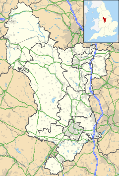
Pilsley is located in Derbyshire
Pilsley

 Pilsley shown within Derbyshire
OS grid reference SK424621
District North East Derbyshire
Shire county Derbyshire
Region East Midlands
Country England
Sovereign state United Kingdom
Post town CHESTERFIELD
Postcode district S45
Police Derbyshire
Fire Derbyshire
Ambulance East Midlands
EU Parliament East Midlands
List of places: UK • England • Derbyshire

Pilsley is a rural village in Northeast Derbyshire, near Chesterfield. Records show that Pilsley and Lower Pilsley (or Nether Pilsley), a smaller village just below Pilsley, make one village,[1] but some of the local residents disagree. Pilsley is also the name of the parish that was formed 30 January 1874 as previously it had been part of Wingfield parish.[1]

Pilsley has an Anglican church, St. Mary's church, two primary schools, a post office and a Kingdom Hall building for Jehovah's Witnesses. It also had a new sports hall built called the Elm Centre.

Pilsley has a Sunday league football team called Pilsley Miners Welfare Football Club. The team is currently part of the Chesterfield and District Sunday League.[2]

The source of the River Rother is at Pilsley.

References

External links

Media related to Pilsley, North East Derbyshire at Wikimedia Commons


Wikimedia Foundation. 2010.

Игры ⚽ Нужна курсовая?

Look at other dictionaries:

  • North East Derbyshire (UK Parliament constituency) — North East Derbyshire County constituency North East Derbyshire shown within …   Wikipedia

  • North East Derbyshire — For the constituency, see North East Derbyshire (UK Parliament constituency). North East Derbyshire District   District   …   Wikipedia

  • Pilsley — may refer to: *Pilsley, Derbyshire Dales *Pilsley, North East Derbyshire …   Wikipedia

  • North Wingfield — Coordinates: 53°10′55″N 1°23′13″W / 53.182°N 1.387°W / 53.182; 1.387 …   Wikipedia

  • Pilsley, Derbyshire Dales — Infobox UK place country = England static static image caption=Pilsley cottages latitude = 53.235 longitude = 1.641 map type = Derbyshire official name = Pilsley population = shire district = Derbyshire Dales shire county = Derbyshire region =… …   Wikipedia

  • List of civil parishes in Derbyshire — poly 70 249 70 233 88 235 90 222 97 222 109 225 109 234 113 239 125 246 127 250 135 253 142 250 143 244 147 240 156 242 165 249 151 259 144 274 137 274 134 284 125 290 121 289 113 292 111 298 111 306 104 311 92 312 87 305 81 299 98 283 86 288 101 …   Wikipedia

  • Reeve Burgess — was a bus body manufacturer based in Pilsley, North East Derbyshire in the United Kingdom. It was a subsidiary of Plaxton from 1980 until its closure in 1991. [Millar, Alan (1992) Bus Coach Recognition : Ian Allan Ltd., ISBN 0 7110 2060 4] Reeve… …   Wikipedia

  • Clay Cross — This article is about the village. For the athlete, see Clay Cross (athlete). Coordinates: 53°09′49″N 1°24′46″W / 53.1637°N 1.4128°W / …   Wikipedia

  • Scarcliffe — infobox UK place country = England latitude= 53.213 longitude= 1.260 static static image caption= Scarcliffe church. official name= Scarcliffe population= civil parish= Scarcliffe shire district= Bolsover region= East Midlands shire county=… …   Wikipedia

  • Dronfield railway station — Dronfield Location Place …   Wikipedia

Share the article and excerpts

Direct link
Do a right-click on the link above
and select “Copy Link”