- Crystal Springs Dam
-
Crystal Springs Dam 
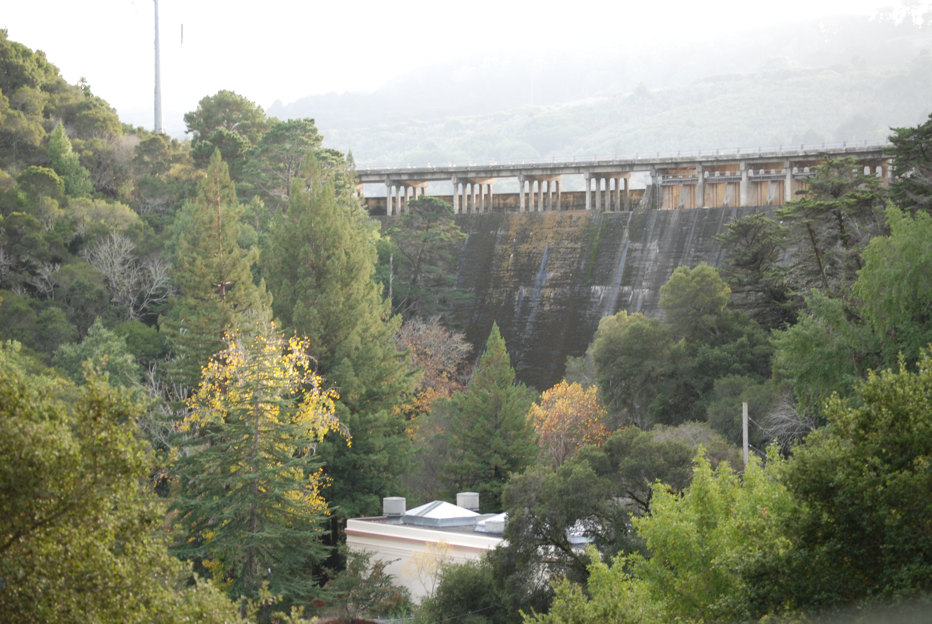
Official name Lower Crystal Springs Dam Location San Mateo County, California Coordinates 37°31′43″N 122°21′44″W / 37.5285°N 122.3622°WCoordinates: 37°31′43″N 122°21′44″W / 37.5285°N 122.3622°W Opening date 1888 Dam and spillways Height 140 ft (43 m) Length 600 ft (180 m) Base width 40 ft (12 m) Impounds San Mateo Creek Reservoir Creates Lower Crystal Springs Reservoir Capacity 57,910 acre·ft (71,430,000 m3) Catchment area 29.4 sq mi (76 km2) Surface area 1,323 acres (5.35 km2) Crystal Springs Dam is a gravity dam constructed across the San Mateo Creek, impounding water to form the Lower Crystal Springs Reservoir in San Mateo County, California.
The structure was completed in 1888, and has survived both the 1906 San Francisco earthquake and the 1989 Loma Prieta earthquake — despite its location directly on the San Andreas Fault.
The dam has a road running over it and forms the trailhead of the popular Sawyer Camp Trail.
Currently the dam is undergoing renovations. The dam is being raised to increase the water storage capacity of the reservoir as well as other changes. The roadway on top of the dam is closed.
-

Lower Crystal Springs Dam
-

Lower Crystal Springs Reservoir
References
- Department of Water Resources (2009). "Station Meta Data: Lower Crystal Springs Dam (CRY)". California Data Exchange Center. State of California. http://cdec.water.ca.gov/cgi-progs/profile?s=CRY&type=dam. Retrieved 2009-04-01.
- "Crystal Spring Dam". Geographic Names Information System, U.S. Geological Survey. 19-Jan-1981. http://geonames.usgs.gov/pls/gnispublic/f?p=gnispq:3:::NO::P3_FID:233747. Retrieved 2009-06-11.
- U.S. Geological Survey (24 November 2003). "Crystal Springs Reservoir". U.S. Department of the Interior. http://3dparks.wr.usgs.gov/3Dbayarea/html/CrystalSprings.htm. Retrieved 2009-04-01.[dead link]
- Ron Horii (1 October 2003). "Bay Area Biking: Crystal Springs Trails". Bay Area Back Page. http://pages.prodigy.net/rhorii/xtalsprg.htm. Retrieved 2009-04-01.
Further reading
- Postel, Mitchell (1994). San Mateo: A Centennial History. San Francisco: Scottwall Associates, Publishers. ISBN 0942087089.
External links
Categories:- Buildings and structures in San Mateo County, California
- Dams in California
- Hetch Hetchy Project
- San Mateo County, California geography stubs
-


Wikimedia Foundation. 2010.