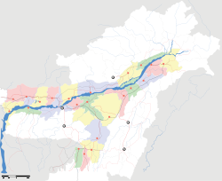
- North Guwahati
-
North Guwahati — city — Coordinates 26°11′N 91°43′E / 26.18°N 91.72°ECoordinates: 26°11′N 91°43′E / 26.18°N 91.72°E Country India State Assam District(s) Kamrup Metro Population 16,131 (2001[update]) Time zone IST (UTC+05:30) Area
• 33 metres (108 ft)
Codes-
• Pincode • 781 XXX
Website Guwahati North Guwahati is northern part of city of Guwahati and a town area committee in Kamrup district in the Indian state of Assam.This town which abounds in historical places and picnic spots. National Highway 31 passes through North Guwahati.
Contents
Geography
North Guwahati is located at 26°11′N 91°43′E / 26.18°N 91.72°E.[1] It has an average elevation of 54 m (177 ft).
Demographics
As of 2001[update] India census,[2] North Guwahati had a population of 16,131. Males constitute 53% of the population and females 47%. North Guwahati has an average literacy rate of 73%, higher than the national average of 59.5%: male literacy is 78%, and female literacy is 68%. In North Guwahati, 10% of the population is under 6 years of age.
Places of interest
North Guwahati abounds with historical temples like Dirgheswari Deavalay (temple or shrine), Mani-karneswar Devalay, Aswaklanta Devalay, Rudreswar Devalay, Auniati Satra, etc. Goddess Durga is worshipped in the Dirgheswari Devalay. Surrounded by evergreen trees and a fast-flowing brook, it is a beautiful spot for picnic. Another beautiful spot is Manikoreneswar Devalay situated on a hill on the back of the river Brahmaputra. Aswaklanta, another historical place, stands on the bank of the river Brahmaputra.
Major industries are set up in North Guwahati.
IIT Guwahati
IIT Guwahati is situated here amidst scenic hills and lakes. This is the only IIT of the entire North East.
References
- ^ Falling Rain Genomics, Inc - North Gauhati
- ^ "Census of India 2001: Data from the 2001 Census, including cities, villages and towns (Provisional)". Census Commission of India. Archived from the original on 2004-06-16. http://web.archive.org/web/20040616075334/http://www.censusindia.net/results/town.php?stad=A&state5=999. Retrieved 2008-11-01.
Categories:- Cities and towns in Kamrup district
- Kamrup
- Assam geography stubs
-
Wikimedia Foundation. 2010.


