- Dickens, Vancouver
-
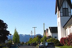
 Street and houses in the Dickens neighbourhood of East Vancouver (with North Shore Mountains in background)
Dickens is a small neighbourhood in East Vancouver, Canada.
Contents
Boundary
Its areas is from East 12th Avenue (northern boundary) to King Edward, or East 25th Avenue (southern boundary) and from Fraser Street (western boundary) to Knight Street (eastern boundary). Kingsway runs diagonally through the neighbourhood.
The neighbourhood lies within the city-defined community of Kensington-Cedar Cottage.
The area is named after the schools in the area, both named Dickens (Charles Dickens Elementary School and its Annex), which are rated one of the top forty schools in Canada.[1]
Amenities
Parks in the Dickens area include Glen Park (adjacent to Charles Dickens Annex) and Sunnyside Park (adjacent to Charles Dickens Elementary). The Windsor Way bike path travels past both schools and provides a traffic-calmed north-south route through the neighbourhood.
The community library is on Knight Street and is part of the King Edward Village condo-shopping project.
The City of Vancouver has recently invested $2.7 million in traffic-calming and beautification measures in the area. This includes improved sidewalks and streetlights, new street trees, sidewalk benches, and others.
Active community association
An active neighbourhood association (the Dickens Community Group) works to improve the area.
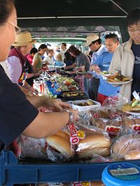
Activities include community gardening projects, working with city planners on zoning and related issues, garbage clean-ups, hosting celebrations (such as the annual Dickens Multi-Cultural Festival or "music in the park" evenings) and community-safety foot patrols. A running group ("Run like the Dickens") was started in 2006. All events are led by local residents.
Notes and references
External links
Neighbourhoods in Vancouver, British Columbia Downtown neighbourhoods Coal Harbour • Chinatown • Davie Village • Downtown Eastside • English Bay • Financial District • Gastown • Granville Entertainment District • Granville Mall • International Village • Japantown • Robsonstrasse • Stanley Park • Victory Square • West End • Yaletown
West Side neighbourhoods Arbutus Ridge • Dunbar–Southlands • Fairview • False Creek • Kerrisdale • Kitsilano • Marpole • Oakridge • Shaughnessy • South Cambie • West Point GreyEast Side neighbourhoods Grandview–Woodland • Hastings–Sunrise • Kensington–Cedar Cottage • Killarney • Mount Pleasant • Renfrew–Collingwood • Riley Park–Little Mountain • Strathcona • Sunset • Victoria–FraserviewOther locations Champlain Heights • Commercial Drive • Granville Island • Greektown • Little Italy • Punjabi Market/Little India • Uptown/South Granville • South Main • University Endowment Lands • Hogan's Alley • Stanley ParkCategories:- Neighbourhoods in Vancouver
Wikimedia Foundation. 2010.

