- Markeaton
-
Coordinates: 52°55′30″N 1°29′31″W / 52.925°N 1.492°W
Markeaton 
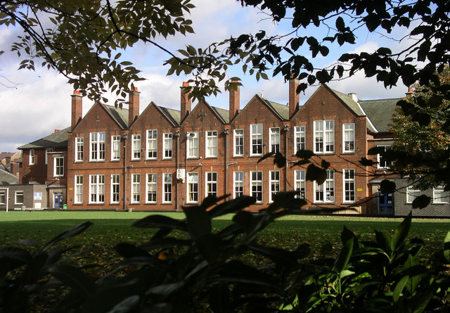
Markeaton Primary School
 Markeaton
Markeaton shown within DerbyshireOS grid reference SK342365 District Derby Shire county Derbyshire Region East Midlands Country England Sovereign state United Kingdom Post town DERBY Postcode district DE1 Police Derbyshire Fire Derbyshire Ambulance East Midlands EU Parliament East Midlands List of places: UK • England • Derbyshire Markeaton is a village within Derby in the East Midlands of England.
The name possibly means Boundary - Island Village, which had stood at this site since Medieval times.
After the Norman conquest the manor of Markeaton which had been held by the Anglo-Saxon Siward, the Fairbairn Earl of Northumbria, was given to Hugh d'Avranches, 1st Earl of Chester, along with chevinetum, Mackworth and Allestree.
It finally passed to John the Earl of Huntingdon and Cambridge who died in 1237, his only heirs being his sisters. To prevent the estate passing to women, it was bought by the Crown in 1246. It was held by various members of the Royal family, including the Black Prince until his death in 1376 when it returned to the Crown.[1]
In the early 14th century the Mundy Family purchased land, Sir John Mundy was Lord Mayor of the City of London in 1522. The village land was enclosed by the Mundys during the 18th century, forcing many of the villagers to move their homes(literally "Up Sticks")outside the enclosed land.
Contents
Markeaton Hall
A grand house, Markeaton Hall was built in traditional half timbered style, this was replaced by a new hall during the late 18th century.
In 1929, the Markeaton Hall and twenty acres (81,000 m²) of its gardens were given to the Corporation by the Reverend Clarke Maxwell who had inherited the estate from the late Mrs Mundy, on condition that the whole area would be used as a public park and that the mansion would be maintained for cultural purposes, for example a museum or and art gallery. Unfortunately the hall was used by the Army during World War II and allowed to fall into disrepair after the war.
The Council had continually neglected the building, which eventually was declared to be unsafe. The council decided to demolish it, leaving only the Orangery and stable yards.
Markeaton Park
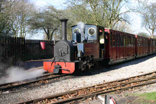
 'The light railway'
This scenic park has over 207 acres of park land. It attracts over one million visitors each year, making it one of the most popular parks in the East Midlands. 180 acres (730,000 m²) of the park were bought by the Corporation in 1930. The Park has a Light Railway system operated by two diesel engines and one steam engine.
Activities popular in the park
- Skateboarding
- Feeding the ducks
- Pitch and Putt
- Crazy Golf
- Playing in the paddling pool (Only open in the summer)
- Donkey rides
- A tree trail
- Canoeing for under 13 year olds
- Rowing boats and pedalos
- Fishing
- Visiting the craft village.
The Church
Markeaton shares its church with the nearby village of Mackworth. This 13th century church was fortified, one of the rare examples of such a church, to protect the villagers and their farm stock from raids by the Meynells, who lived at Langley Meynell.
References
- ^ Turbutt, G., (1999) A History of Derbyshire. Volume 2: Medieval Derbyshire, Cardiff: Merton Priory Press
External links
- Photographs of Markeaton Park
- 360 degree photograph of the Orangery at Markeaton Park - Quicktime required to view.
Suburbs of Derby, Derbyshire, England Allestree · Allenton · Alvaston · Boulton · California · Chaddesden · Chellaston · Darley Abbey · Heatherton Village · Litchurch · Little Chester · Littleover · Mackworth · Markeaton · Mickleover · New Zealand · Normanton · Oakwood · Osmaston · Pear Tree · Rose Hill · Shelton Lock · Sinfin · Spondon · Sunny Hill · West End · WilmortonCategories:- Districts of Derby
- Villages in Derbyshire

Wikimedia Foundation. 2010.