- Dhilwan
-
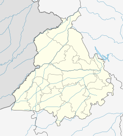
Dhilwan — city — Coordinates 31°31′N 75°21′E / 31.52°N 75.35°ECoordinates: 31°31′N 75°21′E / 31.52°N 75.35°E Country India State Punjab District(s) Kapurthala Population 7,980 (2001[update]) Time zone IST (UTC+05:30) Website dhilwan.org Dhilwan is a town and a nagar panchayat in Kapurthala district in the state of Punjab, India.
Contents
Geography
Dhilwan is located at 31°31′N 75°21′E / 31.52°N 75.35°E in Punjab.[1] It has an average elevation of 219 metres (718 feet).
Dhilwan Kalan
Please note Dhilwan and Dhilwan Kalan in Sikh History Books are two different places. Dhilwan Kalan is also written as Dhilwan, or Dhilwan Sodhian sometimes, which cause confusion among readers. Dhilwan Kalan is near Kotkapura in Faridkot District. Other few villages have same names and resemblance same like this, Dhilwan Khurd (District Faridkot), Dhilwan Wala (District Moga), Dhilwan (District Barnala).
Demographics
As of 2001[update] India census,[2] Dhilwan had a population of 7980. Males constitute 52% of the population and females 48%. Dhilwan has an average literacy rate of 68%, higher than the national average of 59.5%: male literacy is 72% and, female literacy is 63%. In Dhilwan, 12% of the population is under 6 years of age.
References
- ^ Falling Rain Genomics, Inc - Dhilwan
- ^ "Census of India 2001: Data from the 2001 Census, including cities, villages and towns (Provisional)". Census Commission of India. Archived from the original on 2004-06-16. http://web.archive.org/web/20040616075334/http://www.censusindia.net/results/town.php?stad=A&state5=999. Retrieved 2008-11-01.
Cities and towns in Kapurthala district Kapurthala Begowal · Bhulath · Dhilwan · Hussainpur · Kapurthala · Phagwara · Sultanpur Lodhi
Cities and towns
in other districtsAmritsar · Barnala · Bathinda · Faridkot · Fatehgarh Sahib · Firozpur · Gurdaspur · Hoshiarpur · Jalandhar · Ludhiana · Mansa · Moga · Mohali · Muktsar · Nawanshahr · Patiala · Rupnagar · Sangrur · Tarn Taran
Categories:- Cities and towns in Kapurthala district
- Punjab (India) geography stubs
Wikimedia Foundation. 2010.


