- Chabua
-
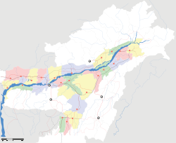
Chabua — city — Coordinates 27°29′N 95°11′E / 27.48°N 95.18°ECoordinates: 27°29′N 95°11′E / 27.48°N 95.18°E Country India State Assam District(s) Dibrugarh Population 7,230 (2001[update]) Time zone IST (UTC+05:30) Area
• 106 metres (348 ft)
Chabua is a town and a town area committee in Dibrugarh district in the state of Assam, India.
Contents
Geography
Chabua is located at 27°29′N 95°11′E / 27.48°N 95.18°E.[1] It has an average elevation of 106 metres (347 feet).
Demographics
As of 2001[update] India census,[2] Chabua had a population of 7230. Males constitute 54% of the population and females 46%. Chabua has an average literacy rate of 78%, higher than the national average of 59.5%; with male literacy of 83% and female literacy of 72%. 11% of the population is under 6 years of age.
Politics
Chabua is part of Lakhimpur (Lok Sabha constituency).[3]
History
During World War II, Chabua Airfield was constructed on the outskirts of the town. Chabua airfield was one of the largest bases used by the United States Army Air Force Air Transport Command to ferry supplies and personnel across The Hump to China in World War II. Chabua was headquarters for both the Assam and Bengal Wings of the India-China Division, ATC; and the operating base for the flying squadron of the 1333rd AAF Base Unit.
References
- ^ Falling Rain Genomics, Inc - Chabua
- ^ "Census of India 2001: Data from the 2001 Census, including cities, villages and towns (Provisional)". Census Commission of India. Archived from the original on 2004-06-16. http://web.archive.org/web/20040616075334/http://www.censusindia.net/results/town.php?stad=A&state5=999. Retrieved 2008-11-01.
- ^ "List of Parliamentary & Assembly Constituencies". Assam. Election Commission of India. http://archive.eci.gov.in/se2001/background/S03/AS_ACPC.pdf. Retrieved 2008-10-06.
Categories:- Cities and towns in Dibrugarh district
- Dibrugarh
- Assam geography stubs
Wikimedia Foundation. 2010.


