- Dadlington
-
Coordinates: 52°34′42″N 1°24′19″W / 52.57832°N 1.40525°W
Dadlington 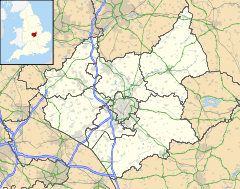
 Dadlington
Dadlington shown within LeicestershireOS grid reference SP404980 District Hinckley and Bosworth Shire county Leicestershire Region East Midlands Country England Sovereign state United Kingdom Post town NUNEATON Postcode district CV13 Police Leicestershire Fire Leicestershire Ambulance East Midlands EU Parliament East Midlands UK Parliament Bosworth List of places: UK • England • Leicestershire Dadlington is a hamlet administered by Hinckley and Bosworth District Council in Leicestershire, England. It is situated between Hinckley, Market Bosworth and Nuneaton.
The village has a population of around 301 and contains a 13th century church (St. James), a pub (the Dog and Hedgehog) and a hotel (the Ambion Court).
The Ashby-de-la-Zouch Canal runs through the village.
History
In 1511 the wardens of St. James' chapel at Dadlington petitioned King Henry VIII for a chantry foundation in memory of those who fell at the Battle of Bosworth, 1485 (the churchyard being the main place of interment for the dead). A 'Letter of Confraternity' was published and the chantry was established in a minimal form but dissolved in 1547 under Edward VI with the general abolition of such foundations. In 1985, the quincentenary year of the battle, Dadlington (through the publications of Dr Colin Richmond and, subsequently, Dr Peter Foss) became the centre of a controversy over the battle's location, which has now resulted in a major reassessment of the battle site and scenario currently being undertaken by Leicestershire County Council.
During the English Civil War Dadlington was visited by troops from the parliamentary garrisons at Tamworth and Coventry seeking horses and free quartering. A claim to the Warwickshire county committee submitted by the constables in June, 1646 reveals that on 12 March, 1643 a certain Burdett, described as “a soldier under Captain Turton of Tamworth” made off with a horse belonging to Ann Turton, a widow. (A Richard Turton is listed in a 1643 Tamworth garrison musters of “officers, dragoons and soldjers”). A few months later “Mason, a soldier under Captain Turton” (probably John Mason, also listed among the Tamworth garrison) took a horse worth £2.6.8 from this same Ann Turton, who may well have been related to the captain. Colonel Purefoy's soldiers from Coventry availed themselves of free quarter "for one night and part of a day" estimated to be worth £2.10, while Captain Flower's footsoldiers from Coventry took a horse worth 2s from Michael Cox and Captain Ottaway's soldiers a horse work 5s from Thomas Everard. (Exchequer accounts, SP 28/161)
External links
Categories:- Hamlets in Leicestershire
- Leicestershire geography stubs

Wikimedia Foundation. 2010.