- New York State Route 962J
-
NYS Route 962J
Valley View Drive Route information Maintained by NYSDOT Length: 0.41 mi[2] (0.66 km) Existed: 2001[1] – present Major junctions South end:  NY 434 in Owego
 NY 17 in Owego
North end:  NY 17C in Owego
Location Counties: Tioga Highway system Numbered highways in New York
Interstate • U.S. • N.Y. (former) • Reference • County←  NY 961F
I-990  →
→New York State Route 962J (NY 962J) is a northeast–southwest reference route that has been erroneously signed as a touring route in Southern Tier town of Owego in Tioga County, New York. Its southwestern terminus is at NY 434 in the census-designated place of Apalachin and its northeastern terminus is at NY 17C south of the hamlet of Campville.
Contents
Route description
The entire route is less than a 1/2 mile in length and has only one name, Valley View Drive.
Shortly after the street begins at NY 434, NY 962J passes over NY 17 (the Southern Tier Expressway). This portion was previously part of the trumpet-style interchange that NY 17 westbound had with NY 434 at exit 66. Today, however, the road continues to the northeast, intersecting the new ramps that lead to and from NY 17 westbound before crossing over the Susquehanna River.
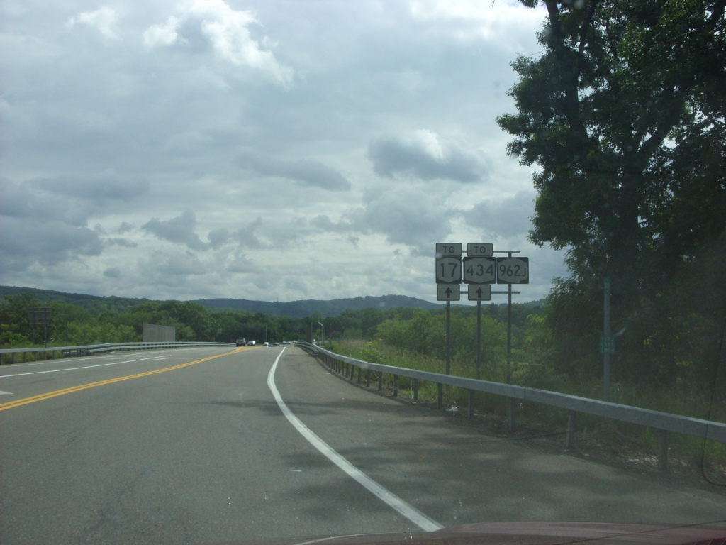
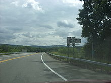 NY 962J heading southbound from NY 17C in Owego
On the other bank of the river, the highway passes over the Norfolk Southern-owned Southern Tier Line before reaching its northern terminus at NY 17C.
History
The bridge over the Susquehanna and the reconfiguration of the westbound ramps at exit 66 were completed in 2001, offering a convenient connector route across the Susquehanna.[3] It was also designated as a reference route at that time.[1] It was not marked as a touring route until early 2005.[4] NY 962J is one of four reference routes in New York State to be erroneously signed as a touring route. See NY 990V for a more detailed explanation of this phenomenon.
Major intersections
The entire route is in Owego, Tioga County.
Mile[2] Destinations Notes 0.00 NY 434Census-designated place of Apalachin 0.15 NY 17 westPart of exit 66 (NY 17) 0.41 NY 17C1.000 mi = 1.609 km; 1.000 km = 0.621 mi References
- ^ a b Perry, N.W.. "Reference Routes – Region 6". Empire State Routes. http://www.empirestateroads.com/sr/refroute6.html. Retrieved January 24, 2010.
- ^ a b "2008 Traffic Data Report for New York State" (PDF). New York State Department of Transportation. June 16, 2009. p. 361. https://www.nysdot.gov/divisions/engineering/technical-services/hds-respository/NYSDOT_Traffic_Data_Report_2008.pdf. Retrieved January 10, 2010.
- ^ National Bridge Inventory, a database compiled by the United States Department of Transportation Federal Highway Administration, available at www.nationalbridges.com. Accessed November 2, 2007.
- ^ Sinsabaugh, Mark. "New York State Route 962J". New York Routes. http://www.gribblenation.net/nyroutes/ind/800_999.htm#962j. Retrieved January 24, 2010.
External links
Categories:- Reference routes in New York
- Transportation in Tioga County, New York

Wikimedia Foundation. 2010.