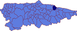
- Colunga
-
Colunga — Municipality — Location in Spain Coordinates: 43°28′N 5°16′W / 43.467°N 5.267°WCoordinates: 43°28′N 5°16′W / 43.467°N 5.267°W Country  Spain
SpainAutonomous community  Asturias
Province Asturias Comarca Oriente Judicial district Villaviciosa Capital Colunga Government - Alcalde José Rogelio Pando (PSOE) Area - Total 97.57 km2 (37.7 sq mi) Highest elevation 1,159 m (3,802 ft) Population - Total 3,930 - Density 40.3/km2 (104.3/sq mi) Demonym colungués / colunguesa Time zone CET (UTC+1) - Summer (DST) CEST (UTC+2) Postal code 33320 - 33340 Official language(s) Website Official website Colunga is a municipality in the Autonomous Community of the Principality of Asturias, Spain. It lies on the Cantabrian Sea, and is bordered to the west by Villaviciosa, to the south by Parres and Piloña, and to the east by Caravia.
Contents
Politic
PSOE PP IU-BA Others Total 2003 4 4 1 2 11 2007 6 5 0 0 11 Parishes
- Carrandi
- Colunga
- Gobiendes
- La Isla
- La Llera
- La Riera
- Lastres
- Libardón
- Lue
- Pernús
- Pivierda
- Sales
- San Juan de Duz
Demography

Quelle: Instituto Nacional de Estadística de España - grafische Aufarbeitung für Wikipedia Anchovy beaching incident
On Septembter 29th, 2006, millions of anchovies, constituting a weight of over three tons, had beached themselves near Colunga. Tests on the dead fish did not detect any toxic chemical that could have caused the beaching, and the current working theory is that the shoal beached itself trying to escape from "hungry dolphins or tuna." If the beached specimens had grown to maturity, it would have been more than "100 tons of potential breeders."[1]
Gallery
Notes
- ^ Millions of anchovies die on Spain beach AP, Sept. 29th, 2006
References
- Populationsdata INE
- Postalcodes [1]
- Altitdude Google Earth
External links
- www.llastres.com | foros de lastres (Spanish)
- Federación Asturiana de Concejos(Spanish)
- Portal sobre el concejo (Spanish)
- 14 rutas por colunga (Spanish)
Municipalities in Asturias Allande · Aller · Amieva · Avilés · Belmonte de Miranda · Bimenes · Boal · Cabrales · Cabranes · Candamo · Cangas de Onís · Cangas del Narcea · Caravia · Carreño · Caso · Castrillón · Castropol · Coaña · Colunga · Corvera de Asturias · Cudillero · Degaña · El Franco · Gijón/Xixón · Gozón · Grado · Grandas de Salime · Ibias · Illano · Illas · Llangréu/Langreo · Laviana · Lena · Llanera · Llanes · Mieres · Morcín · Muros de Nalón · Nava · Navia · Noreña · Onís · Oviedo · Parres · Peñamellera Alta · Peñamellera Baja · Pesoz · Piloña · Ponga · Pravia · Proaza · Quirós · Las Regueras · Ribadedeva · Ribadesella · La Ribera/Ribera de Arriba · Riosa · Salas · San Martín de Oscos · San Martín del Rey Aurelio · San Tirso de Abres · Santa Eulalia de Oscos · Santo Adriano · Sariego · Siero · Sobrescobio · Somiedo · Soto del Barco · Tapia de Casariego · Taramundi · Teverga · Tineo · Valdés · Vegadeo · Villanueva de Oscos · Villaviciosa · Villayón · Yernes y Tameza Categories:
- Municipalities in Asturias
- Populated places in Asturias
- Asturias geography stubs
Wikimedia Foundation. 2010.


