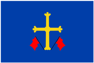
- Gozón
coat of arms= Gozon coat of arms.svg
Location map|Spain|label=Gozón|lat_deg=43|lat_min=36|lon_deg=-5|lon_min=-47|position=right|width=280|float=right|background=#FFFFDD
capital=Luanco
coordinates = coord|43|36|35.9|N|5|47|23.9|W|display=title,inline|type:adm2nd(10723)_elevation:30_dim:5000_region:ES-AS-AS-GO_source:dewiki
judicial district=
parishes= 13
year= 2007
population= 10,723
population rank= 21
population percentage= 0.99
density= 131.22
area= 78
area rank= 46
area percentage= 0.74
highest point= Tabladas, 133
postcode= 33418, 33440, 33448, 33449, 33490
mayor= Salvador Marcelino Fernández Vega
party= PP
website= http://www.ayto-gozon.comGozón is a municipality in the
Autonomous Community of thePrincipality of Asturias ,Spain . TheCantabrian Sea lies on its northern edge, and it is bordered to the south byCorvera de Asturias , to the west byAvilés , and to the east byCarreño .The municipality is a fishing port.
It is the location of the
Cabo de Peñas (Cape of Boulders).Toponymy
In decree 72/2005 of
July 7 ,2005 , published in the "Boletin Oficial del Principado de Asturias" (BOPA; official bulletin of the Principality of Asturias) granted the Asturian forms of the municipal place names official status for all uses, with the exception of the capital Lluanco/Luanco, which maintains a bilingual name. Therefore, with this exception, the Asturian names are the only ones which can appear on road signs and official maps.Politic
Art and Culture
*
*
* The Clock Tower dating from 1705
*
*
*
Demography
Demography 5col|510px|
11.570|11.410|11.074|10.744|10.742
Parishes
External links
* [http://www.facc.info/CONCEJOS/Gozon.htm Federación Asturiana de Concejos] es
* [http://www.alnorteluancorural.com/ Asociación de Turismo Rural del Cabo Peñas "El Faro"] es
Wikimedia Foundation. 2010.

