- Washington State Route 203
Infobox WA State Route
type=SR
route=203
sec=390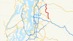
formed=1964
length_mi=24.26
length_round=2
length_ref= [ cite web|url=http://www.wsdot.wa.gov/mapsdata/tdo/PDF_and_ZIP_Files/HwyLog2005.pdf|title=State Highway Log Planning Report 2005 Volume 1 (SR 2 to SR 971)|accessdate=2007-02-18|date=May 4, 2005|format=PDF|publisher=Washington State Department of Transportation , Strategic Planning and Programming Division]
dir1=South
dir2=North
from=
to=
previous_type=WA
previous_route=202
next_type=WA
next_route=204
spur_type=US
spur_of=2State Route 203, also known as SR 203, is a numbered United States
state highway inWashington . State Route 203 begins at its junction with State Route 202 across theSnoqualmie River just north of Fall City. It then heads north along the east side of the Snoqualmie Valley for 24.26 miles before reaching its terminus in Monroe, where it meets U.S. Route 2. SR 203 offers brilliant views of the Snoqualmie River Valley andMount Rainier on a clear day.State Route 203 is also the primary connector to the towns of Carnation and Duvall, and can become slightly congested during heavy traffic hours. For the majority of its length, SR 203 has a speed limit of 50-55 MPH but drops considerably in the business districts of Carnation and Duvall. Upon entering the city of Monroe, the speed limit drops from 55 MPH to 35 MPH then to, 25 MPH.
History:
Formed in 1937 as Secondary State Highway 15b.
References

Wikimedia Foundation. 2010.