Washington State Route 204
- Washington State Route 204
Infobox WA State Route
type=State
route=204
sec=395
formed=1964
length_mi=2.38
length_km=3.8
length_ref= [ cite web|url=http://www.wsdot.wa.gov/mapsdata/tdo/PDF_and_ZIP_Files/HwyLog2005.pdf
title=State Highway Log Planning Report 2005 Volume 1 (SR 2 to SR 971)
accessdate=2007-02-18 |date=May 4, 2005 |format=PDF
publisher=Washington State Department of Transportation, Strategic Planning and Programming Division ]
dir1=West
dir2=North
from=
to=
previous_type=WA
previous_route=203
next_type=Interstate
next_route=205
spur_type=US
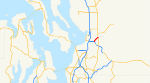
spur_of=2State Route 204 is a state highway in Snohomish County in the U.S. state of Washington. It runs for convert|2.4|mi|km|1 from the junction at the east end of the Hewitt Avenue Trestle on U.S. 2, east of Everett, northeastward to the junction with State Route 9 in the Frontier Village commercial district of the city of Lake Stevens.
References
Wikimedia Foundation.
2010.
Look at other dictionaries:
Washington State Route 204 — Karte … Deutsch Wikipedia
Washington State Route 203 — Infobox WA State Route type=SR route=203 sec=390 formed=1964 length mi=24.26 length round=2 length ref= [ cite web|url=http://www.wsdot.wa.gov/mapsdata/tdo/PDF and ZIP Files/HwyLog2005.pdf|title=State Highway Log Planning Report 2005 Volume 1 (SR … Wikipedia
Washington State Route 206 — State Route 206 Route information … Wikipedia
Virginia State Route 204 — Infobox road state=VA type= route=204 alternate name=Popes Creek Road length mi=1.73 length ref=PDFlink| [http://www.virginiadot.org/info/resources/AADT 096 Westmoreland 2005.pdf 2005 Virginia Department of Transportation Jurisdiction Report… … Wikipedia
Washington State Route 92 — infobox WA State Route type = State route = 92 sec = 145 parent = 9 parent type = State length mi = 8.25 length ref = length round = 2 formed = 1964 dir1 = West dir2 = East from = to = Granite Avenue in Granite Falls previous type = Interstate… … Wikipedia
California State Route 78 — State Route 78 State Route 78 highlighted in red … Wikipedia
Ohio State Route 7 — State Route 7 Major highways in Ohio with OH 7 in red. Route information … Wikipedia
Ohio State Route 83 — State Route 83 Route information Maintained by ODOT Length: 157.59 mi[1 … Wikipedia
Utah State Route 39 — State Route 39 12th Street Ogden River Scenic Byway … Wikipedia
New York State Route 173 — NYS Route 173 Map of the Syracuse area with NY 173 highlighted in red Route information … Wikipedia
