- Severo-Kurilsk
-
Severo-Kurilsk (English)
Северо-Курильск (Russian)- Inhabited locality - 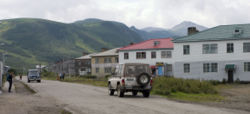
Main street of Severo-Kurilsk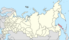
Location of Sakhalin Oblast in Russia
 Severo-Kurilsk
Coordinates: 50°41′N 156°07′E / 50.683°N 156.117°ECoordinates: 50°41′N 156°07′E / 50.683°N 156.117°E 

Coat of arms Flag Administrative status Country Russia Federal subject Sakhalin Oblast Administrative center of Severo-Kurilsk District[citation needed] Municipal status Urban settlement Severo-Kurilsk Urban Settlement[citation needed] Statistics Population (2002 Census) 2,592 inhabitants[1] Postal code(s) 694550[citation needed] Dialing code(s) +7 42453[citation needed] Official website Severo-Kurilsk (Russian: Се́веро-Кури́льск; Japanese: 柏原, Kashiwabara) is a town in Sakhalin Oblast, Russia. It is situated in the northern part of the Kuril Islands, on the island of Paramushir. Population: 2,592 (2002 Census); 5,180 (1989 Census).
Contents
History
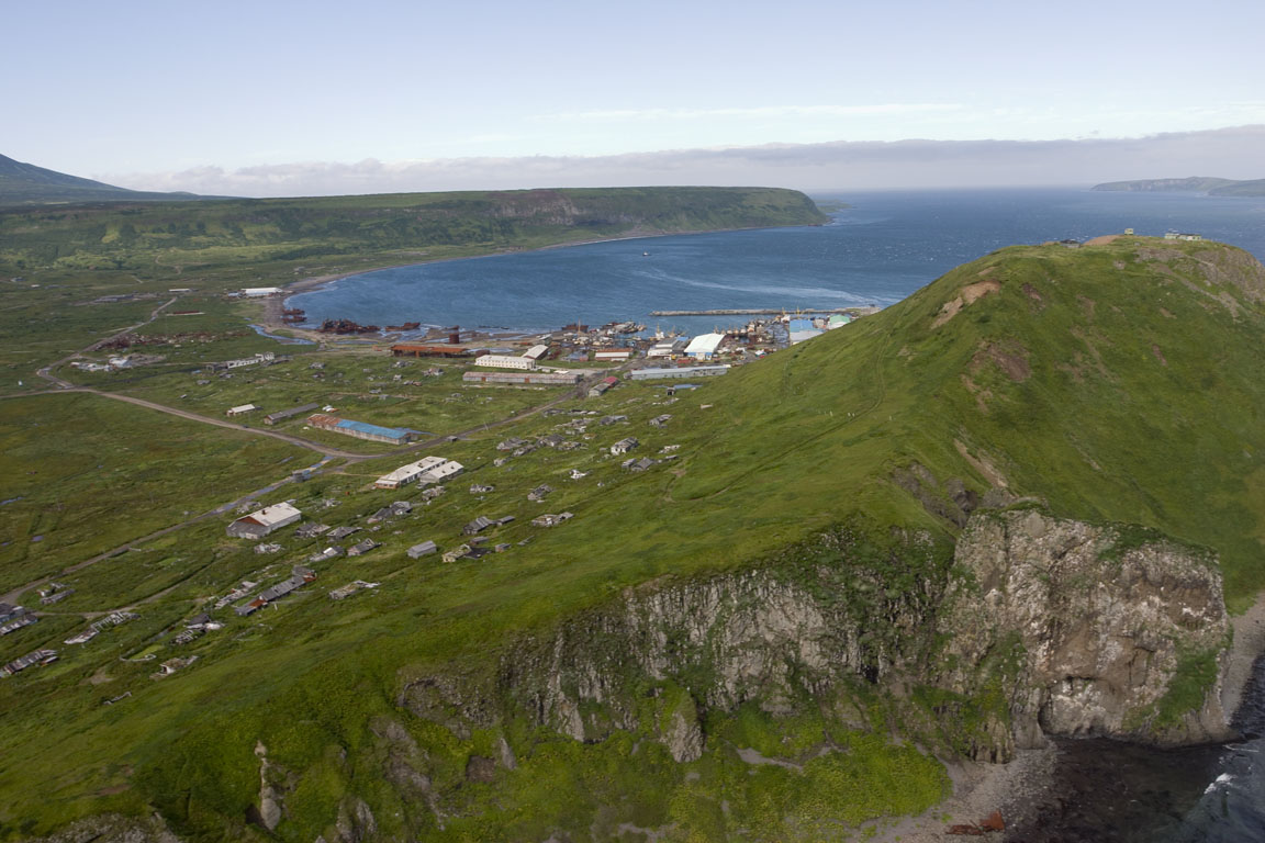
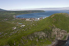 View of the original site of Severo-Kurilsk
The Ainu are the original inhabitants of Paramushir, which came under the control of Imperial Russia in the mid-18th century. Russian sovereignty was initially confirmed under the terms of the Treaty of Shimoda in 1855, but the island was transferred to the Empire of Japan per the Treaty of Saint Petersburg in 1875. The Japanese established a settlement, Kashiwabara, on the site of the largest Ainu village, which became the major port on the island, and a center for the commercial fishing industry, particularly for herring. The village was named for the captain of the survey vessel Iwaki, which charted the coasts of the island in 1875. The village had the northernmost post office in Japan. During World War II Kashiwabara was strongly garrisoned by the Imperial Japanese Army and served as the headquarters of the IJA 91st Infantry Division. Kashiwabara Airfield was established in the outskirts of the village, and numerous fortifications and gun emplacements were built. The area was subject to sporadic air raids from the US Army Air Force and US Navy based in the Aleutian Islands from 1943 until the end of the war.
During the Invasion of the Kuril Islands, Soviet landed on Paramushir on August 18, 1945, and combat operations continued through August 23, ending with the surrender of the surviving members of the Japanese garrison. The Soviets forcibly deported the remaining Japanese civilian inhabitants and sent the prisoners of war to labor camps. Kashiwabara was renamed Severo-Kurilsk (Northern Kuril Town) and the island annexed by the Soviet Union in 1946.
On 5 November 1952 the town was completely destroyed by the 1952 Severo-Kurilsk tsunami, with at least 2,336 of the town's 6,000 inhabitants killed. Severo-Kurilsk was rebuilt on higher ground, and the population soon rose above its original level, however in the years since the dissolution of the Soviet Union and the associated economic crisis of the 1990s, the town's population has again sunk.
Economy and infrastructure
Commercial fishing is virtually the only industry in the town.
The surrounding area has some remaining Japanese fortifications visible.
Sister city relations
References
- ^ Федеральная служба государственной статистики (Federal State Statistics Service) (2004-05-21). "Численность населения России, субъектов Российской Федерации в составе федеральных округов, районов, городских поселений, сельских населённых пунктов – районных центров и сельских населённых пунктов с населением 3 тысячи и более человек (Population of Russia, its federal districts, federal subjects, districts, urban localities, rural localities—administrative centers, and rural localities with population of over 3,000)" (in Russian). Всероссийская перепись населения 2002 года (All-Russia Population Census of 2002). Federal State Statistics Service. http://www.perepis2002.ru/ct/doc/1_TOM_01_04.xls. Retrieved 2010-03-23.
- ^ Sister relations with Hokkaido
References
- Krasheninnikov, Stepan Petrovich, and James Greive. The History of Kamtschatka and the Kurilski Islands, with the Countries Adjacent. Chicago: Quadrangle Books, 1963.
- Rees, David. The Soviet Seizure of the Kuriles. New York: Praeger, 1985. ISBN 0-03-002552-4
Cities and towns in Sakhalin Oblast Administrative center: Yuzhno-Sakhalinsk
 Categories:
- Cities and towns in Sakhalin Oblast
- Paramushir


Wikimedia Foundation. 2010.