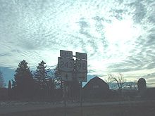
- New York State Route 243
-
NYS Route 243 Route information Maintained by NYSDOT Length: 11.03 mi[2] (17.75 km) Existed: 1930[1] – present Major junctions West end:  NY 98 in Fairview
East end:  NY 19 in Caneadea
Location Counties: Cattaraugus, Allegany Highway system Numbered highways in New York
Interstate • U.S. • N.Y. (former) • Reference • County←  NY 242
NY 244  →
→New York State Route 243 (NY 243) is a short east–west state highway in the Southern Tier of Western New York. Despite its minimal length, it is an important route as it provides access to Rushford Lake.
Contents
Route description
It begins at an awkward intersection with NY 98 at the hamlet of Fairview in the Cattaraugus County town of Farmersville. Shortly afterwards, it crosses the Allegany County line at a five-way intersection.
It then wends its way southward to Rushford, then east again to run along the north shore of the lake and through the hamlet of Balcom Beach. Two miles (3.2 km) past the lake, it ends at NY 19 in Caneadea.
History
NY 243 was assigned to its current alignment in the 1930 renumbering and has not been altered since.[1]
Major intersections
County Location Mile[2] Destinations Notes Cattaraugus Farmersville 0.00  NY 98
NY 98Hamlet of Fairview Allegany Caneadea 11.03  NY 19
NY 191.000 mi = 1.609 km; 1.000 km = 0.621 mi References
- ^ a b Dickinson, Leon A. (January 12, 1930). "New Signs for State Highways". The New York Times: p. 136.
- ^ a b "2008 Traffic Volume Report for New York State" (PDF). New York State Department of Transportation. June 16, 2009. p. 195. https://www.nysdot.gov/divisions/engineering/technical-services/hds-respository/NYSDOT%20TVR%202008%20by%20Route.pdf. Retrieved February 1, 2010.
External links
Categories:- State highways in New York
- Transportation in Allegany County, New York
- Transportation in Cattaraugus County, New York
Wikimedia Foundation. 2010.


