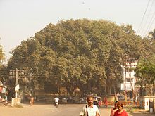
- Dahanu
-
Dahanu (Village) — town — Coordinates 19°58′N 72°44′E / 19.97°N 72.73°ECoordinates: 19°58′N 72°44′E / 19.97°N 72.73°E Country India State Maharashtra District(s) Thane Population 44,393 (2001[update]) Time zone IST (UTC+05:30) Area
• 0 metres (0 ft)
Website www.dahanu.com/ Dahanu (Marathi: डहाणू) is a coastal city and a municipal council in Thane district in the western state of Maharashtra, India.
Contents
The Town
The name "Dahanu Gaon" originates from the word "Dhenu Gram" meaning the village of cows. A lot of cattle, particularly cows were owned by the people in Dahanu. Today, Dahanu has become a major commercial and industrial town in the Thane district. It is well known for rose gardens,coconut grooves and the chickoo fruit and accounts for over 35% of India's chickoo production. Rubber balloons, rice mills and manufactured goods, are major manufacturing products which are produced in Dahanu. There is also a 500-MW power plant that supplies electricity to Mumbai. The electricity is distributed by Reliance Energy. It was formerly owned by the government.
Education in Dahanu
Colleges
There are 3 colleges in Dahanu:-
- S.R.K College in Masoli(Vadkun)
- Ponda College near Dahanu beach
- P G Junior College, Bordi.
English middle schools
There are also English middle schools including
- St. Mary's High School
- H.M.P High School
- Shirin Diniyar Iranis Learners Academy
Other Schools
1. Pujya Acharya Bhise Vidyalay Kasa 2. Balakanji Bari High School Bapugaon 3. Surya nagar High school Waghadi 4. K.L. Ponda High School, Parnaka, Dahanu 5. H & H J Vakil Model High School. 6. S P H Highschool, Bordi
Social Entrepreneurship
The virtual platform for social developement activities, AYUSH group is initiated by tribal youth from Dahanu taluka. AYUSH is stands for Adivasi Yuva Shakti, a online platform with technological touch for tribal development activities. Base operated from Waghadi, near Kasa about 25 km from Dahanu Station. This group has initiated various program for guiding rural students, preserving tribal art & culture.
Industries
The BSES (Bombay Suburban Electricity Supply) PowerPlant was renamed as Reliance Energy Power Plant in the year 2005. Dahanu is a coastal region, the staple food of the people living there is rice and fish. Dahanu Road railway station is the last main station within boundary of Maharashtra State en route Mumbai Vadodara Western Railway line. Many Express trains halt at this station. Weather here is very pleasant in the winters. Dahanu is also famous for the tribal people called adivasis. Dahanu and surrounding area is designated by the government of India as an ecologically fragile zone, to protect the greenery from industrial pollution. Dahanu Road also has many balloon factories in the Masoli area. Industrial development received a setback from new ecological regulations hence tourism, animal husbandry, fishing, small scale units and farming are the only industries where expansion can take place.
Temples
Some of the famous temples :[Mahalakshmi Temple], Mata Mahalaxmi & Mahalaxmi Gadh, Santoshi Temple-Ashagadh, Sai Baba Temple- Narpad, Shri Kevda Devi Mandir -Agar Road, Jagrut Hanuman Mandir - Agar & Waghadi, Mata Saptashrungi Mandir Nikane,Shri Gajanan Maharaj Mandir - Parnaka. Shree Ram mandir-Ramwadi,Dahanu Road (East).
Jain Temples The old Jain temple in Dahanu Gaon (Fort Area) has recently completed 100 years and is now included in Jain Tirth (Teerths) It is a Chandraprabhu Swami's temple and also has idols of Dadaguru Dev.
The newly constructed temple at Kosbad Hill is an attraction for people from Mumbai and Surat as there are many visitors on Sundays. Tour organisers arrange a single day picnic from Mumbai and they come in numbers every weekends.
There is a famous 'Vishveshwar Temple' in Dahanu Gaon and a beautiful Ganesh Temple near Dahanu Fort.
Geography
Dahanu is located at 19°58′N 72°44′E / 19.97°N 72.73°E.[1] It has an average elevation of 9.89 metres. To the west of the town is the beautiful coast of the Arabian sea while the east is lined with the magnificent Sahyadri ranges. This unique combination has made Dahanu a major tourist attraction. Sprawling Chickoo wadis (farms), rose gardens, salt pans are among the other things that dot the landscape.
The Dahanu beach is an extensive 15 km stretch - lined by coconut and "suru" trees.this is mostly crowded on the weekend when people from the metropolitian city of mumbai come to visit as it is a short commute.the other days life is very laidback and the beach doesnt see much tourist crowd except inhabitants of dahanu.there are horse,camel and weekend fairs on the beach.
Demographics
As of 2011[update] India census,[2] Dahanu had a population of 1,27,000. Males constitute 52% of the population and females 48%. Dahanu has an average literacy rate of 71%, higher than the national average of 59.5%: male literacy is 77% and, female literacy is 64%. In Dahanu, 13% of the population is under 6 years of age.
Art & Culture
The people in dahanu taluka are mostly tribals, mostly inhibiting rural areas and having daily commute to urban areas for work. tribal culture is dominant in the talk and customs.the tribal art mostly predominantly shows village life and the day to day functions. The original people of this land are tribals. World famous tribal art "warli art" originated here.many foreign students have resided in the tribal settlements for learning warli art. Similarly Tarpa dance and Dhole dance are famous all over the world.
Festivals
- Koli Bhaji
- Nag Panchami
- Gauri Ganapati
- Sakar Chuvat
- Nava Bhat Khane
- Sarvapitari Avas or Omasya
- Dival Baras or Bagh Baras
- Dasara
- Divali
- Saticha Deva
- Sakrat
- Holi or Simga
- Mahi Bij
- Gudi Padwa
- Akhati
- Boida
- Khalyacha Deva
- Shri Ram navami
References
- ^ Falling Rain Genomics, Inc - Dahanu
- ^ "Census of India 2001: Data from the 2001 Census, including cities, villages and towns (Provisional)". Census Commission of India. Archived from the original on 2004-06-16. http://web.archive.org/web/20040616075334/http://www.censusindia.net/results/town.php?stad=A&state5=999. Retrieved 2008-11-01.
External links
Categories:- Cities and towns in Thane district
- Talukas in Maharashtra
Wikimedia Foundation. 2010.


