- Dahanu Road
-
Dahanu — town — Coordinates Country India State Maharashtra Time zone IST (UTC+05:30) Website www.dahanu.com 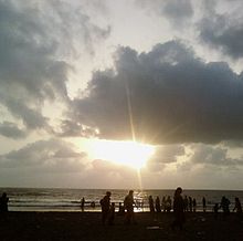 Beautiful Sunset at Parnaka Beach
Contents
Location
Dahanu is located 65 km north of Virar on the Western Railway line of Mumbai Suburban Railway. It can be reached from National Highway NH-8, 20 km off from Charoti Naka. It is 22 km North of Boisar on the Western Railway line. It has nice and beautiful beaches. There is nice beach at Parnaka. Nearby Sai temple is located in Narpad.
Topographically, Dahanu taluka can be divided into a 10-12 kilometre wide bandarpatti, the coastal belt of lowlands and flats extending from the sea coast to the railway line situated at the foot of the Sahyadari range. The entire coastal belt with its rich natural resources, wetlands, mangroves and river deltas, forms a lucrative fishing area. The junglepatti, to the east of the railway line consists of tropical deciduous forests. Interestingly the forest cover in Dahanu is still fairly high at 45.2 percent. A large part of the indigenous community resides in this zone, in remote almost inaccessible villages. Also famous for Mahalaxmi Temple located just 4km from Charoti.
Agriculture
Dahanu is well known for its famous delicious chikoos, capsicum and coconuts,tadee a juice of palm tree.
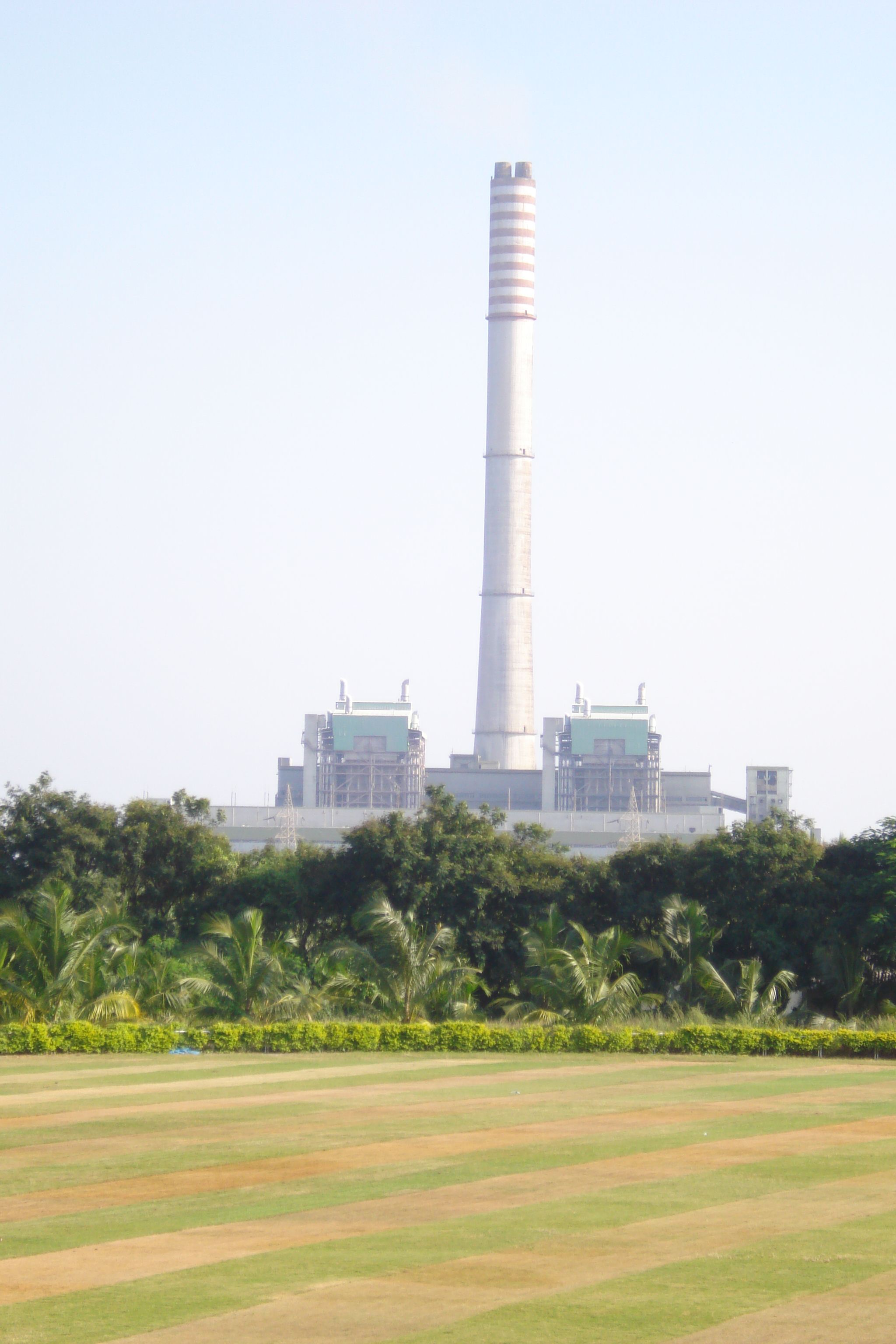
Dahanu Thermal Power Station
 A view of Dahanu Thermal Power Station, Reliance Energy Limited
Dahanu Thermal Power Station (DTPS) is Reliance Energy Ltd.’s single largest power generating facility. It is a 500 MW (2 X 250 MW) coal based thermal power station.
The power plant was commissioned in 1995. DTPS is the first power utility to get both ISO 9000 and ISO 14001 certificate in India.
Electrostatic precipitators (ESP) are installed to collect fly ash and minimize emissions to the atmosphere.
DTPS has installed a 275.34 m stack to ensure better dispersion of particulate matter. The stack has a diameter of 31.5 m at the bottom and a diameter of 16 m at the top, with two separate flues of 5.25 m diameter at the bottom and 4.75 m diameter at the top for each unit. This is the highest stack in India. (reference: http://www.rel.co.in/aboutus/dahanutps.asp )
Nearby Industrial Area and Other Power Stations
Tarapur Industrial Estate and Tarapur Atomic Power Station are located close by. The huge industrial area at Tarapur accommodates various specialty chemical, bulk drugs, steel and alloy and textile manufacturing companies.
Residential
Dahanu is a good residential location. Very good schools & colleges, are located here.
Public transport
State transport buses (Maharashtra State Transport Corporation) and auto rickshaws are the general mode of transport.Dahanu Road is also accessible by train.
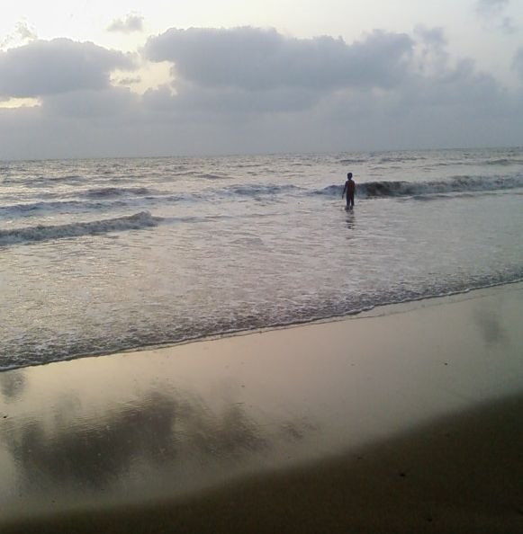
 Parnaka(Dahanu Beach)
Population of Dahanu Taluka
In spite of a tradition of resistance, the indigenous Warlis have today become poor marginal farmers or migrant labourers barely surviving from year to year. While their narratives and consciousness come from a history of police brutality, exploitation by landlords, moneylenders and liquor contractors and from their continuous struggle for land rights and access to the forests, they are today forced into practicing settled subsistence agriculture. Moreover, categorized as backward and primitive, their culture, heritage and ecological understanding has come under attack. They now live on the margins of industrial and urban areas on the fringes of their slowly eroding forest lands.
Dahanu Road Next station south:
VangaonMumbai Suburban Railway : Western Line Next station north:
LastStop No: 36 KM from starting: 120 Platforms: {{{7}}} Stations on the Western Line of Mumbai Suburban Railway Churchgate · Marine Lines · Charni Road · Grant Road · Mumbai Central · Mahalaxmi · Lower Parel · Elphinstone Road · Dadar · Matunga Road · Mahim Junction · Bandra · Khar Road · Santacruz · Vile Parle · Andheri · Jogeshwari · Goregaon · Malad · Kandivali · Borivali · Dahisar · Mira Road · Bhayandar · Naigaon · Vasai Road · Nala Sopara · Virar · Vaitarna · Saphale · Kelve Road · Palghar · Umroli · Boisar · Vangaon · Dahanu RoadCategories:- Railway stations in Mumbai
- Cities and towns in Thane district

Wikimedia Foundation. 2010.