- Mammoth Pool Reservoir
-
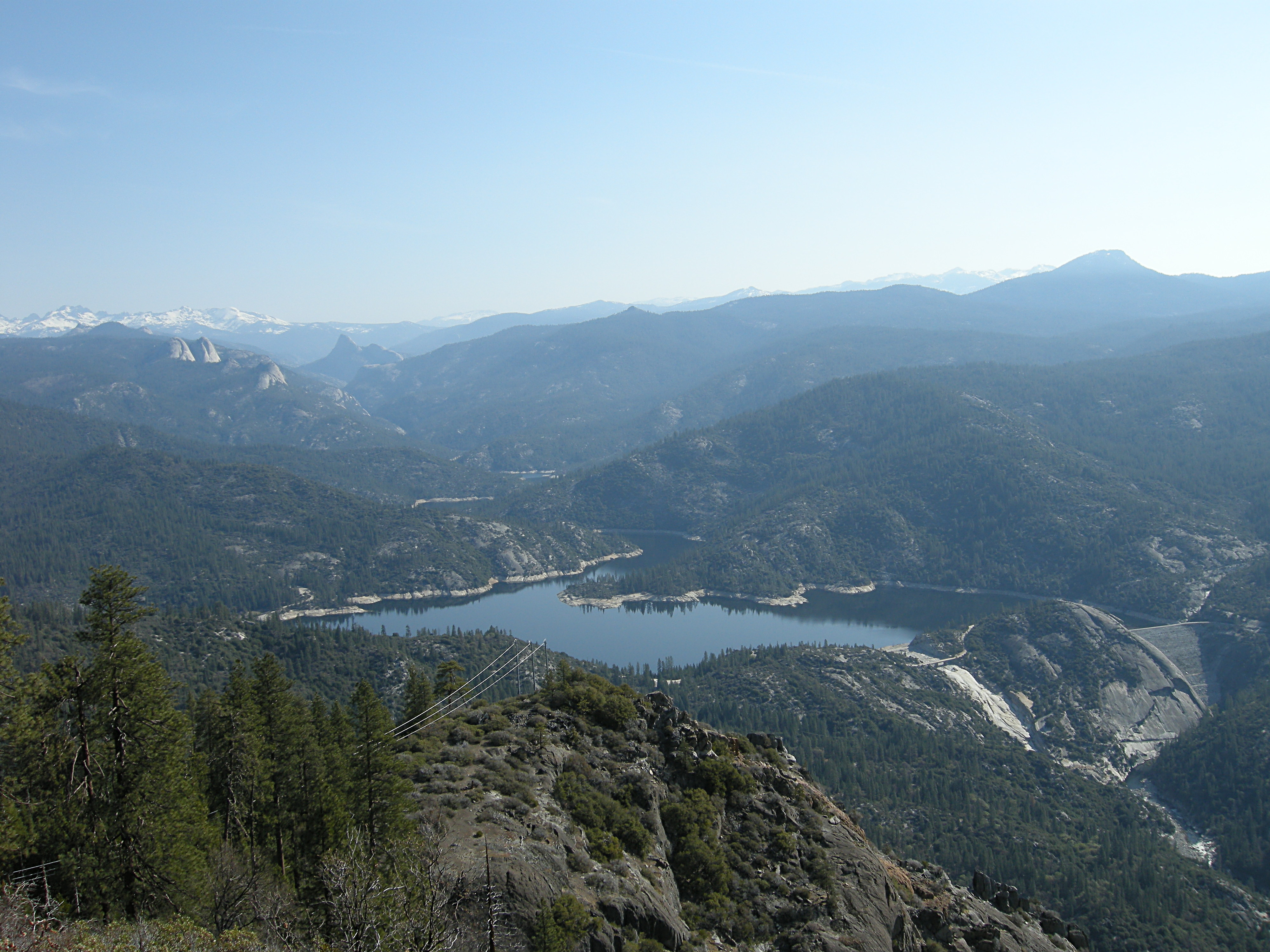
Mammoth Pool Reservoir 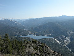
Location Sierra National Forest
Fresno County, California
Madera County, CaliforniaCoordinates 37°21′15″N 119°18′32″W / 37.3541°N 119.309°WCoordinates: 37°21′15″N 119°18′32″W / 37.3541°N 119.309°W Lake type Reservoir Primary inflows San Joaquin River Primary outflows San Joaquin River Catchment area 998 sq mi (2,580 km2) Basin countries United States Max. length 5 mi (8.0 km) Max. width 1.5 mi (2.4 km) Surface area 1,100 acres (450 ha) Water volume 123,000 acre·ft (152,000,000 m3) Surface elevation 3,330 ft (1,010 m) References U.S. Geological Survey Geographic Names Information System: Mammoth Pool Reservoir Mammoth Pool Reservoir is a reservoir on the San Joaquin River in the Sierra Nevada, within the Sierra National Forest in California. It straddles the border of Fresno County and Madera County. It is about 45 miles (72 km) north-northeast of Fresno.
Contents
Hydroelectric power
The 123,000 acre·ft (152,000,000 m3) reservoir is formed by Mammoth Pool Dam, an earth-fill dam completed in 1960.[1] It was built by Southern California Edison for hydroelectricity production. The dam's power plant can produce up to 190 megawatts.[citation needed] The dam, reservoir and power plant are part of the Big Creek Hydroelectric Project, perhaps the most extensive hydroelectric system in the world.[citation needed]
Recreation
The reservoir is also a recreation area. Activities at the lake include, swimming, fishing, camping and boating.
The reservoir is closed to the public during the month of May and the first half of June to allow migrating deer to swim across the reservoir. They spend the summer in the Sierra Nevada.
The reservoir is inaccessible following the first snowstorm, usually occurring in November, as the access road is not snowplowed.[2]
References
- ^ Department of Water Resources (2009). "Station Meta Data: Pine Flat Dam (PNF)". California Data Exchange Center. State of California. http://cdec.water.ca.gov/cgi-progs/profile?s=MPL&type=dam. Retrieved 2009-08-28.
- ^ US Forest Service (22 February 2009). "Sierra National Forest - Recreation, Lakes & Reservoirs:". U.S. Department of the Interior. http://www.fs.fed.us/r5/sierra/recreation/lakes/mammothpool/index.shtm. Retrieved 2009-08-28.
External links
Categories:- Reservoirs in California
- Sierra National Forest
- Lakes of Fresno County, California
- Lakes of Madera County, California
- Sierra Nevada (U.S.)
- San Joaquin River
- Buildings and structures in Fresno County, California
- Buildings and structures in Madera County, California
Wikimedia Foundation. 2010.