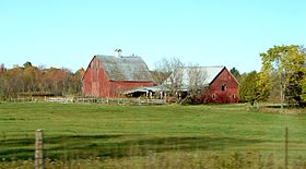
- Montague, Ontario
-
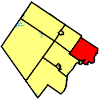
Township of Montague — Township — Montague within Lanark County. Coordinates: 44°59′N 75°59′W / 44.983°N 75.983°WCoordinates: 44°59′N 75°59′W / 44.983°N 75.983°W Country  Canada
Province  Ontario
County Lanark Incorporated Government - Type Township - Reeve John MacTavish - Governing Body Montague Township Council - MP Scott Reid (CPC) - MPP Randy Hillier (OPC) Area - Total 277.03 km2 (107 sq mi) Population (2006)[1] - Total 3,595 - Density 13.0/km2 (33.7/sq mi) Time zone EST (UTC-5) - Summer (DST) EDT (UTC-4) Postal code span Area code(s) 613 Website www.township.montague.on.ca Montague is a township in eastern Ontario, Canada, in the County of Lanark on the Rideau River.
Communities
The township comprises the communities of Andrewsville, Atironto, Kilmarnock, Nolans Corners, Numogate, Poolers Corners, Rosedale and Welsh.
Demographics
According to the Canada 2006 Census:
- Population: 3,595
- % Change (1996-2001): -2.1
- Dwellings: 1,276
- Area (km²): 277.03
- Density (persons per km²): 13.0
External links

Beckwith Ottawa 
Drummond/North Elmsley 
 Montague

Smiths Falls Merrickville-Wolford Categories:- Township municipalities in Ontario
- Municipalities in Lanark County, Ontario
- Eastern Ontario geography stubs
Wikimedia Foundation. 2010.


