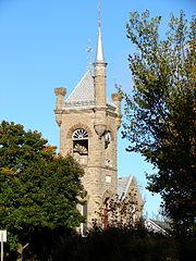
- Beckwith, Ontario
-
Township of Beckwith — Township — Beckwith within Lanark County. Coordinates: 45°05′N 76°04′W / 45.083°N 76.067°WCoordinates: 45°05′N 76°04′W / 45.083°N 76.067°W Country  Canada
Province  Ontario
County Lanark Incorporated Government – Type Township – Reeve Richard Kidd – Governing Body Beckwith Township Council – MP Scott Reid (CPC) – MPP Randy Hillier (OPC) Area – Total 240.12 km2 (92.7 sq mi) Population (2006)[1] – Total 6,387 – Density 26.6/km2 (68.9/sq mi) Time zone EST (UTC-5) – Summer (DST) EDT (UTC-4) Postal code span Area code(s) 613 Website Township of Beckwith Beckwith is a township in eastern Ontario, Canada, in the County of Lanark on the Mississippi River. It is located within Canada's National Capital Region.
Contents
Communities
The township comprises the communities of 10th Line Shore, Ontario, Black's Corners, Franktown, Franktown Station, Gillies Corners, Hay's Shore, McCann's Shore, Prospect, Rothwell's Shore, Scotch Corners and Tennyson.
Black's Corners, a hamlet south of Carleton Place, is the location for the town hall of Beckwith. This site was chosen in 1857 as a compromise between Franktown and Carleton Place where the township council had met on an alternating basis previously.[1] Currently, there are just a few houses and a store there.
Culture
Franktown promotes itself as the "Lilac Capital of Ontario". It is home to Lilac Lane, which features a beautiful park containing many lilac bushes that have grown there naturally over time, and where a lilac festival is held near the end of May. Within the park facility there is also a baseball diamond and play structure.
Also located within Franktown are the Calvary Christian Academy, a private school, and the "Franktown General Store", which features a gas bar, general merchandise, a take-out section (opened in 2007) as well as dry-cleaning services.
Geography
An Environment Canada weather doppler radar station for Ottawa and eastern Ontario, part of the Canadian weather radar network, is located at Franktown.[2]
The Jock River originates in a marsh near Franktown.
Demographics
According to the Canada 2006 Census:
- Population: 6,387
- % Change (1996-2001): 5.6
- Dwellings: 2,649
- Area (km².): 240.12
- Density (persons per km².): 26.6
References
- ^ Lockwood, Glenn J (1991). Beckwith: Irish and Scottish Identities in a Canadian Community. Carleton Place, Ont: Township of Beckwith. p. 317. ISBN 9780969575801. OCLC 29310814.
- ^ "Weather Radar - Franktown". Meteorological Service of Canada. Environment Canada. 2009-10-14. http://www.weatheroffice.gc.ca/radar/index_e.html?id=XFT. Retrieved 2009-10-16.
External links

Mississippi Mills, Carleton Place Ottawa 

 Beckwith

Drummond/North Elmsley Montague Categories:- Township municipalities in Ontario
- Municipalities in Lanark County, Ontario
- Eastern Ontario geography stubs
Wikimedia Foundation. 2010.


