- Nettleden
-
Coordinates: 51°46′46″N 0°32′15″W / 51.77956°N 0.53737°W
Nettleden 
Nettleden Church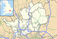
 Nettleden
Nettleden shown within HertfordshirePopulation 53 OS grid reference TL0110 District Dacorum Shire county Hertfordshire Region East Country England Sovereign state United Kingdom Post town BERKHAMSTED Postcode district HP4 Police Hertfordshire Fire Hertfordshire Ambulance East of England EU Parliament East of England UK Parliament Hemel Hempstead List of places: UK • England • Hertfordshire Nettleden is a village in Hertfordshire, England. It is in the Chiltern Hills, about four miles north west of Hemel Hempstead, surrounded by Little Gaddesden, Great Gaddesden and Frithsden. Nettleden with Potten End is a civil parish in Dacorum District.
The village name of Nettleden is Anglo Saxon in origin, and means 'valley where nettles grow'. In manorial records of the late Twelfth century the village was recorded as Neteleydene.
Anciently the village was a hamlet in the parish of Pitstone in Buckinghamshire, though the boundary of the hamlet was surrounded by the county of Hertfordshire. Nettleden was transferred from Buckinghamshire to Hertfordshire, and made a parish in its own right, in 1895. The church, St Lawrence, was first mentioned in 1285 when it became a part of the endowment of Ashridge Monastery. The church, except for the tower, was largely rebuilt in brick by John, earl of Bridgewater in 1811. Until 1895 it was a chapelry of Pitstone.
When Nettleden became a parish the hamlet of St Margaret's, formerly belonging to Ivinghoe in Buckinghamshire, was connected to Nettleden. At this place Henry de Blois bishop of Winchester founded the nunnery St Margaret's de Bosco. After the Dissolution in 1539 St Margaret's came in private hands. During the Second World War the St Margaret's Camp was a school for evacuees - children from London and surroundings. Since 1984 it is the place of the Amaravati Buddhist Monastery.
Today the village sits in a very attractive location, on the periphery of Ashridge. From Nettleden to Frithsden goes the Roman Lane or Spooky Lane, named after the ghost of an Ashridge monk. In the early 19th century the lane was dug deep in the hill with high revetted walls on both sides and a bridge was built over the lane, in order that people using the driveway leading to Ashridge do not meet the villagers. Another feature of Nettleden is the steep Pipers Hill east of the village.
References
William Page (editor) (1908). "Parishes: Nettleden". A History of the County of Hertford: volume 2. Institute of Historical Research. http://www.british-history.ac.uk/report.aspx?compid=43285. Retrieved 27 July 2011.
External links
Categories:- Villages in Hertfordshire
- Dacorum
- Civil parishes in Hertfordshire
- Hertfordshire geography stubs


Wikimedia Foundation. 2010.