- Chief Mountain
-
This article is about the mountain in Montana. For nearby Alberta community, see Chief Mountain, Alberta.
Chief Mountain 
Chief MountainElevation 9,080 ft (2,768 m) [1] Prominence 1,840 ft (561 m) [1] Location Glacier County, Montana, USA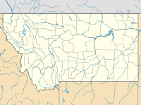
 Chief Mountain
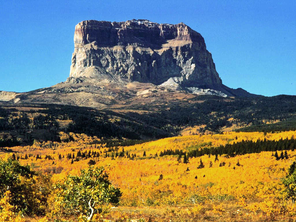
Range Lewis Range Coordinates 48°55′58″N 113°36′33″W / 48.9327629°N 113.6092671°WCoordinates: 48°55′58″N 113°36′33″W / 48.9327629°N 113.6092671°W[2] Topo map USGS Many Glacier Climbing First ascent 1892 by Stimson, et al.[3] Easiest route Climb Chief Mountain (also called Old Chief Mountain) is located in the U.S. state of Montana on the eastern border of Glacier National Park and the Blackfeet Indian Reservation. The mountain is one of the most prominent peaks and rock formations along the Rocky Mountain Front, a 200 mi (320 km) long overthrust fault, known as the Lewis Overthrust, which extends from central Montana into southern Alberta, Canada.
Contents
The peak
The peak is easily seen from Montana and Alberta due to the rapid 5,000 foot (1,524 m) altitude gain over the Great Plains which are immediately east of the mountain. Despite the mountain's being mostly in Montana, the distinctive eastern face quickly becomes hidden as one travels south into Montana, but remains very easy to see on clear days over much of southern Alberta. Hence, many businesses in the area (notably Lethbridge) have "Chief Mountain" in their name.
Chief Mountain is an example of a klippe. It consists of a Precambrian block which rests directly above younger Cretaceous gray shales. The surrounding portion of the thrust sheet has been removed by erosion leaving behind this isolated block of Proterozoic rock.
Many names for a sacred place
Chief Mountain has been a sacred mountain to Native American tribes for hundreds of years. The Blackfoot name for the mountain is Ninastiko. The mountain was seen by white explorers in the late 18th century and was known as "Kings Peak" on maps produced in the United Kingdom in 1795. Meriwether Lewis, coleader of the Lewis and Clark Expedition, saw the mountain in 1805 and called it "Tower Mountain". The name was changed in the late 19th century in reflection of Blackfeet naming of the mountain which was "Great Chief". When Glacier National Park was created in 1910, the summit and most prominent eastern slopes of the mountain were located within the park, leaving only the lower slopes within Blackfeet jurisdiction
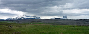 Chief Mountain on the right, Montana
Climbing
The eastern face of the mountain rises over 1,500 vertical feet (457 m) and the easiest route on this section is rated class 4 by mountaineers. The rock is also primarily sedimentary and provides poor anchor points, which in turn is a contributing factor to the difficulty rating. Henry Stimson and two other explorers, including a Blackfeet Indian, climbed the difficult eastern face on September 8, 1892, and this is the first known ascent of the peak by white explorers. Upon the summit, Stimson's party observed ceremonial remains including bison skulls that had been left behind by Native Americans. The eastern face of the peak wasn't successfully climbed again until 1951. Though the summit can be gained by approaching from the west, the easiest access is from the east, and the Blackfeet tribe issues camping and access permits to cross reservation lands. National Park Service visitor centers at St. Mary, Montana and at Many Glacier have additional information available.
See also
References
- ^ a b "Chief Mountain". Peakbagger.com. http://www.peakbagger.com/peak.aspx?pid=4755. Retrieved 2006-04-20.
- ^ "Chief Mountain". Geographic Names Information System, U.S. Geological Survey. http://geonames.usgs.gov/pls/gnispublic/f?p=gnispq:3:::NO::P3_FID:769823. Retrieved 2010-01-01.
- ^ "Chief Mountain (MT)". SummitPost.org. http://www.summitpost.org/page/153887. Retrieved 2011-05-09.
Categories:- Mountains of Glacier National Park (U.S.)
- Mountains of Glacier County, Montana
- Religious places of the indigenous peoples of North America
- Sacred mountains


Wikimedia Foundation. 2010.