- Nambucca Heads, New South Wales
-
Nambucca Heads
New South Wales
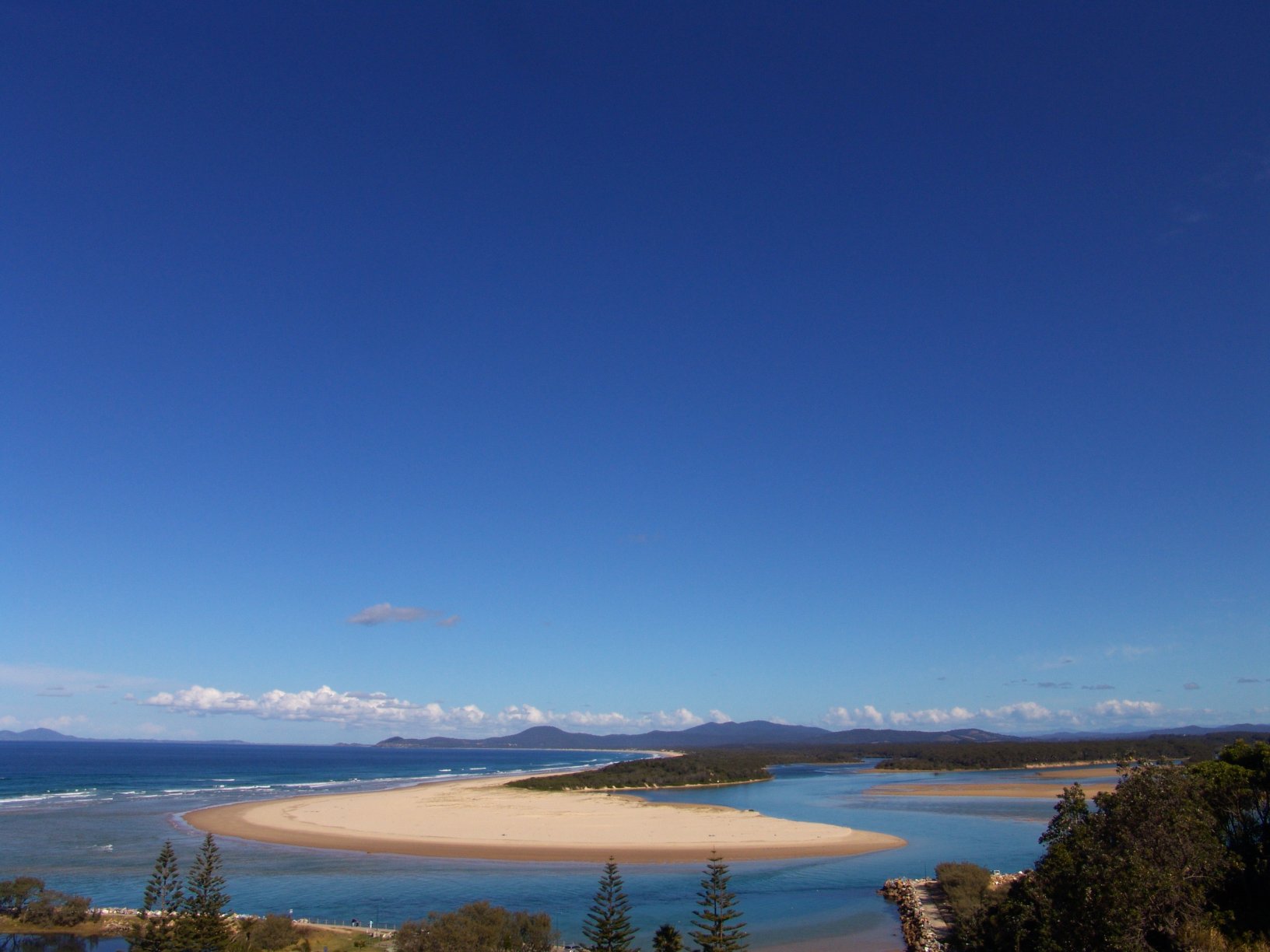
Nambucca Heads, Photograph by John Catsoulis
 Nambucca Heads
Population: 6,137[1] Postcode: 2448 Coordinates: 30°39′S 153°00′E / 30.65°S 153°ECoordinates: 30°39′S 153°00′E / 30.65°S 153°E Elevation: 26 m (85 ft) Location: - 512 km (318 mi) from Sydney
- 13 km (8 mi) from Macksville
LGA: Nambucca Shire State District: Oxley,[2] Federal Division: Cowper[3] Nambucca Heads is a town on the Mid North Coast of New South Wales, Australia in Nambucca Shire. It is a holiday and retirement centre located on a ridge north of the estuary of the Nambucca River near the Pacific Highway, which now bypasses it. Its 2006 population was 6,137, including 445 (7.3%) indigenous persons and 5,058 (82.4%) Australian-born persons in the Shire.[1] The place name is derived from an aboriginal word meaning 'entrance to the waters'.[4]
The town is located on the North Coast railway line, and is served by the three daily XPT services.
Contents
History
Europeans may have explored the area in 1818, and John Oxley surveyed the area in 1820.
The cutting of Australian red cedar had started in the area by 1842. It is believed that the first house was built in 1867, when about 50 people had settled in the valley to cut cedar or raise corn. The site of the town was surveyed in 1874 and the first hotel and school were both established in 1884. It was proclaimed a village in 1885.[5] The North Coast railway was extended from Taree to south Grafton in 1915, but the station at Nambucca Heads was not opened until 1923.[6]
Nambucca also has one of the oldest surf lifesaving clubs in Australia and also invented junior surf lifesaving known as Nippers.
Local media
Radio Stations 2CS-FM (106.3), Star FM (105.5 & 105.1), 2MC-FM (106.7), Triple J (91.5 & 96.3), 2NVR FM (105.9)
The Nambucca Valley's community radio station, 2NVR 105.9FM, focuses on the Macksville, Bowraville, Nambucca Heads and surrounding communities.
Newspapers Midcoast Observer, Hibiscus Happynings, Guardian News Coffs Coast advocate.
Television ABC, ABC2, SBS, SBS NEWS, Channel Seven Coffs Harbour (Seven), Southern Cross Ten (Ten), NBN (NINE)
Railway Station
 Nambucca Heads
CountryLink North Coast Station code NBH Suburb Nambucca Distance from Central Station 565 km Altitude (above sea level) ? m Types of stopping trains CountryLink Number of platforms 1 Number of tracks 2 Platform arrangement Island Type of station Ground Ticket barriers No Transfers available none Disabled access 
Yes (Assisted) Station facilities {{{facilities}}} The town consists of its own railway station, opened in 1923, on the North Coast Line. It is serviced by six Countrylink trains per day. Services may only use those platforms:
Platform Line Stopping Pattern Notes 
CountryLink North Coast country services to Sydney (3 per day), Brisbane, Casino and Grafton (1 per day) References
- ^ a b Australian Bureau of Statistics (25 October 2007). "Nambucca Heads (State Suburb)". 2006 Census QuickStats. http://www.censusdata.abs.gov.au/ABSNavigation/prenav/LocationSearch?collection=Census&period=2006&areacode=SSC18285&producttype=QuickStats&breadcrumb=PL&action=401. Retrieved 2007-09-17.
- ^ "Oxley Electoral District". New South Wales Electoral Commission. http://elections.nsw.gov.au/redistribution_2004/all_districts_/oxley. Retrieved 2006-11-21.
- ^ "Cowper". Australian Electoral Commission. http://www.aec.gov.au/_content/Who/profiles/c/cowper.htm. Retrieved 2006-11-21.
- ^ "Nambucca Heads". Geographical Names Board of New South Wales. http://www.gnb.nsw.gov.au/name_search/extract?id=ujKqwprXJP. Retrieved 5 November 2009.
- ^ "Nambucca Heads". Walkabout. Fairfax Digital. http://walkabout.com.au/locations/NSWNambuccaHeads.shtml. Retrieved 2006-11-21.
- ^ "North Coast Line". www.nswrail.net. http://www.nswrail.net/lines/show.php?state=NSW&line=north_coast. Retrieved 2006-11-21.
Preceding station NSW Main lines Following station towards Border LoopNorth Coast Line towards MaitlandPreceding station CountryLink Following station UrungaCountryLink North Coast towards SydneyCategories:- Towns in New South Wales
- Mid North Coast


Wikimedia Foundation. 2010.