- Mount Churchill
-
Mount Churchill 
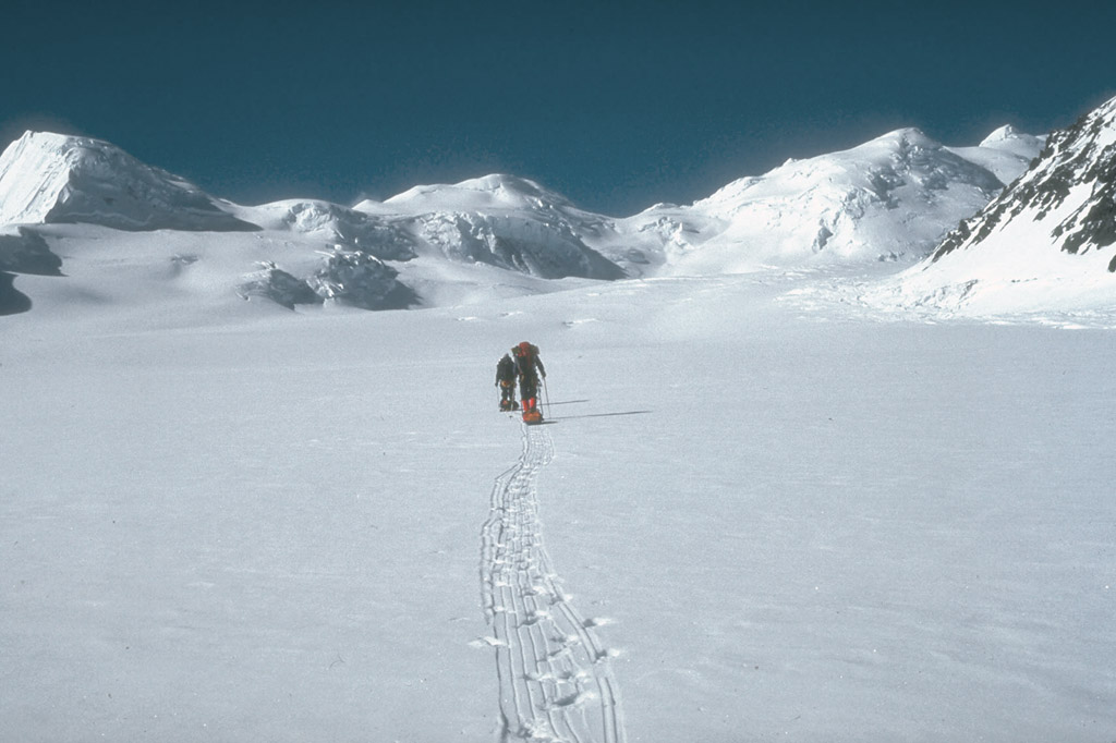
U.S. Geological Survey climbing party ascending the Klutlan Glacier en route to Mount ChurchillElevation 15,638 ft (4,766 m) Prominence 1,188 ft (362 m) Location Location Wrangell-St. Elias National Park and Preserve, Alaska, USA Range Saint Elias Mountains Coordinates 61°25′10″N 141°42′53″W / 61.41944°N 141.71472°WCoordinates: 61°25′10″N 141°42′53″W / 61.41944°N 141.71472°W Topo map USGS McCarthy B-2 Quadrangle Geology Type Stratovolcano with caldera Volcanic arc/belt Wrangell Volcanic Field Last eruption 700 AD ± 200 years Climbing First ascent August 20, 1951 by R. Gates, J. Lindberg Easiest route snow climb Mount Churchill is a volcano in the Saint Elias Mountains and the Wrangell Volcanic Field of eastern Alaska. Churchill and its higher neighbor Mount Bona about 2 mi (3 km) to the southwest are both large ice-covered stratovolcanoes, with Churchill being the fourth highest volcano in the United States and the seventh highest in North America.
Contents
Volcanic eruptions
Mount Churchill is most noteworthy as the source of the White River Ash, deposited during two of the largest volcanic eruptions in North America during the past two millennia. This twin-lobed tephra deposit covers more than 130,000 mi² (340,000 km²) of eastern Alaska and northwestern Canada, with the northern lobe deposited 1900 years ago and extending over 250 miles (400 km) and the larger eastern lobe about 1250 years ago and stretching over 500 miles (800 km). The total volume of the ash exceeds 12 mi³ (50 km³), or roughly 50 times the volume of the 1980 eruption of Mount St. Helens, and ash layers up to 2 ft (60 cm) thick can be seen just below the surface in many roadcuts along the Alaska Highway.
The extensive ash deposits in the lowlands near the White and Yukon Rivers were first recognized in 1883, but their source remained a mystery for the next century. Geologists in the 1960s traced the two lobes of the ash back into the Saint Elias Mountains, and postulated that the ash may have come from a vent now buried under the Klutlan Glacier, which flows east for over 40 mi (64 km) from the Bona-Churchill massif into the Yukon Territory of Canada. More detailed studies in the 1990s by the U.S. Geological Survey finally produced the definitive answer. Aerial photos showed a 2.6 x 1.7 miles (4.2 x 2.7 km) elliptical, gently sloping, ice-filled depression at 14,500 ft (4400 m) just east of the present summit of Mount Churchill. This was identified as a caldera, which had formed by the collapse of the volcano's previous summit during the cataclysmic eruptions. The geological field work revealed thick young pumice deposits along the rim of the caldera which are mineralogically and chemically identical to the White River Ash.
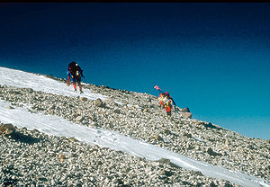 U.S. Geological Survey climbing party reaching the east rim of the summit caldera on Mount Churchill. Blocky debris in the photo consists of pumice and lithic fragments ejected 1,250 years ago, during the eruption which formed the eastern lobe of the White River Ash.
History
Mount Churchill was first climbed in 1951 by R. Gates and J. Lindberg, but the peak was merely an unnamed satellite of Mount Bona at the time. The mountain was named in 1965 by the Alaska State Legislature for English statesman Winston Churchill.[1]
In terms of elevation, it is a major North American peak, at well over 15,000 feet; however, in terms of topographic prominence or isolation, it is less significant, with less than a 1200 foot drop from its summit to the saddle with Bona. Churchill also lies on the northern, gentler side of the Bona massif, making it a less visually spectacular peak than some of the lower outliers of Bona such as University Peak or Aello Peak. The current standard climbing route is the South Ridge, usually as part of a climb of Mount Bona from the east starting from a ski-equipped bush plane landing at around 10,000 ft (3,000 m) on the Klutlan Glacier.
References
- Richter, D. H.; Preece, S. J.; McGimsey, R. G.; Westgate, J. A. (1995). "Mount Churchill, Alaska; source of the late Holocene White River Ash". Canadian Journal of Earth Sciences 32 (6): 741–748. doi:10.1139/e95-063.
- "Churchill". Global Volcanism Program. Smithsonian Institution. http://www.volcano.si.edu/world/volcano.cfm?vnum=1105-03-. Retrieved 2007-03-10.
- Wood, Charles A.; Jürgen Kienle, eds. (1990). Volcanoes of North America. Cambridge University Press. ISBN 0-521-43811-X.
- Richter, Donald H.; Danny S. Rosenkrans and Margaret J. Steigerwald (1995). Guide to the Volcanoes of the Western Wrangell Mountains, Alaska. USGS Bulletin 2072. http://www.nps.gov/wrst/naturescience/guide-to-the-wrangell-volcanoes.htm.
- Winkler, Gary R. (2000). A Geologic Guide to Wrangell—Saint Elias National Park and Preserve, Alaska: A Tectonic Collage of Northbound Terranes. USGS Professional Paper 1616. ISBN 0-607-92676-7. http://pubs.usgs.gov/pp/p1616/.
- Richter, Donald H.; Cindi C. Preller, Keith A. Labay, and Nora B. Shew (2006). Geologic Map of the Wrangell-Saint Elias National Park and Preserve, Alaska. USGS Scientific Investigations Map 2877. http://pubs.usgs.gov/sim/2006/2877/.
- Wood, Michael; Coombs, Colby (2001). Alaska: A Climbing Guide. Mountaineers Books. ISBN 0-89886-724-X.
External links
Categories:- Saint Elias Mountains
- Stratovolcanoes
- Subduction volcanoes
- Mountains of Alaska
- Landforms of Valdez–Cordova Census Area, Alaska
- Volcanoes of Alaska
- VEI-6 volcanoes
- Wrangell–St. Elias National Park and Preserve
- Potentially active volcanoes

Wikimedia Foundation. 2010.