- Bhakkar District
-
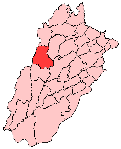
Bhakkar — District — Location of Bhakkar District
(highlighted in red) within Punjab.Country Pakistan Province Punjab Capital Bhakkar Established Government – District Nazim – District Naib Nazim Area – Total 8,114. km2 (3,132.8 sq mi) Population (1998)[1] – Total 1,051,456 Time zone PST (UTC+5) District Council Number of Tehsils 4 Website http://www.bhakkar.com.pk/ Bhakkar (Urdu: ضلع بھکر) is a District in the Punjab province of Pakistan. The district was created in 1981 with Bhakkar city (known as Bakhar in Seraiki) as the capital. It is located between 31° 10' and 32° 22' N. and 70° 47' and 72° E. with an area of 3,134 square miles (8,120 km2), most of it lies in the desolate plain of the Thal, but the Kachhi or strip of riverine land along the Indus is of great fertility.[2] Its area consists of riverine tract along the Indus called Kacha and the Thal historically called Chol-e-Jalali. Most of its area comprises greater Thal.
Mankera in centre of The Great Thal is a place of great antiquity. The old fort here; a historical heritage, is a great land mark of Thal needs preservation. Another old place in the district is Kallurkot. Bhakkar is part of Seraiki Wasaib in western Punjab.
Contents
Demography
Bhakkar city has a population of almost 300,000[citation needed], the total population of the district was estimated to be 1.37 million in 2008.[3]
Administration
The district is administratively divided into four tehsils and 42 Union Councils:[4]
Name of Tehsil No of Unions Bhakkar Tehsil 17 Darya Khan Tehsil 8 Kaloorkot Tehsil 10 Mankera Tehsil 7 Total 42 Khansar Union Council is one of the major Union Councils in Bhakkar. Mari shah Sakhira Union Council is very close to Bhakkar District boundary
Towns
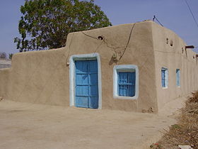 Home in Thal
The main towns of District Bhakkar are
- Darya Khan
- Mankera
- Kaloorkot
History
The town has some historical places like Dilkusha Bagh which is believed to be a Mughal era garden and is attached to Humayun; but historical facts do not verify it. Humayun never came here. On his retreat to Iran, he went to another Bakhar in Sindh to seek help from Mahmood Khan.But this path or route taken was rejected by Major Henry Raverty as the possible retreat of Humayun.
The old town was walled and had gates as Tavela gate and Imamanwala gate. The only remaining gate Jinnah Gate (formerly King Gate) was built in British period in the name of Mr. King the then Deputy Commissioner. There are remains of a handera (tomb) near Sheikh Raoo bridge, which is believed to be burial place of Bakhar Khan, the founder of the city. The present police station was originally a Baloch fortress. Some 30 years ago a branch of River Indus flowed past the town. West side of the town was green and pleasant. This is a very scarce silver coin belonging to the reign of Nadir Shah 1148-1160 AH (AD1735-1747) from the Afsharid dynasty, it is an Indian type minted during his occupation of the area. It is listed by type as Album #2744.2 (Type D). It weighs 11.3 gr. (18 mm.) and minted in the city of Bhakkar in the state of Punjab in India, dated 1157AH.
The main city center is consist of Mondi Town, King gate (markets and shopping centers), Chimni Muhalla (ancient area ever in Bhakkar city from past of the Hindus and Sikh residency), Iron Market, Gulshan-e-Madina Town, Officers Colony, New Iqbal Town (Zaheer ud din babar), Canal Avenue, new developed Green Town, Dhandla Muhalla, Gadola, and Aalam Abad. The adjacent city area Mondi Town is the developed area of the city with entire facilities. The population of city area mostly speak Urdu, Punjabi and sariki. The city is known for its quality of students as they ever get top positions in relevant boards and the trend of study is comparatively considerably higher than other areas of Punjab Province because of lacking industry and public sector employment.Their preference for study is Lahore, Faisalabad and Multan. The business in the city is major source of income for the population and mostly business activities are connected with Capital of Province, Lahore.
British rule
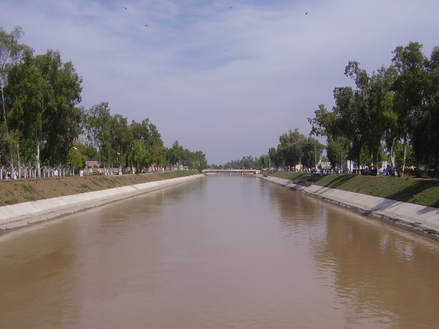
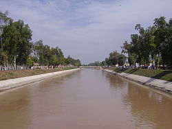 Thal Canal
During British rule, the district was a tehsil of Mianwali District, the population according to the 1891 census of India was 119,219 which had risen to 125,803 at the 1901 census. In addition to the headquarters Bhakkar (population, 5,312), the tehsil contained and 196 villages. The land revenue and cesses amounted in 1903-4 to Rs 1.7 lakhs. Places of interest are Mankera and Muhammad Rajan, at the latter of which is the shrine of Pir Muhammad Rajan, who died there on a pilgrimage.[2]
References
Divisions of Pakistan Balochistan KP Punjab Bahawalpur · Dera Ghazi Khan · Faisalabad · Gujranwala · Lahore · Multan · Rawalpindi · Sahiwal · SargodhaSindh
Categories:

Wikimedia Foundation. 2010.