- Muztagh Ata
-
Muztagh Ata 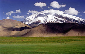
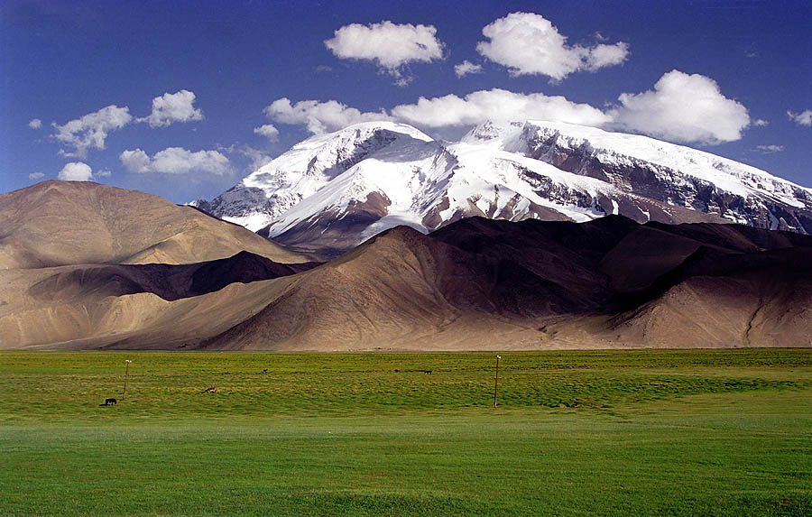
Muztagh Ata, as viewed from the Karakoram HighwayElevation 7,546 m (24,757 ft)
Ranked 43rdProminence 2,735 m (8,973 ft) [1] Listing Ultra Translation Father of ice mountains (Uyghur) Location Xinjiang, China
 Muztagh Ata
Range Muztagata Range, Kunlun Shan Coordinates 38°16′42″N 75°06′57″E / 38.27833°N 75.11583°ECoordinates: 38°16′42″N 75°06′57″E / 38.27833°N 75.11583°E Climbing First ascent 1956 by E. A. Beletskiy et al. Easiest route glacier/snow climb 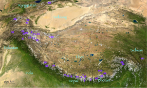 Muztagh Ata is #43 (top left area) on this location map from List of highest mountains
Muztagh Ata, or Muztagata (Uyghur: مۇز تاغ ئاتا, literally "ice-mountain-father"; Chinese: 慕士塔格峰; pinyin: Mùshìtǎgé Fēng), is the second highest (7546 metres) of the mountains which form the northern edge of the Tibetan Plateau (not the second highest of the mountains of the Tibetan Plateau). It is sometimes regarded as being part of the Kunlun Shan, although physically it is more closely connected to the Pamirs. It is also reputedly one of the easiest 7,000 m peaks in the world to climb, due to its gentle western slope and the comparatively drier weather of Xinjiang.
Location
Muztagh Ata lies just south of Kongur Tagh, the highest peak of the Kunlun Shan. Together they form a somewhat isolated group, separated from the main chain of the Kunlun, and also separate from the Pamir Mountains to the west. (Both peaks are sometimes regarded as being in the "Chinese Pamir", and are more closely connected to the main Pamir group than the main Kunlun group.) Not far to the north and east of this group are the lowlands of the Tarim Basin and the Taklamakan Desert. The Karakoram Highway passes very close to both peaks as well as Karakul Lake, from which the mountain is conveniently viewed. The closest city is to the mountain is Tashkurgan, the westernmost town in China and very close to the border with Pakistan.
History
The Swedish explorer and geographer Sven Hedin made the first recorded attempt to climb Muztagh Ata, in 1894. Additional attempts were made in 1900, 1904 and 1947, the last by the team of Eric Shipton and Bill Tilman who came very close to the summit but were turned back due to cold and deep snow.
The first ascent of the peak was in 1956 by a large party of Chinese and Russian climbers, via the west ridge, which is now the standard route.
Since the first ascent, many ascents of Muztagh Ata have been made. In 1980, a party led by Ned Gillette made a ski ascent/descent of the standard route, the first ski ascent of a mountain over 7,500 m (24,600 ft). An ascent of the much harder south-east ridge was made in 2000, and a secondary route at the west side of the mountain was first climbed in the summer of 2005.
Notes
- ^ "Xinjiang region ultra-prominences". peaklist.org. http://peaklist.org/WWlists/ultras/china2.html. Retrieved 2010-11-05.
Sources
- Jill Neate, High Asia: An Illustrated History of the 7000 Metre Peaks, ISBN 0-89886-238-8.
- Himalayan Index
External links
- Muztagh Ata on summitpost.org (Lots of information)
- Muztagh ata Information
Categories:- Mountains of China
- Geography of Xinjiang

Wikimedia Foundation. 2010.