- National Register of Historic Places listings in Fayette County, Pennsylvania
-
 Location of Fayette County in Pennsylvania
This is a list of the National Register of Historic Places listings in Fayette County, Pennsylvania.
This is intended to be a complete list of the properties and districts on the National Register of Historic Places in Fayette County, Pennsylvania, United States. The locations of National Register properties and districts for which the latitude and longitude coordinates are included below, may be seen in a Google map.[1]
There are 67 properties and districts listed on the National Register in the county. Four sites are further designated as National Historic Landmarks. One is also designated as a National Historic Site and another is designated as a National Battlefield.
-
- This National Park Service list is complete through NPS recent listings posted November 10, 2011.[2]
Current listings
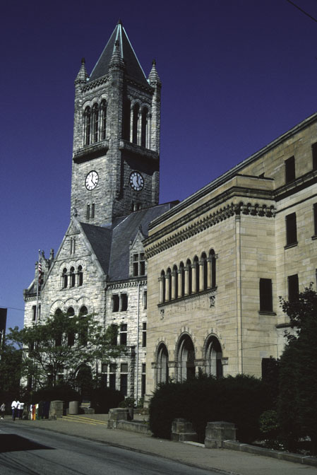
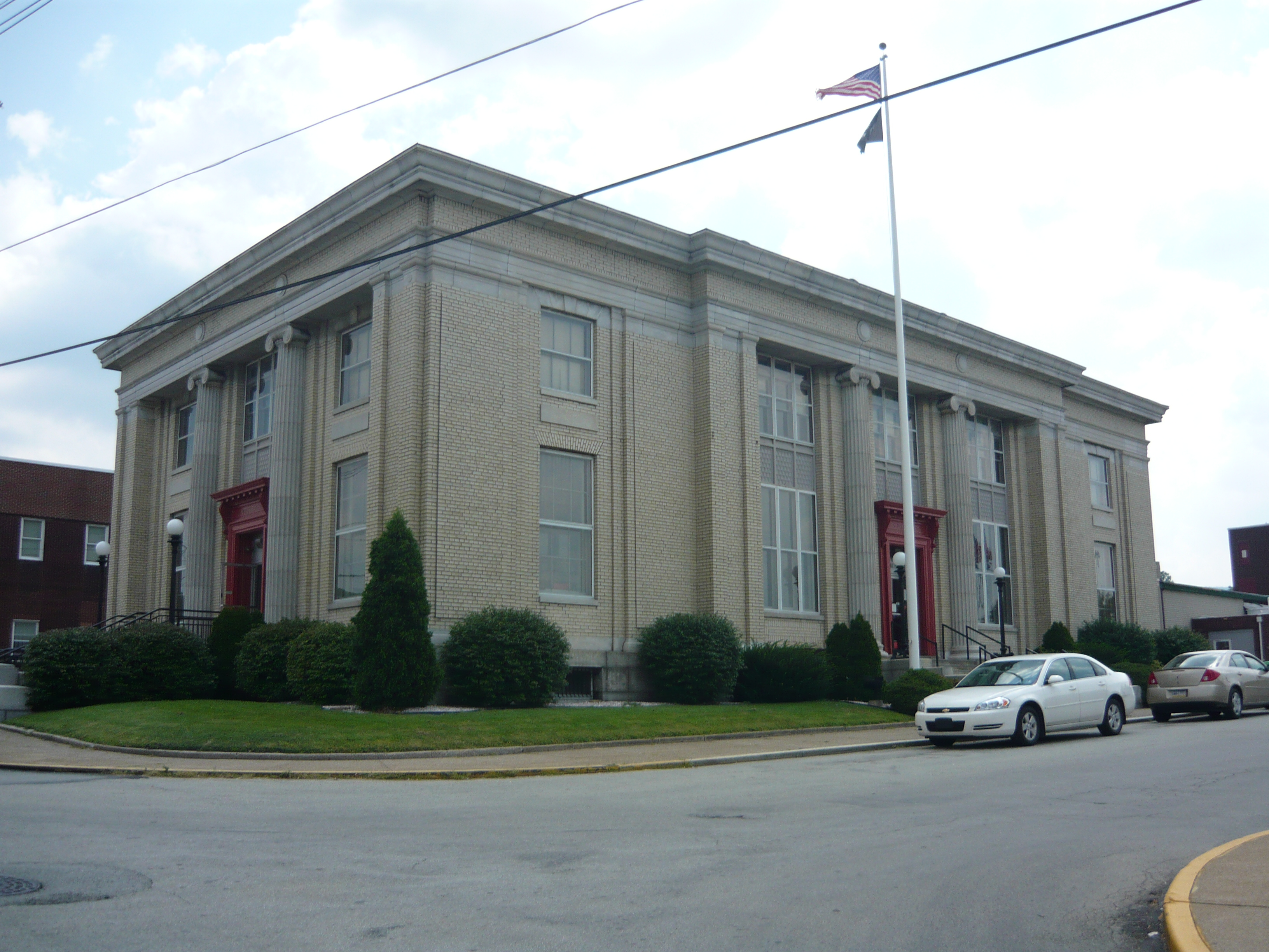
[3] Landmark name Image Date listed Location City or town Summary 1 Alliance Furnace September 6, 1991 Off Township 568 at Jacob's Creek, northeast of Perryopolis
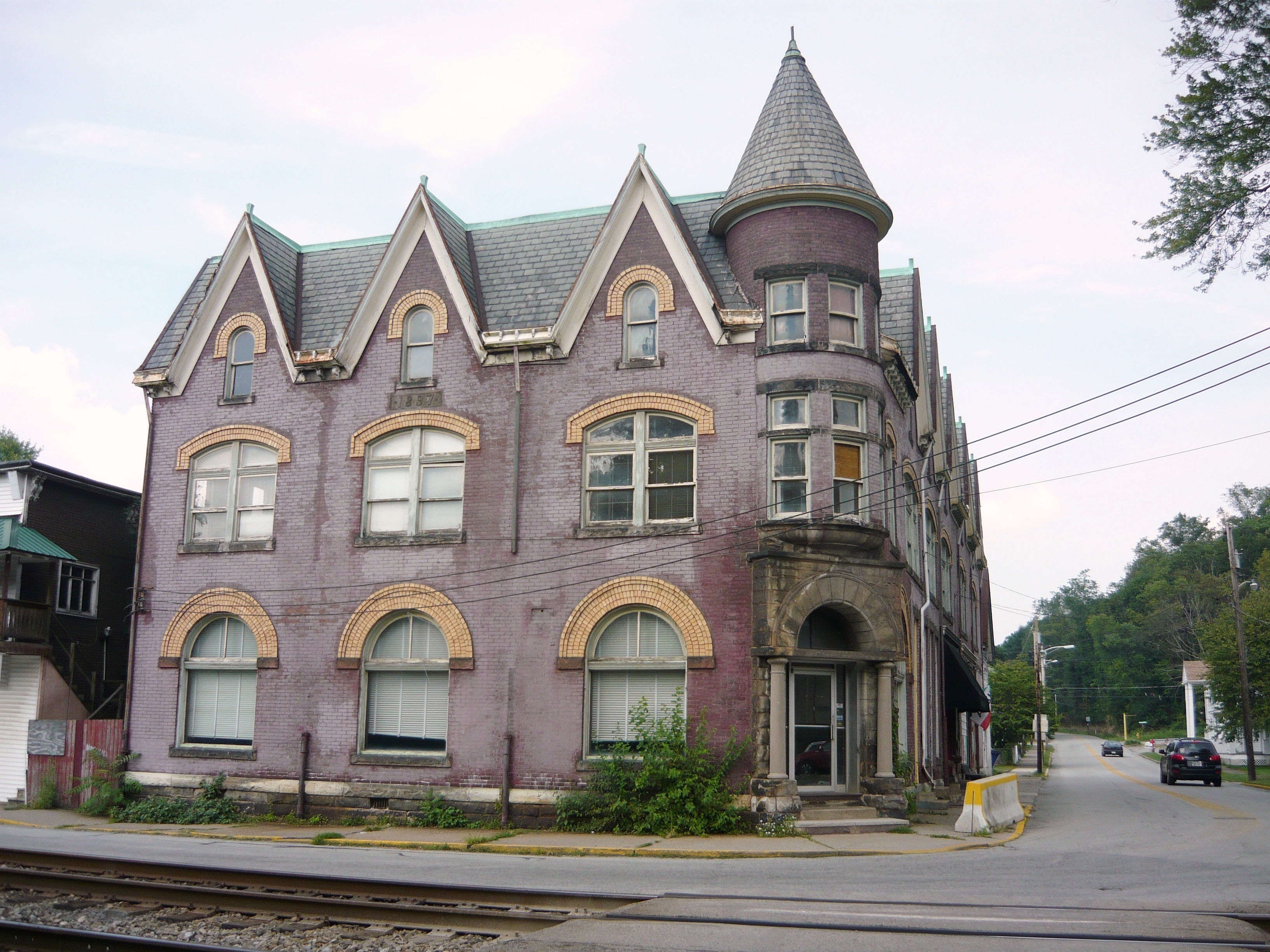
40°06′45″N 79°43′03″W / 40.1125°N 79.7175°WPerry Township 2 Bowman's Castle 
March 3, 1975 Front Street
40°01′21″N 79°53′02″W / 40.0225°N 79.883889°WBrownsville 3 Brier Hill 
July 2, 1973 On U.S. Route 40 at Brier Hill
39°58′46″N 79°49′49″W / 39.979444°N 79.830278°WRedstone Township 4 Brown-Moore Blacksmith Shop May 7, 1992 0.1 miles (0.16 km) west of Pennsylvania Route 4020
39°58′23″N 79°53′55″W / 39.973056°N 79.898611°WLuzerne Township 5 Brownsville Bridge 
June 22, 1988 State Route 4025 over the Monongahela River
40°01′20″N 79°53′26″W / 40.022222°N 79.890556°WBrownsville Extends into Washington County 6 Brownsville Commercial Historic District 
August 2, 1993 105–128 Brownsville Avenue and 1–145 Market, 101–200 High, 2–6 Water, 100 Charles, 1 Seneca, and 108 Bank Streets
40°01′17″N 79°53′13″W / 40.021389°N 79.886944°WBrownsville 7 Brownsville Northside Historic District 
August 2, 1993 Roughly bounded by Front Street, Broadway, Shaffner Road, and Baltimore Street
40°01′19″N 79°52′51″W / 40.021944°N 79.880833°WBrownsville 8 Carnegie Free Library 
October 8, 1981 South Pittsburgh Street
40°00′56″N 79°35′19″W / 40.015556°N 79.588611°WConnellsville 9 Philip G. Cochran Memorial United Methodist Church June 4, 1984 Howell and Griscom Streets
40°02′49″N 79°39′17″W / 40.046944°N 79.654722°WDawson 10 Abel Colley Tavern November 27, 1995 U.S. Route 40, approximately 0.5 miles (0.80 km) west of Searights Crossroads
39°57′34″N 79°49′01″W / 39.959444°N 79.816944°WMenallen Township 11 Peter Colley Tavern and Barn 
July 24, 1973 On U.S. Route 40 at Brier Hill
39°58′49″N 79°49′53″W / 39.980278°N 79.831389°WRedstone Township 12 Colonial National Bank Building 
November 15, 2002 101 East Crawford Avenue
40°01′03″N 79°35′21″W / 40.017556°N 79.589056°WConnellsville 13 John P. Conn House 
July 28, 1988 84 Ben Lomond Street
39°54′13″N 79°44′03″W / 39.903611°N 79.734167°WUniontown 14 Connellsville Armory 
November 14, 1991 108 West Washington Street
40°00′41″N 79°35′24″W / 40.011389°N 79.59°WConnellsville 15 Connellsville Union Passenger Depot 
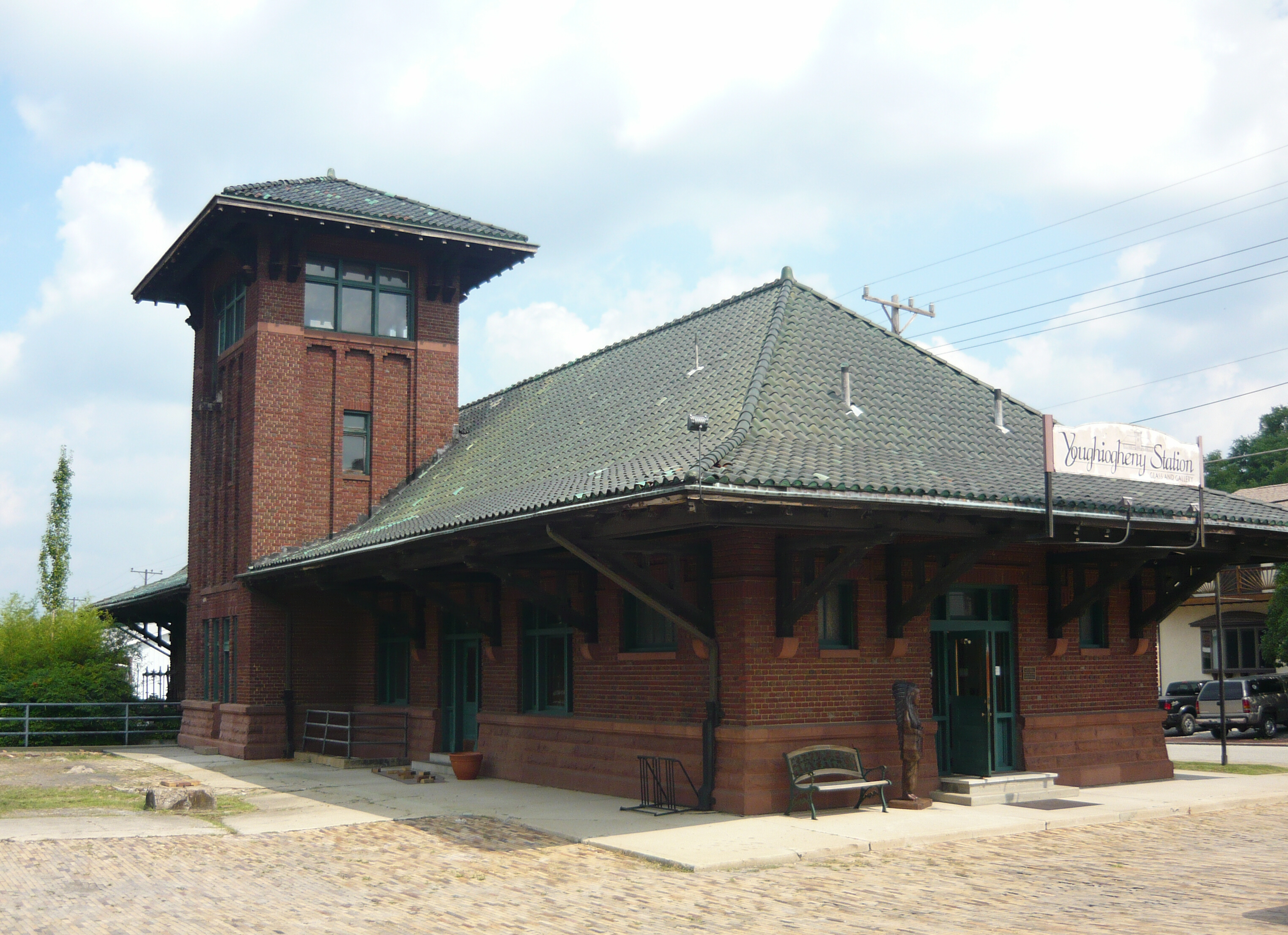
March 29, 1996 900 West Crawford Avenue
40°00′59″N 79°35′58″W / 40.016389°N 79.599444°WConnellsville 16 Col. Edward Cook House 
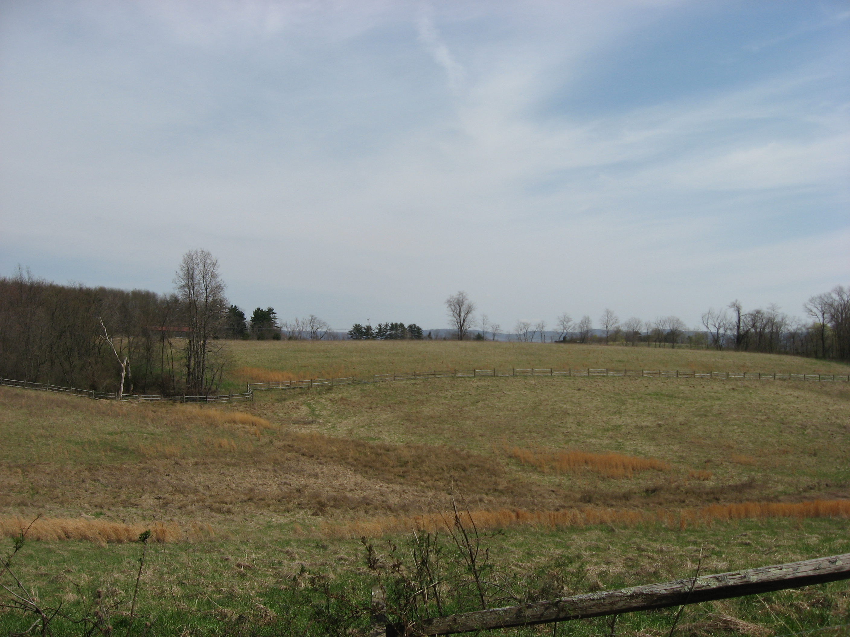
March 29, 1978 East of Belle Vernon
40°07′37″N 79°49′38″W / 40.126944°N 79.827222°WWashington Township 17 Dawson Historic District 
November 5, 1997 Roughly bounded by Howell Street, Middle Alley, the Youghiogheny River, River Road, and Spring and Locust Alleys
40°02′48″N 79°39′31″W / 40.046667°N 79.658611°WDawson 18 Deffenbaugh Site (36FA57) 
May 14, 1984 On a saddle between two hills, along Old Frame Rd.
39°48′7.2″N 79°51′36″W / 39.802°N 79.86°W[4]Nicholson Township 19 John S. Douglas House 
February 4, 1994 136 North Gallatin Avenue
39°54′17″N 79°43′23″W / 39.904722°N 79.723056°WUniontown 20 Downer Tavern November 27, 1995 U.S. Route 40 at Chalkhill
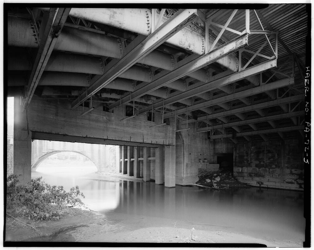
39°50′38″N 79°37′03″W / 39.843889°N 79.6175°WWharton Township 21 Dunlap's Creek Bridge 
July 31, 1978 Spans Dunlap Creek
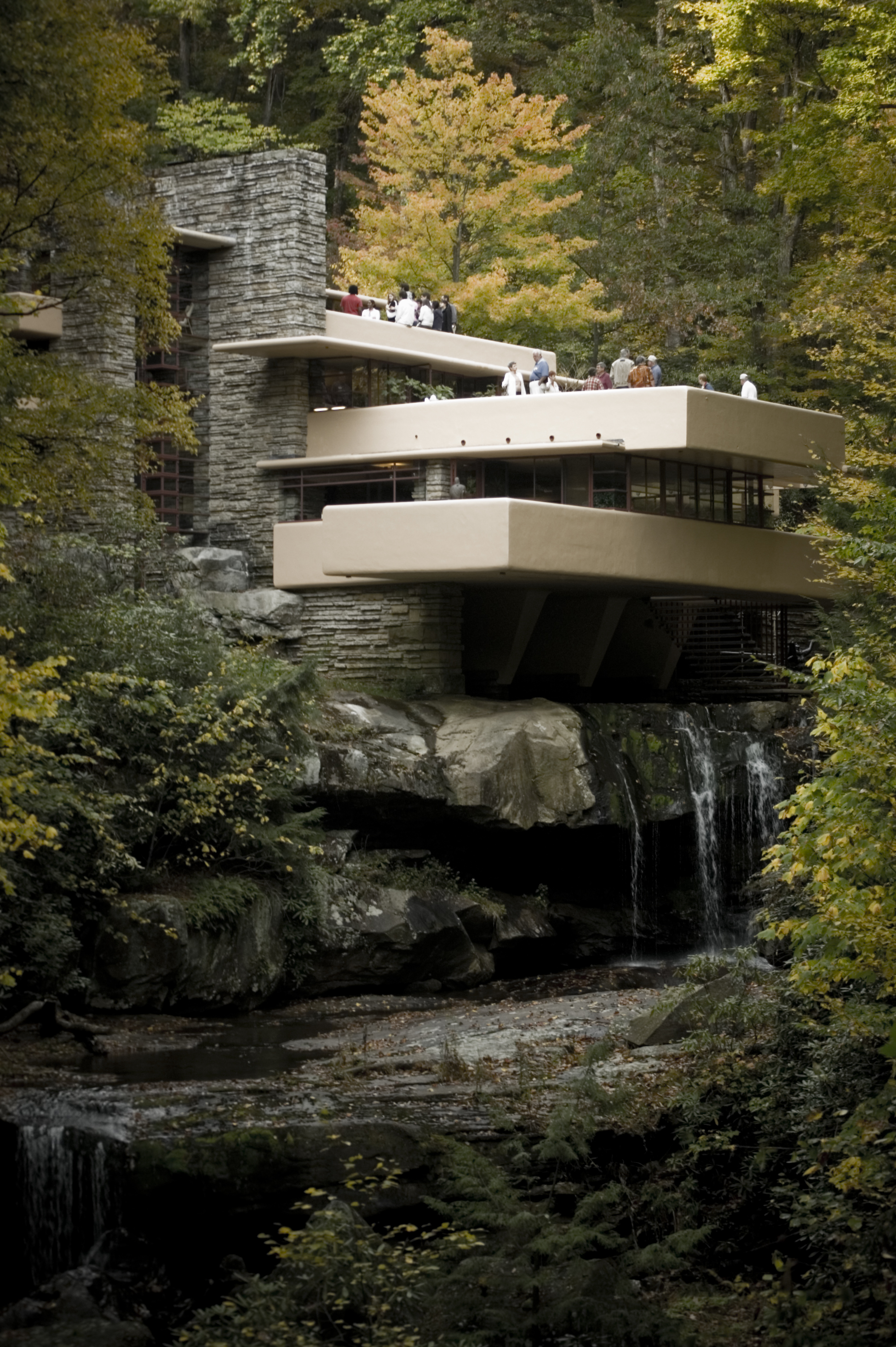
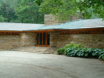
40°01′17″N 79°53′18″W / 40.021389°N 79.888333°WBrownsville 22 Fallingwater 
July 23, 1974 West of Pennsylvania Route 381
39°54′24″N 79°28′05″W / 39.906667°N 79.468056°WStewart Township 23 Fayette-Springs Hotel November 27, 1995 U.S. Route 40, approximately 0.5 miles (0.80 km) east of Chalk Hill
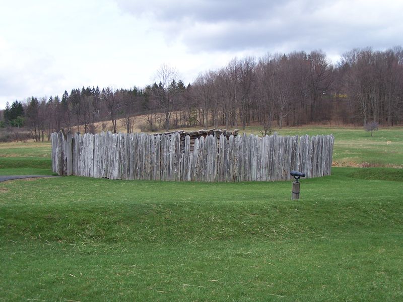
39°50′26″N 79°36′36″W / 39.840556°N 79.61°WWharton Township 24 Fort Necessity National Battlefield 
October 15, 1966 11 miles (18 km) east of Uniontown on U.S. Route 40
39°49′7″N 79°35′37″W / 39.81861°N 79.59361°WWharton Township 25 Francis Farm Petroglyphs Site (36FA35) May 10, 1984 Off Perry Road, 1 mile (1.6 km) west of the junction of Pennsylvania Routes 51 and 201
40°3′0″N 79°47′30″W / 40.05°N 79.79167°W[5]Jefferson Township 26 Josiah Frost House 
October 24, 1996 Southern side of U.S. Route 40, west of Searight's Corners
39°57′18″N 79°48′21″W / 39.955°N 79.805833°WMenallen Township 27 Thomas Gaddis Homestead 
April 26, 1974 South of Uniontown off U.S. Route 119
39°52′02″N 79°44′39″W / 39.867222°N 79.744167°WSouth Union Township 28 Gallatin School 
July 23, 1998 165 N. Gallatin Avenue
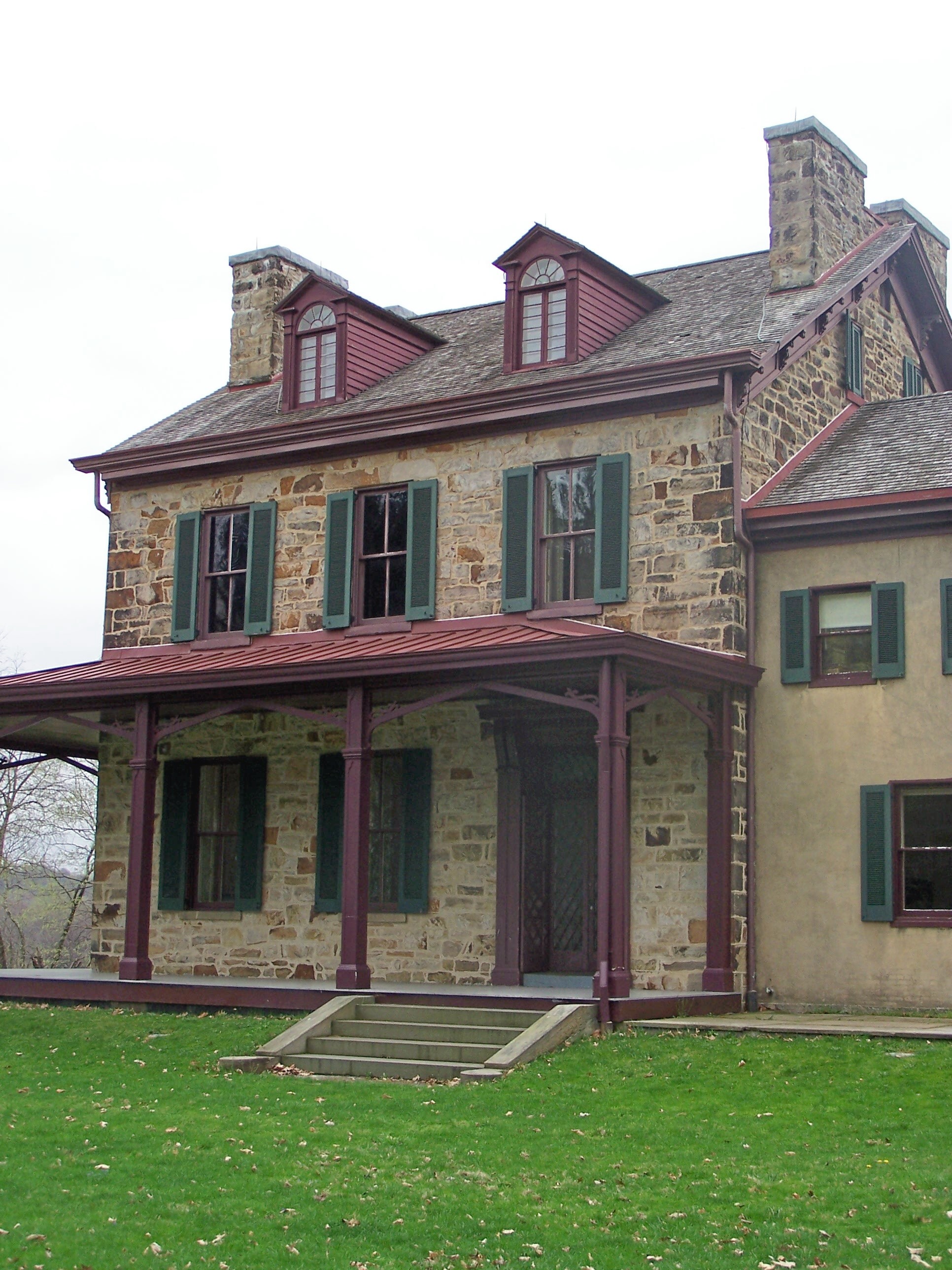
39°54′24″N 79°43′21″W / 39.906667°N 79.7225°WUniontown 29 Albert Gallatin House; Friendship Hill National Historic Site 
October 15, 1966 3 miles (4.8 km) north of Point Marion on Pennsylvania Route 166
39°46′39″N 79°55′36″W / 39.7775°N 79.92667°WSpringhill Township 30 Isaac Newton Hagan House 
May 16, 2000 Northeast of Chalkhill, less than 1 mile (1.6 km) southwest of the junction of Legislative Routes 2010 and 2019
39°52′06″N 79°31′21″W / 39.868333°N 79.5225°WStewart Township 31 Hopwood-Miller Tavern November 27, 1995 U.S. Route 40 (Main Street) in Hopwood
39°52′37″N 79°42′47″W / 39.876944°N 79.713056°WSouth Union Township 32 Johnson-Hatfield Tavern November 27, 1995 U.S. Route 40, 0.5 miles (0.80 km) east of Brier Hill
39°58′20″N 79°49′27″W / 39.972222°N 79.824167°WRedstone Township 33 Karolcik Building 
October 24, 1997 115–117 South Liberty Street
40°05′12″N 79°45′05″W / 40.086667°N 79.751389°WPerryopolis 34 Hugh Laughlin House April 30, 1987 Township Route 422 south of Brownsville
39°59′53″N 79°50′28″W / 39.998056°N 79.841111°WRedstone Township 35 Layton Bridge 
June 22, 1988 Legislative Route 26191 over the Youghiogheny River at Layton
40°05′21″N 79°43′49″W / 40.089167°N 79.730278°WPerry Township 36 Linden Hall at Saint James Park 
October 11, 1989 RR 26051 northwest of Dawson
40°04′01″N 79°41′45″W / 40.066944°N 79.695833°WLower Tyrone Township 37 Locus 7 Site 
March 20, 1980 On a bluff above Downers Run north of Fayette City, 2,000 feet (610 m) east of the Monongahela River
40°6′23.88″N 79°50′12.9″W / 40.1066333°N 79.836917°W[6]Washington Township 38 Marion Bridge 
June 22, 1988 Pennsylvania Route 88 over the Monongahela River
39°44′22″N 79°54′19″W / 39.739444°N 79.905278°WPoint Marion Demolished November 16, 2009.[7] Extended into Greene County. 39 Dr. J.C. McClenathan House and Office 
November 15, 2002 134 South Pittsburgh Street
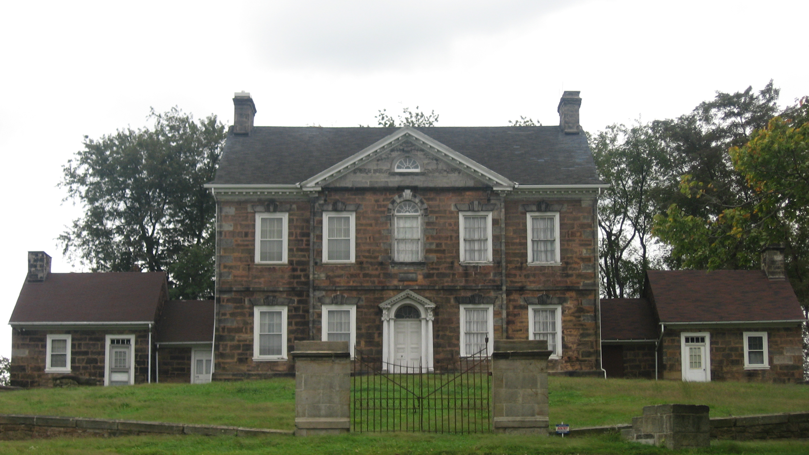
40°01′01″N 79°35′23″W / 40.016944°N 79.589722°WConnellsville 40 Isaac Meason House 
January 25, 1971 U.S. Route 119 North in Mount Braddock
39°57′15″N 79°38′54″W / 39.954167°N 79.648333°WDunbar Township 41 Monroe Tavern November 27, 1995 U.S. Route 40 (Main Street) in Hopwood
39°52′32″N 79°42′05″W / 39.875556°N 79.701389°WSouth Union Township 42 Morris-Hair Tavern November 27, 1995 U.S. Route 40 (Main Street) in Hopwood
39°52′25″N 79°42′00″W / 39.873611°N 79.7°WSouth Union Township 43 Mount Vernon Furnace September 6, 1991 Entsey Road east of Pennsylvania Route 982, east of Scottdale
40°05′45″N 79°30′38″W / 40.095833°N 79.510556°WBullskin Township 44 New Geneva Historic District August 28, 1996 Roughly bounded by Front Street east from Church Lane, Georges Creek, and the Monongahela River
39°47′11″N 79°54′49″W / 39.786389°N 79.913611°WNicholson Township 45 Peter and Jonathan Newmyer Farm July 23, 1998 3165 Richey Road
40°04′35″N 79°33′32″W / 40.076389°N 79.558889°WBullskin Township 46 Adam Clarke Nutt Mansion 
October 25, 1990 26 Nutt Avenue
39°53′56″N 79°44′09″W / 39.898889°N 79.735833°WUniontown 47 Oak Hill Estate May 12, 1999 U.S. Route 40, 0.25 miles (0.40 km) west of U.S. Route 119
39°54′54″N 79°44′26″W / 39.915°N 79.740556°WNorth Union Township 48 Penn-Craft Historic District 
May 18, 1989 Roughly bounded by Legislative Route 4020 and Township Routes 326 and 549
39°57′33″N 79°54′45″W / 39.959167°N 79.9125°WLuzerne Township 49 Providence Quaker Cemetery and Chapel October 24, 1997 Junction of Legislative Routes 4036 and 4038 West
40°04′22″N 79°46′56″W / 40.072778°N 79.782222°WPerry Township 50 Andrew Rabb House November 12, 1992 Off Pennsylvania Route 166 north of Masontown
39°52′15″N 79°54′27″W / 39.870833°N 79.9075°WGerman Township 51 Rush House March 8, 1978 U.S. Route 40 and Pennsylvania Route 381 in Farmington
39°48′26″N 79°33′58″W / 39.807222°N 79.566111°WWharton Township 52 St. Nicholas Byzantine Catholic Church November 7, 1997 504 South Liberty Street
40°04′55″N 79°45′08″W / 40.081944°N 79.752222°WPerryopolis 53 St. Peter's Church 
October 15, 1980 Church Street
40°01′21″N 79°52′39″W / 40.0225°N 79.8775°WBrownsville 54 Searight's Fulling Mill June 19, 1973 Cemetery Road
40°05′01″N 79°44′42″W / 40.083611°N 79.745°WPerryopolis 55 Searights Tollhouse, National Road 
October 15, 1966 West of Uniontown off U.S. Route 40
39°56′50″N 79°47′40″W / 39.947222°N 79.794444°WMenallen Township 56 Shoaf Historic District 
June 3, 1994 Roughly bounded by 1–170 First Street, Second Street, processing buildings, and the bank of coke ovens
39°50′31″N 79°48′32″W / 39.841944°N 79.808889°WGeorges Township 57 Smock Historic District June 3, 1994 Roughly bounded by Redstone Cemetery, Colonial Mine No. 1, Smock Hill, Colonial Mine No. 2, and Redstone Creek at Smock
39°59′58″N 79°47′05″W / 39.999444°N 79.784722°WFranklin and Menallen Townships 58 Springer Farm 
July 23, 1982 Pennsylvania Route 51, northwest of Uniontown
39°55′08″N 79°44′33″W / 39.918889°N 79.7425°WNorth Union Township 59 Star Junction Historic District 
October 24, 1997 Roughly the junction of Pennsylvania Route 51 and Legislative Route 4036, including Post Office Road, Church Street, Pennsylvania Route 532, and Old Ridge Road
40°03′42″N 79°45′43″W / 40.061667°N 79.761944°WPerry Township 60 Summit Hotel February 15, 2005 101 Skyline Drive
39°51′06″N 79°39′28″W / 39.851667°N 79.657778°WNorth Union and South Union Townships 61 Thomas H. Thompson House February 24, 1995 815 Water Street
40°01′12″N 79°53′46″W / 40.02°N 79.896111°WBrownsville 62 Uniontown Downtown Historic District 
May 19, 1989 Roughly Main Street between Court Street and Mill Street
39°54′04″N 79°43′33″W / 39.901111°N 79.725833°WUniontown 63 US Post Office-Connellsville 
June 24, 1993 115 North Arch Street
40°00′58″N 79°35′23″W / 40.016111°N 79.589722°WConnellsville 64 Wallace-Baily Tavern November 27, 1995 U.S. Route 40, 1.5 miles (2.4 km) west of Brier Hill
39°59′36″N 79°51′05″W / 39.993333°N 79.851389°WRedstone Township 65 Wharton Furnace September 6, 1991 Wharton Furnace-Hull Road south of U.S. Route 40, southeast of Hopwood
39°49′32″N 79°38′18″W / 39.825556°N 79.638333°WWharton Township 66 Whitsett Historic District July 21, 1995 Roughly bounded by the Youghiogheny River, the former Elwell Branch of the Pittsburgh and Lake Erie railroad tracks, and Elwell Run, at Whitsett
40°06′22″N 79°46′21″W / 40.106111°N 79.7725°WPerry Township 67 Youghiogheny Bank of Pennsylvania October 24, 1997 South Liberty Street, south of Washington Diamond
40°05′12″N 79°45′03″W / 40.086667°N 79.750833°WPerryopolis See also
- National Register of Historic Places listings in Pennsylvania
- List of National Historic Landmarks in Pennsylvania
- List of Pennsylvania state historical markers in Fayette County
References
- ^ The latitude and longitude information provided in this table was derived originally from the National Register Information System, which has been found to be fairly accurate for about 99% of listings. For about 1% of NRIS original coordinates, experience has shown that one or both coordinates are typos or otherwise extremely far off; some corrections may have been made. A more subtle problem causes many locations to be off by up to 150 yards, depending on location in the country: most NRIS coordinates were derived from tracing out latitude and longitudes off of USGS topographical quadrant maps created under the North American Datum of 1927, which differs from the current, highly accurate WGS84 GPS system used by Google maps. Chicago is about right, but NRIS longitudes in Washington are higher by about 4.5 seconds, and are lower by about 2.0 seconds in Maine. Latitudes differ by about 1.0 second in Florida. Some locations in this table may have been corrected to current GPS standards.
- ^ "National Register of Historic Places: Weekly List Actions". National Park Service, United States Department of the Interior. Retrieved on November 10, 2011.
- ^ Numbers represent an ordering by significant words. Various colorings, defined here, differentiate National Historic Landmark sites and National Register of Historic Places Districts from other NRHP buildings, structures, sites or objects.
- ^ Location derived from its NRHP nomination form; the NRIS lists the site as "Address Restricted"
- ^ Location derived from Swauger, James L. Rock Art of the Upper Ohio Valley. Graz: Akademische Druck und Verlagsanstalt, 1974, 115. The NRIS lists the site as "Address Restricted".
- ^ Location derived from its NRHP nomination form; the NRIS lists the site as "Address Restricted"
- ^ "Old bridge at Point Marion brought down in controlled implosion". Pittsburgh Post-Gazette. November 16, 2009. http://www.post-gazette.com/pg/09320/1013926-100.stm. Retrieved March 22, 2010.
Municipalities and communities of Fayette County, Pennsylvania Cities 
Boroughs Belle Vernon | Brownsville | Dawson | Dunbar | Everson | Fairchance | Fayette City | Markleysburg | Masontown | Newell | Ohiopyle | Perryopolis | Point Marion | Seven Springs‡ | Smithfield | South Connellsville | Vanderbilt
Townships Brownsville | Bullskin | Connellsville | Dunbar | Franklin | Georges | German | Henry Clay | Jefferson | Lower Tyrone | Luzerne | Menallen | Nicholson | North Union | Perry | Redstone | Saltlick | South Union | Springfield | Springhill | Stewart | Upper Tyrone | Washington | Wharton
CDPs Unincorporated
communitiesAcme | Adah | Farmington | Gans | Grindstone | Lake Lynn | Lemont Furnace | McClellandtown | Rowes Run | Star Junction | Whitsett | Wickhaven
Footnotes ‡This populated place also has portions in an adjacent county or counties
Categories:- Fayette County, Pennsylvania
- National Register of Historic Places in Pennsylvania by county
-


Wikimedia Foundation. 2010.