- Mu Ko Phetra National Park
-
Mu Ko Phetra National Park IUCN Category II (National Park)
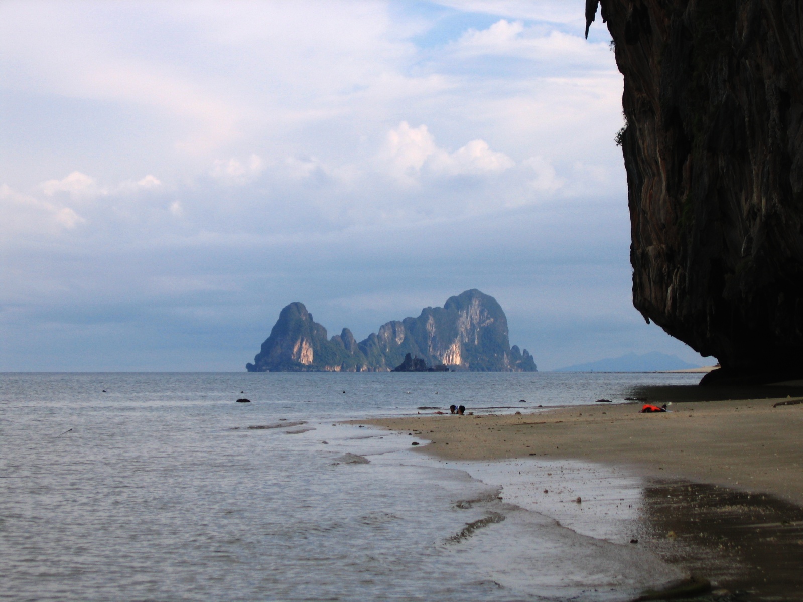
View of Ko Phetra from Ko Lao Liang NueaLocation Trang Province and Satun Province, Thailand Coordinates 6°51′0″N 99°32′0″E / 6.85°N 99.533333°ECoordinates: 6°51′0″N 99°32′0″E / 6.85°N 99.533333°E Area 494.38 km² Established 1984 Mu Ko Phetra is a marine national park in Andaman Sea side of Thailand, covering mostly intact coastal line, open water, and about 30 islands of southern part of Trang Province and northern part of Satun Province. Established on 31 December 1984, it is the 49th national park and 14th marine national park of Thailand.
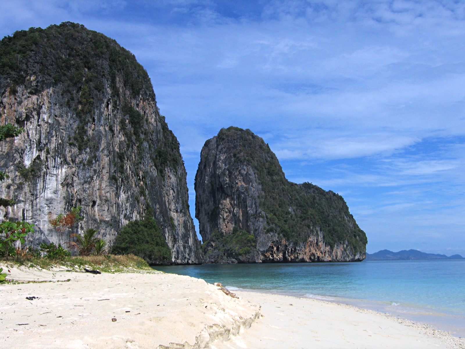
The majority of the park, about 94.74% or 468.38 km² out of 494.38 km² are open water. Two largest islands of the parks are Ko Phetra (Thai: เกาะเภตรา), where the name of the park is derived from, and Ko Khao Yai (Thai: เกาะเขาใหญ่). Several islands are the site where marine turtles lay eggs. Rich coral reef is also present around islands. Many of the islands consist of steep limestone rocks and little beaches. They are still used as temporary residence by fishermen during fishing season.
In the caves of the cliffs high above the ground in some of the islands are where swiftlets build their nest and breed. Several islands were placed under concession for decades to collect bird nests. They are highly valuable and closely guarded with firearms. Traveling to those islands should be done through local tour companies in the provinces as their boats are recognized and ignored by the guards.
The name Phetra is a Thai corruption of its original Malay name, Pulau Petra (the Island of Petra).
Contents
Trang islands
 Ko Lao Liang Tai
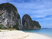
- Ko Lao Liang actually consists of two similar islands just 300 m in separation. The smaller northern-most island, Ko Lao Liang Nuea (Thai: เกาะเหลาเหลียงเหนือ) (also known as Ko Lao Liang Nong; Thai: เกาะเหลาเหลียงน้อง), and the larger island to the south, Ko Lao Liang Tai (Thai: เกาะเหลาเหลียงใต้) (also known as Ko Lao Liang Phi; Thai: เกาะเหลาเหลียงพี่). Both have rather small beaches and are under bird nest concession. Around the islands are shallow reefs for diving.
Satun islands
- Ko Phetra (Thai: เกาะเภตรา / Malay: Pulau Petra) is an island with odd-shaped cliffs. A bird nest concession island, surrounding sea is available for diving.
- Ko Lidi (Thai: เกาะลิดี / Malay: Pulau Lidi) is a rather big island with beach.
- Ko Khao Yai (Thai: เกาะเขาใหญ่), the biggest island with castle-like limestone rocks. Part of the island is the Ao Kam Poo (Thai: อ่าวก้ามปู) which is a 700 m wide bay with waterfall and stream. The bay is a site where sea turtles come to lay eggs.
- Ko Bulon (Thai: เกาะบุโหลน / Malay: Pulau Bulan), a beautiful island with clear water and corel reef. It is a popular tourism spot of the national park.
Satun beaches
- Rawai Beach (Thai: หาดราไว), not to be confused with another beach with the same name in Phuket Province, is a 3.5 km long beach on the mainland. It is also popular camping spot.
External links
- Mu Ko Petra National Park from National Park, Wildlife and Plant Conservation Department
- Mu Ko Petra National Park from Ministry of Defense (Thai only)
National parks, forest parks and wetlands in Thailand National parks Budo-Su-ngai Padi · Chiang Dao · Doi Inthanon · Erawan · Hat Khanom - Mu Ko Thale Tai · Kaeng Chet Khwae · Kaeng Krachan · Kaeng Krung · Kaeng Tana · Khao Phra Wihan · Khao Luang · Khao Sok · Khao Yai · Khlong Lan · Khlong Phanom · Khlong Wang Chao · Kui Buri · Mae Yom · Mae Wong · Nam Nao · Namtok Chat Trakan · Pa Hin Ngam · Pha Taem · Phu Chong-Na Yoi · Phu Hin Rong Kla · Phu Kradueng · Phu Toei · Phu Wiang · Ramkhamhaeng · Salawin · Si Phang-nga · Si Satchanalai · Tai Rom Yen · Thale Ban · Than Sadet-Ko Pha-Ngan · Thap Lan · Thung Salaeng Luang
Marine national parks Ao Phang Nga (Phang Nga Bay) · Hat Chao Mai · Hat Nai Yang · Hat Nopharat Thara-Mu Ko Phi Phi · Khao Laem Ya-Mu Ko Samet · Khao Sam Roi Yot · Laem Son · Mu Ko Ang Thong · Mu Ko Chang · Mu Ko Lanta · Mu Ko Phetra · Mu Ko Similan · Mu Ko Surin · Tarutao
Forest parks Wetlands Categories:- IUCN Category II
- National parks of Thailand
- Protected areas established in 1984
- Trang Province
- Satun Province
- Andaman Sea
Wikimedia Foundation. 2010.