- North Carolina Highway 4
-
- "NC 4" redirects here. For other uses, see NC 4 (disambiguation).
NC 4

Route information Maintained by NCDOT Length: 35 mi[1] (56 km) Existed: 1934[1] – present Major junctions South end:  US 301 near Rocky Mount
 I-95 near Rocky Mount
North end: 
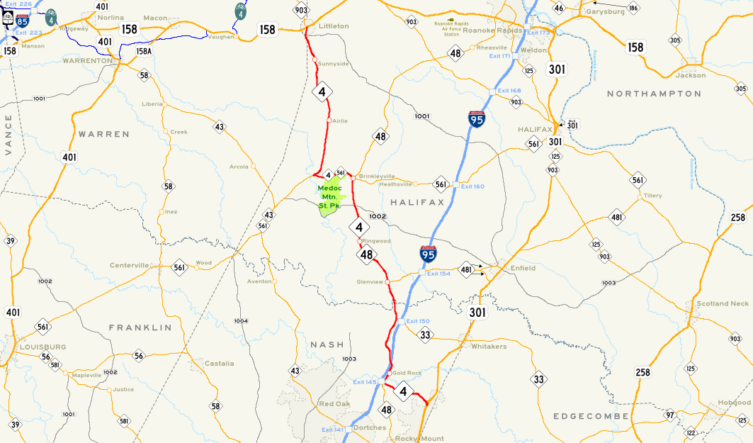
 US 158 / NC 903 in Littleton
Location Counties: Nash, Halifax, Warren Highway system ←  NC 3
NC 3NC 5  →
→NC 4 is a North Carolina state highway that is 34 miles (55 km) in length. Running near the Virginia border in Nash and Halifax counties, NC 4 connects the region with I-95.
Contents
Route description
The southern terminus of NC 4 is at US 301 near Rocky Mount. After heading west, NC 4 joins NC 48 near I-95 with exit/entrance ramps (exit 145); numerous hotels can be found here, built especially for I-95 travelers. After heading north for about 15 miles (24 km), NC 4 splits from NC 48 and joins NC 561 near Medoc Mountain State Park, heading west. After several miles, the road splits off and heads north for about 12 miles (19 km) before entering Littleton and ending at US 158/NC 903 downtown.
NC 4 is one of the more rural roads in this part of the state; before entering Littleton, there are no incorporated towns along the route. This section of the state is mainly farmland.
History
- 1934: As North Carolina renumbered its state highways, NC 4 was commissioned as a short state highway, running only a few miles from US 158 to the community of Airlie, just south of Littleton.
- 1951: NC 48 running from Airlie to Littleton is rerouted to the east, leaving NC 4 to take its place.
- 1984: NC 4 is extended southward, taking over parts of NC 561, NC 48, and the decommissioned I-95 Business to US 301. I-95 Business was intended to take traffic from US 301 to I-95, and NC 4 took over that role.[1]
See also
References
External links
Categories:- State highways in North Carolina

Wikimedia Foundation. 2010.