Devil's Path (Catskills)

Devil's Path (Catskills)
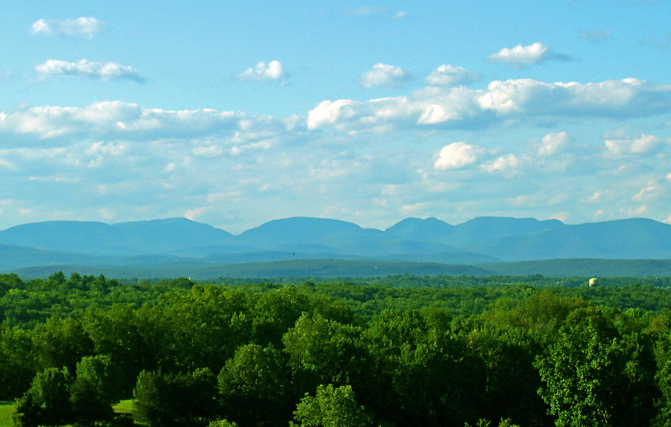
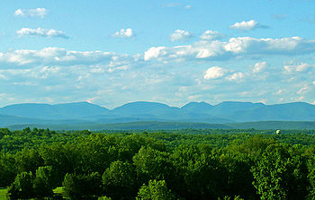
The Devil's Path, seen from the south. From left: Plateau, Sugarloaf, Twin and Indian Head. Overlook Mountain at right is not in the range.

The Devil's Path is the name of a mountain range and hiking trail in the Greene County portion of New York's Catskill Mountains. The mountains commonly considered to be part of the Devil's Path are, from west to east, West Kill, Hunter, Plateau, Sugarloaf, Twin, and Indian Head.

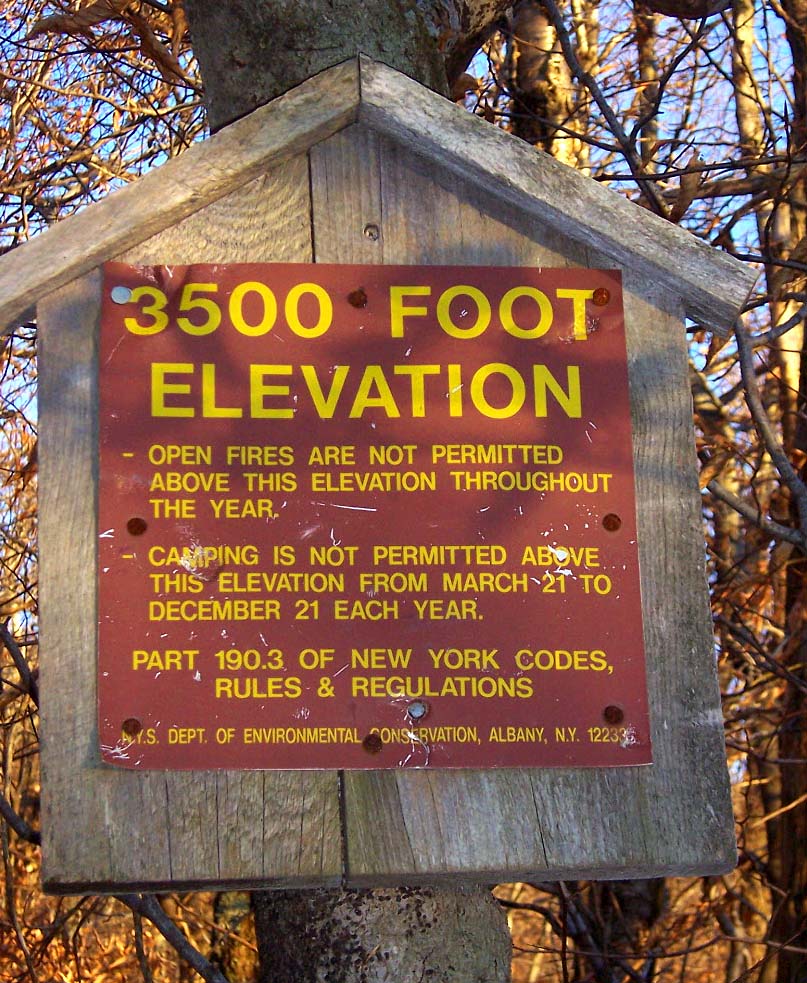
The name comes from early settlers of the region, who believed the range's craggy cliffs were specially built by the devil so that he alone could climb them and occasionally retreat from the world of men. Today, they are famous for the deep gaps between them, which get lower in elevation as the mountains between them get higher when proceeding westward on the hiking trail.

The mountains and the land around them were acquired by the state as Forest Preserve and made part of the Catskill Park in the 1920s and '30s. Today the area is managed by the New York State Department of Environmental Conservation as the Indian Head Wilderness Area.

External links


Wikimedia Foundation. 2010.

Игры ⚽ Нужна курсовая?

Look at other dictionaries:

  • Devil's Path — may refer to: Devil s Path (EP), by Norwegian black metal band Dimmu Borgir Devil s Path (Catskills), a mountain range in the Catskill Mountains of New York Devil s Path (hiking trail), a hiking trail over the above range This disambiguation page …   Wikipedia

  • Devil's Path (hiking trail) — Devil s Path A backpacker negotiates a rock chimney on Indian Head Mountain Length 24.2 miles (39km) Location Town of Hunter / Town of Lexington, Greene County, New York, U …   Wikipedia

  • Long Path — Infobox Hiking trail Name=Long Path Photo=Long Path sign.jpg Caption=Long Path mileage sign in Palisades Interstate Park Location=New Jersey and New York, United States Length=347.25mi; 559km Start/End Points=Fort Lee, New Jersey Indian Ladder… …   Wikipedia

  • Sugarloaf Mountain (Greene County, New York) — Infobox Mountain Name = Sugarloaf Mountain Photo = Caption = Elevation = convert|3810|ft|m| 1|lk=on [Summit elevation between 3,800 and 3,820 ft. ] Prominence = convert|1200|ft|m| 1|abbr=on [Key col elevation between 2,600 and 2,620 ft. ]… …   Wikipedia

  • Hunter Mountain (New York) — Infobox Mountain Name = Hunter Mountain Photo = Hunter Mountain from Black Dome.jpg Caption = Hunter Mountain from Black Dome to the north. Ski trails visible at right. Elevation = 4,040 feet ( 1,234 m) Location = New York, USA Range = Catskills… …   Wikipedia

  • Stony Clove Notch — Infobox Mountain Pass Name = Stony Clove Notch Photo = Stony Clove Notch.jpg Caption = Stony Clove Notch behind Notch Lake. Elevation = 2,220 feet (677 m) Location = New York, USA Range = Catskills Coordinates =… …   Wikipedia

  • Slide Mountain (Ulster County, New York) — Infobox Mountain Name = Slide Mountain Photo = Slide Mountain Catskills.jpg Caption = Slide Mountain from Ashokan High Point Elevation = 4,180 feet (1,277 m) Location = New York, USA Range = Catskills Prominence = 3,300 feet (1005 m) Coordinates …   Wikipedia

  • Kaaterskill High Peak — Infobox Mountain Name = Kaaterskill High Peak Photo = Kaaterskill High Peak.jpg Caption = Kaaterskill High Peak from southwest Elevation = 3,655 feet (1,114 m) Location = Catskills, New York, USA Range = Escarpment Prominence = 1,775 feet (541 m) …   Wikipedia

  • Catskill Park — Geobox|Protected Area name = Catskill Park native name = other name = category = New York Forest Preserve image caption = View to central Catskills from Twin Mountain image size = 300px country = USA state = New York region = Catskill Mountains… …   Wikipedia

  • Hunter Mountain Fire Tower — Infobox nrhp name = Hunter Mountain Fire Tower nrhp type = caption = Tower prior to renovations in 1999 location = Summit of Hunter Mountain, Town of Hunter, NY nearest city = Kingston lat degrees = 42 lat minutes = 10 lat seconds = 40 lat… …   Wikipedia

Share the article and excerpts

Direct link
Do a right-click on the link above
and select “Copy Link”