- Delmar Loop
-
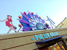 Pin-Up Bowl is a bowling alley located in the east section of the Loop
The Delmar Loop is an entertainment, cultural and restaurant district in University City, Missouri and the ajoining western edge of St. Louis, Missouri. Most of its attractions are located in the streetcar suburb of University City, but the area is expanding eastward into the Skinker-Debaliviere Neighborhood of the City of St. Louis proper. In 2007, the American Planning Association named the Delmar Loop "One of the 10 Great Streets in America."[1]
Contents
Origin
The area gets its name from a streetcar turnaround, or "loop", formerly located in the area.[2] Most of the attractions are on Delmar Boulevard, a major east-west thoroughfare that continues east to downtown St. Louis. A MetroLink light rail transit station is at the east side of the area. There are plans to build a 2.2-mile trolley line from the Loop to the Missouri History Museum in Forest Park.
Attractions
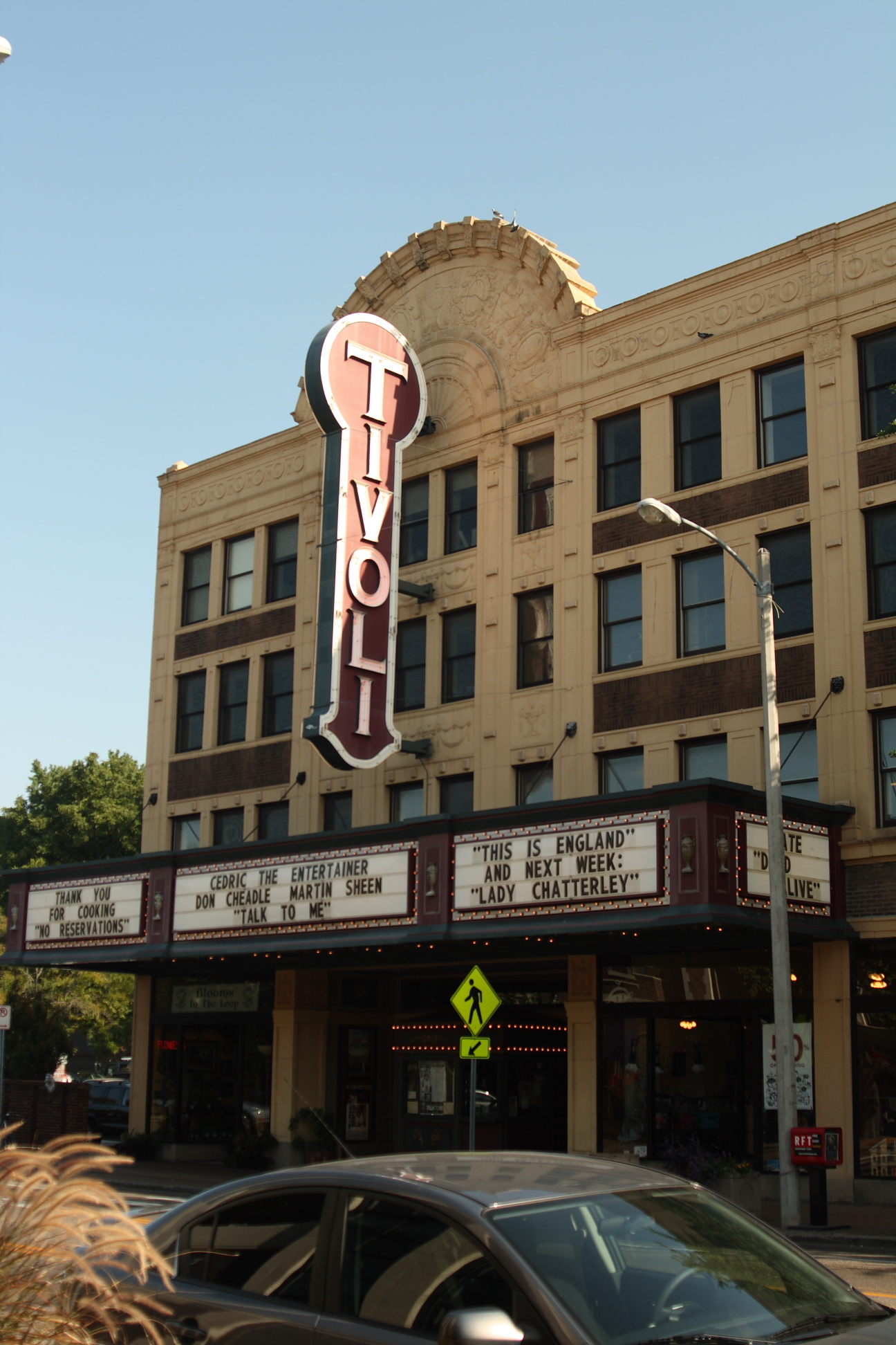
 The Tivoli Theatre is a three screen art house theater on the Delmar Loop
Major Loop institutions include: the Community Music School, owned by Washington University in St. Louis; the Craft Alliance, noted for its pottery studios and classes; the Riverfront Times; Vintage Vinyl; The Pageant Concert Nightclub; Tivoli Theater; Cicero's Italian Restaurant & Entertainment Venue; Fitz's Restaurant and Bottling Company; Star Clipper, the Eisner Award-winning comic book store; Brandt's Cafe and Red Carpet Lounge; Headz n Threadz clothing shop; the Melting Pot fondue restaurant; and Blueberry Hill, a pub and restaurant that served as the engine for the revival of the Loop beginning in the 1970s.
The Loop is the home of the St. Louis Walk of Fame, a series of brass plaques embedded in the sidewalk along Delmar Boulevard commemorating famous St. Louisans, including musicians Chuck Berry, Miles Davis and Tina Turner, John Goodman, Sheryl Crow, bridge-builder James Eads and sexologists Masters and Johnson.
Trolley
The Delmar Loop Trolley has plans in place for a 2.2-mile heritage fixed-track trolley line to come to the Delmar Loop which will link up to MetroLink and Forest Park attractions, a project that received a $24.9 million dollar grant from the Federal Transit Administration.[3]
The western demarcation of the Loop is generally considered to be the U. City Lions,[4][5] sculptures of a male lion and a male tiger on pedestals flanking Delmar immediately west of the University City City Hall. West of the lions, Delmar becomes largely residential. The eastern boundary of the Loop traditionally was the St. Louis City border, punctuated by The Delmar Lounge at the corner of Delmar and Eastgate, but the area began expanding into the city proper around 2000. This expansion has largely been due to the redevelopment efforts of Joe and Linda Edwards, owners of Blueberry Hill, The Pageant, and Pin-Up Bowl, and the Tivoli Theater, the Moonrise Hotel, and Eclipse Restaurant. The Saint Louis Regional Arts Commission completed its new headquarters on Delmar in 2003, creating performance and office spaces for theater groups. The Pageant, located across Delmar from the Arts Commission, has become one of St. Louis's main venues for mid-size popular musical performances, featuring rap, rock, and country artists, including Saint Louisans Chuck Berry and Nelly.
The Loop attracts an eclectic clientele and wide variety of street life, due in part to its proximity to Washington University and dating back to the late 1960s when Streetside Records and head shops dominated the retail landscape. Although the Loop is the natural "college town" area for nearby Washington University, few of the retail establishments and restaurants are primarily supported by college students.
Streets
The portion of Delmar Boulevard within the city of St. Louis has been designated Barack Obama Boulevard, making it one of the world's first streets to be renamed for the U.S. President.[6][7][8] Delmar thus runs from North Price Road at the tri-city border of Ladue, Olivette, and University City, downhill to the University City/St. Louis City boundary, at which point it becomes Barack Obama Boulevard (with another block of the Delmar Loop now sitting on the renamed portion in the city), which runs to North Tucker Street (a.k.a, 12th Street, briefly interrupted between Vandeventer and Grand at the VA hospital), at which point it becomes Convention Center Plaza.
History
During the 1950s, the Loop was the meeting place for U. City's teenagers. The Varsity Theater and the Tivoli showed first-run movies. Joe's Billiards which was located between the two theaters was always full of teenagers. There were restaurants up and down the Loop area. Enright Avenue, which was part of the streetcar turnaround, had a drug store and three restaurants plus a record store. There was another drug store on the corner of Delmar and Kingsland. Both drugstores had soda fountains. Delmar at Skinker wasn't considered part of the Loop but had a Garaveli's Restaurant and a well known nightclub Davy "Nose" Bold's across from it.[citation needed]
-
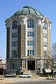
University City City Hall
-

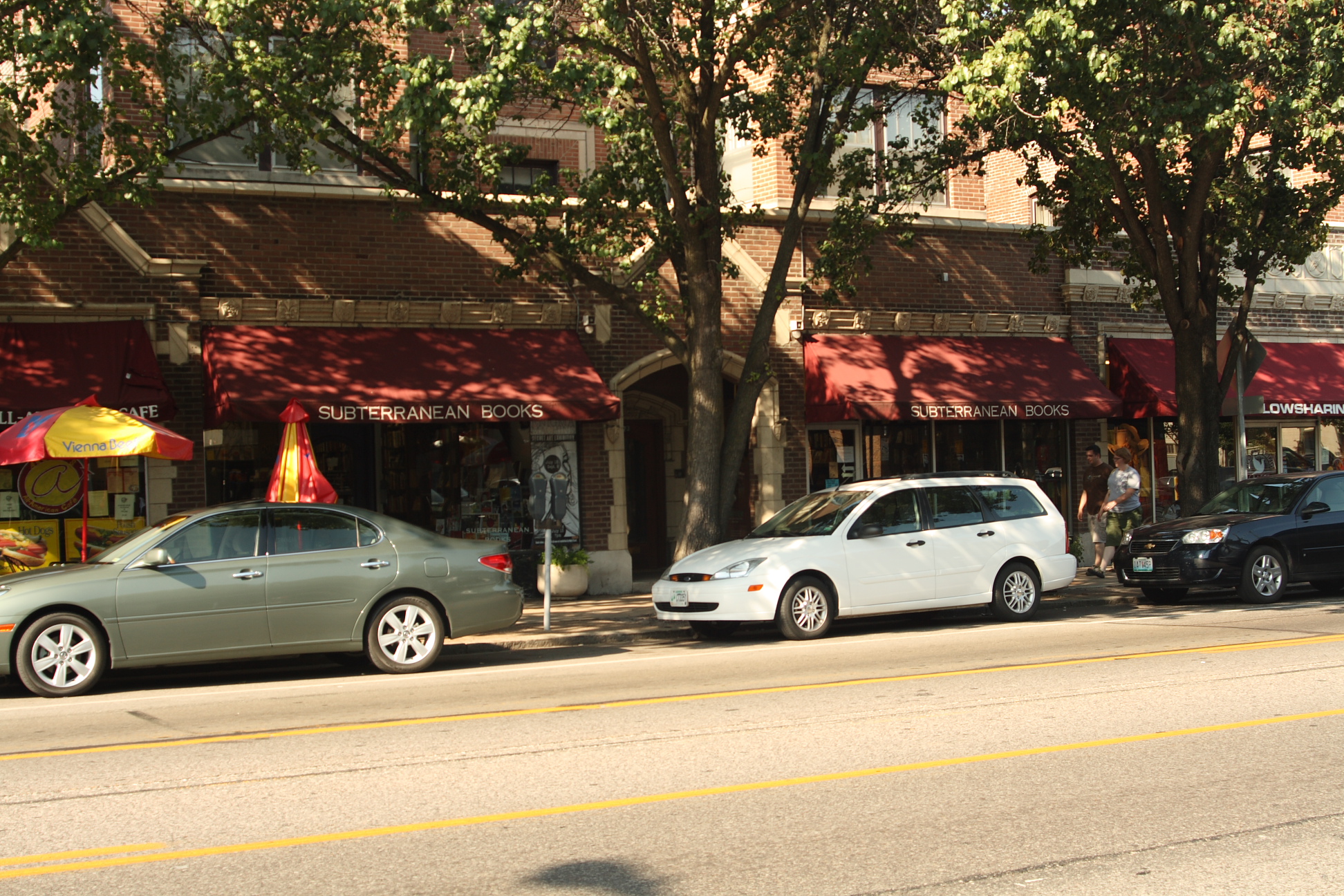
Subterranean Books
See also
- Streetcars in St. Louis
References
- ^ "APA's Great Streets 2007". Archived from the original on October 13, 2007. http://web.archive.org/web/20071013234319/http%3A//www.planning.org/greatplaces/streets/. Retrieved 2007-12-28.
- ^ Hoekstra, Dave (2010-01-10). "Thrown for a Loop in St. Louis' Delmar neighborhood". Chicago Sun-Times. http://www.suntimes.com/lifestyles/hoekstra/1981169,hoekstra-detours-st-louis-berry-delmar-011010.article.
- ^ Get in the Loop - St. Louis Business Journal
- ^ University City, MO : Lion statue at west end of the Delmar Loop photo, picture, image (Missouri) at city-data.com
- ^ University City, MO : Lion statue at west end of the Delmar Loop photo, picture, image (Missouri) at city-data.com
- ^ West End Word Road to change: Delmar to be designated Obama Boulevard (by Kara Krekeler - January 21, 2009)
- ^ http://www.stltoday.com/stltoday/news/stories.nsf/stlouiscitycounty/story/DEE572978AF1A2C78625754000182211?OpenDocument ST. LOUIS POST-DISPATCH St. Louis Board of Aldermen poised to approve Obama Boulevard, Jake Wagman 01/16/2009
- ^ Economist.com Obamaville, Dec 30th, 2008
External links
- Delmar Loop home page
- A blog/critique of certain aspects of the Loop, with photos
- Loop Trolley home page
Streets and highways of St. Louis Numbered Streets 1st St. • 2nd St. • 3rd St. • 4th St. • 5th St. • 6th St. • 7th St. • 8th St. • 9th St. • 10th St. • 11th St. • 12th St. • 13th St. • 14th St. • 15th St. • 16th St. • 17th St. • 18th St. • 19th St. • 20th St. • 21st St. • 22nd St. • 23rd St. • 24th St. • 25th St.Streets Arsenal St. • Bates St. • Biddle St. • Carr St. • Chestnut St. • Chippewa St. • Cole St. • Commercial St. • Delor St. • Germania St. • Hall St. • Itaska Street • Keokuk St. • La Salle St. • Locust St. • Market St. • Meramec St. • Miami St. • O'Fallon St. • Olive St. • Palm St. • Papin St. • Parnell St. • Pine St. • Salisbury St. • Sarah St. • Sidney St. • St. Charles St. • Thomas St. • Utah St. • Walnut St. • Wyoming St.Boulevards Leonor K. Sullivan Blvd. • Lacledes Landing Blvd. • Tucker Blvd. • Grand Blvd. • Kingshighway Bivd. • Delmar Blvd. • Lindell Blvd. • Page Blvd. • Lindbergh Blvd. • Union Blvd. • Skinker Blvd. • Brentwood Blvd. • Olive Blvd. • Midland Blvd. • Big Bend Blvd. • Goodfellow Blvd. • James S. McDonnell Blvd. • Lewis & Clark Blvd. • Holly Hills Blvd. • Wydown Blvd. • Forsyth Blvd. • Carondelet Blvd. • Christy Blvd. • W. Pine Blvd. • Shaw Blvd.Avenues Jefferson Ave. • St. Louis Ave. • W. Florissant Ave. • Manchester Ave. • Chouteau Ave. • Lucas Ave. • Clark Ave. • Hampton Ave. • Page Ave. • Vandeventer Ave. • Maryland Ave. • Compton Ave. • Euclid Ave. • Meramec Ave. • Cass Ave. • Newstead Ave. • DeBaliviere Ave. • Taylor Ave. • Park Ave. • Lafayette Ave. • Magnolia Ave. • Loughborough Ave. • Adelaide Ave. • Tower Grove Ave. • Frost Ave. • Dale Ave. • Southwest Ave. • Oakville Ave. • Kingsland Ave. • Clayton Ave. • Oakland Ave. • Laclede Ave. • Brannon Ave. • Jamieson Ave. • Nebraska Ave.Roads Natural Bridge Rd. • St. Charles Rock Rd. • Gravois Rd. • Missouri Bottom Road • Ladue Rd. • Clayton Rd. • Hanley Rd. • North & South Rd. • Lucas & Hunt Rd. • Jennings Station Rd. • New Ballas Rd. • Spoede Rd. • Halls Ferry Road • Old Halls Ferry Rd. • New Halls Ferry Rd. • Fee Fee Rd. • Airport Rd. • Old Bonhomme Rd. • Florissant Rd. • Big Bend Rd. • State Rd. • Morganford Rd. • Watson Rd. • MacKenzie Rd. • Tesson Ferry Rd. • Dunn Road • Chambers Rd. • Meramec Bottom Rd. • Brown Rd.Parkways, Drives, and Expressways Memorial Dr. • Delmar Loop • Forest Park Pkwy. • River Des Peres Pkwy • Dr. Martin Luther King Dr. • Riverview Dr. • Maryland Heights Expy • Earth City Expy • Truman Pkwy. • Chesterfield Pkwy. • Bermuda Dr.See also Streets and Highways of St. Louis, MissouriCoordinates: 38°39′20.61″N 90°18′9.51″W / 38.655725°N 90.3026417°W
Categories:- Greater St. Louis
- Culture of St. Louis, Missouri
- St. Louis County, Missouri
- Streets in St. Louis, Missouri
- Shopping districts and streets in the United States
- Entertainment districts
- Restaurant districts and streets
- Neighborhoods in St. Louis, Missouri
- Economy of St. Louis, Missouri
-

Wikimedia Foundation. 2010.