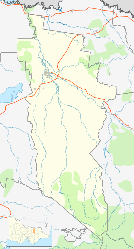
- Cheshunt, Victoria
-
Cheshunt
VictoriaPopulation: 200[1] Postcode: 3678 Location: - 231 km (144 mi) NW of Melbourne
- 59 km (37 mi) S of Wangaratta
- 31 km (19 mi) S of Moyhu
LGA: Rural City of Wangaratta State District: Benalla Federal Division: Indi Cheshunt is a small rural village situated in the King Valley in north-east Victoria, Australia. It is located about 50km from Wangaratta and is close to the Alpine National Park. At the 2006 census, Cheshunt and the surrounding area had a population of 200.[1]
Cheshunt Post Office opened on 2 August 1886. [2]
Golfers play at the course of the Whitfield and District Golf Club.[3]
References
- ^ a b Australian Bureau of Statistics (25 October 2007). "Cheshunt (State Suburb)". 2006 Census QuickStats. http://www.censusdata.abs.gov.au/ABSNavigation/prenav/LocationSearch?collection=Census&period=2006&areacode=SSC25335&producttype=QuickStats&breadcrumb=PL&action=401. Retrieved 2007-07-26.
- ^ Premier Postal History, Post Office List, https://www.premierpostal.com/cgi-bin/wsProd.sh/Viewpocdwrapper.p?SortBy=VIC&country=, retrieved 2008-04-11
- ^ Golf Select, Whitfield and District, http://www.golfselect.com.au/armchair/courseView.aspx?course_id=1123, retrieved 2009-05-11
External links
Towns in the Rural City of Wangaratta Categories:- Towns in Victoria (Australia)
- Victoria (Australia) geography stubs
Wikimedia Foundation. 2010.

