- Drighlington
-
Coordinates: 53°45′24″N 1°39′42″W / 53.756767°N 1.661639°W
Drighlington 
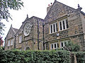
St Paul's Church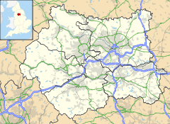
 Drighlington
Drighlington shown within West YorkshireOS grid reference SE2229 Metropolitan borough City of Leeds Metropolitan county West Yorkshire Region Yorkshire and the Humber Country England Sovereign state United Kingdom Post town BRADFORD Postcode district BD11 Dialling code 0113 Police West Yorkshire Fire West Yorkshire Ambulance Yorkshire EU Parliament Yorkshire and the Humber UK Parliament Morley and Outwood List of places: UK • England • Yorkshire Drighlington (pronounced /ˈdrɪɡlɪŋtən/) is a village and civil parish in the City of Leeds metropolitan district, West Yorkshire, England. The village lies 5 miles (9 km) south west of Leeds and 4 miles (6 km) south east of Bradford. The name of the village is often shortened to Drig.
Contents
Geographical
The village is at the junction of the A58 Leeds-Halifax road and the B6135 Tong to Gildersome Street road which used to be part of the A650 Bradford to Wakefield road. The junction is known as the Drighlington Crossroads. The A650 now bypasses Drighlington to the west of the village following part of the structure of what was the GNR railway line (from Bradford to Wakefield/London).
Political
Since local government changes in 1974, Drighlington has been in the City of Leeds metropolitan borough, in the metropolitan county of West Yorkshire. The village once formed part of the former Municipal Borough of Morley, and is still classed as part of Morley in the census.[citation needed] However, it is technically separate and is not governed by Morley Town Council. Since 2004, the village has a parish council.[1]
The metropolitan district includes many other towns and villages with their own clear identity, such as Morley and Otley as well as the city of Leeds. Drighlington is in the Morley North ward, which elects three councillors to Leeds City Council. Until the 2010 general election Drighlington was in the Morley and Rothwell parliamentary constituency, when it was transferred to the newly created constituency of Morley and Outwood. Drighlington has a Bradford postcode of "BD11" and the Royal Mail official address is "Drighlington, Bradford", while the village telephone numbers are "0113", the Leeds prefix.
Historically, Drighlington was in the West Riding of Yorkshire in the ancient parish of Birstall. The ecclesiastical parish of Drighlington was created in 1817. Drighlington was an urban district 1894-1937 and was part of Morley Municipal borough 1937-1974.[2] Drighlington was part of the Bradford Registration district from 1837–1891 and North Bierley Registration district from 1892-1937.[3]
History
The earliest mention of Drighlington is to be found in the Domesday Book where it is described as “Dreslin(g)tone", and its modern name is derived from this root. The old Roman road from York to Chester ran through the village
In 1576 Queen Elizabeth I granted Letters of Patent to one James Brooke allowing him to hold a market every second Thursday and two horse and cattle fairs annually. These fairs took place at the White Hart Public House (now demolished).
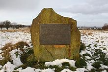
The village is also the site of the Battle of Adwalton Moor fought on 30 June 1643 in the First English Civil War between the armies of King Charles I and the Parliamentarians. The Royalist army under the Earl of Newcastle defeated that of Parliament under the command of Lord Ferdinando Fairfax and his son Sir Thomas. There are four commemorative stones with plaques depicting the battle at strategic points around the common and there is an information board on the wall of the community hall.
James Margetson was a native of Drighlington of humble origins who eventually became Archbishop of Armagh and Primate of All Ireland. He built the Drighlington Free Grammar School and he endowed the school to the extent of £60.00 a year, a significant sum in 1678. This school was superseded in 1875 by the Drighlington Board School.
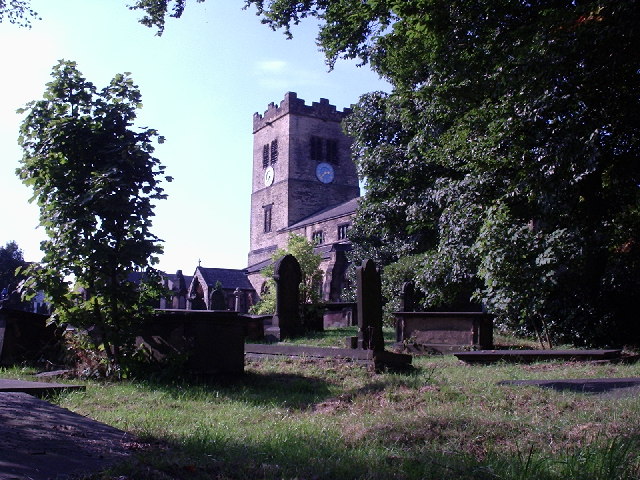
St Paul's Church was built in 1878 and the foundation stone was laid by the Lord of the Manor on 9 September 1876.
Gallery
-
Lumb Hall, 1640, built for the Brookes family
-

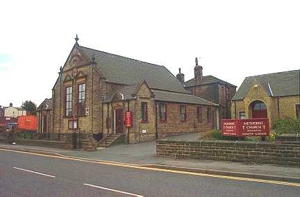
Methodist church in 2000
-

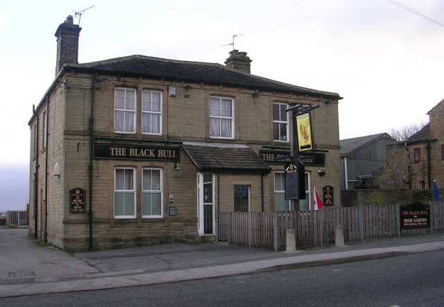
Black Bull in 2008
-

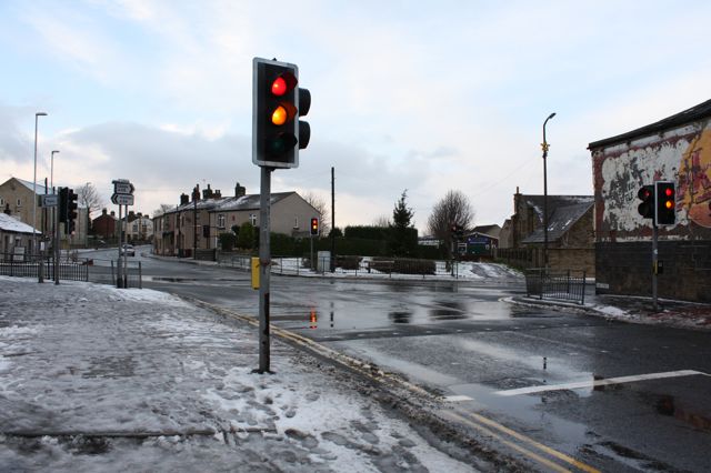
Drighlington crossroads in 2008
Community and amenities
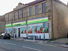 The Co-op
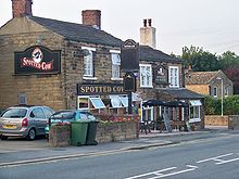 Spotted Cow.
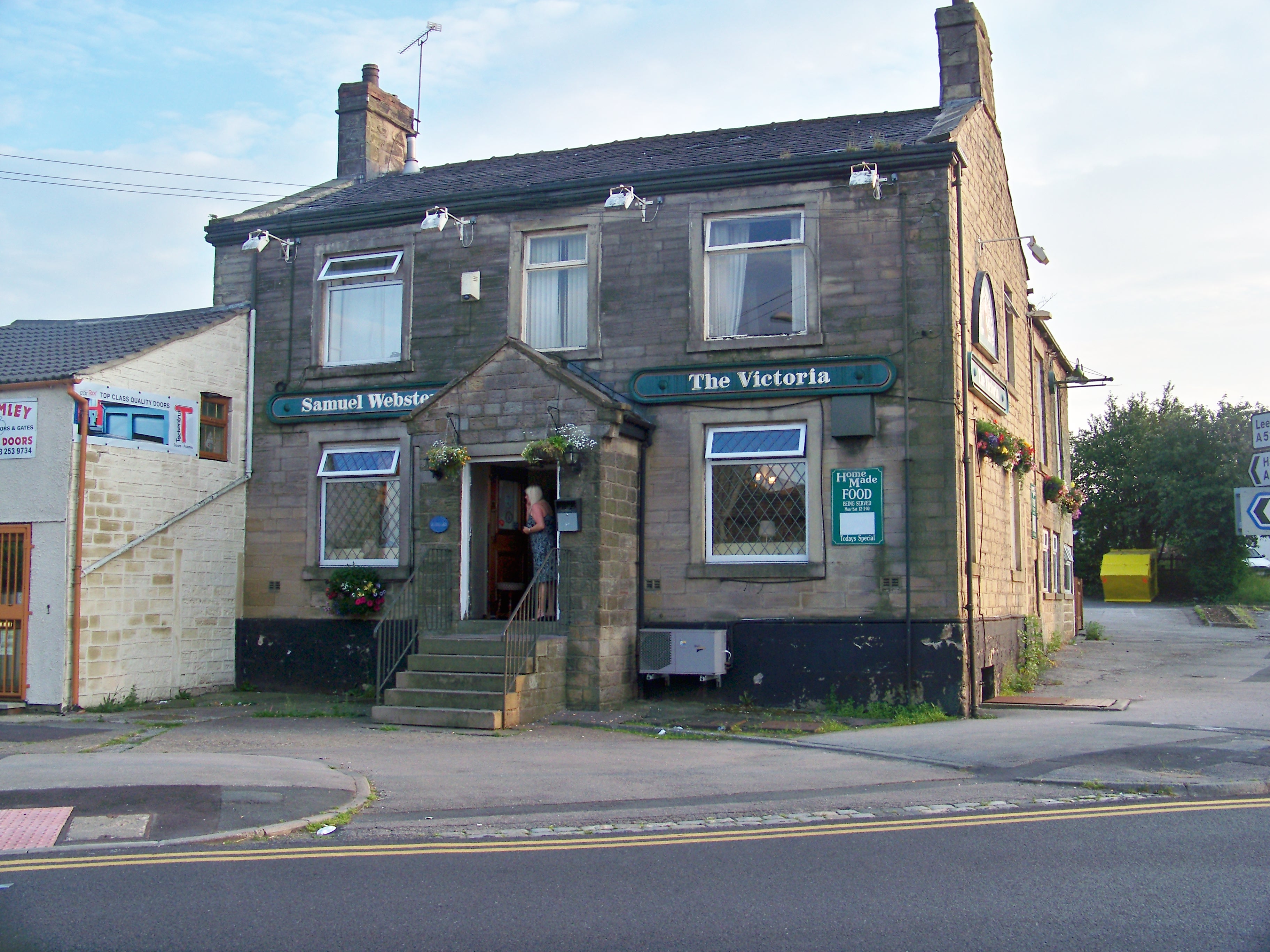
 The Victoria
In the village there are a few shops, a post office, a small library and community centre, numerous pubs and one school (Drighlington Primary School). Drighlington has football, rugby league and cricket teams, and a golf course called "The Manor". It also has Scout and Rainbows packs as well as a championship level contesting Brass Band and a youth band. There is also a new skate park and multi courts. The village also has a Co-operative branch, which is situated in the original Co-operative buildings, with the words Drighlington Industrial Co-operative Society embossed along the roofline.
Nearby amenities
The nearby town of Morley has many high street names trading in its town centre as well as an indoor market. There are two supermarkets in Morley, a Morrisons and an Asda, which are both often frequented by Drighlington residents. Morley also has a railway station, which offers rail links to Leeds city centre, Dewsbury, Huddersfield and Manchester. There is also a large 'out of town' shopping centre nearby: the White Rose Centre is a fully indoor shopping centre offering most high street brands as well as a supermarket and department stores. There are no secondary schools in Drighlington however there are three in neighbouring Morley and one in neighbouring Farnley, all of these are secular comprehensive schools.
Some of the social focal points in the village are the Adwalton Cricket Club, Tempest Constitutional Club, Drighlington Cricket Club and Drighlington Amateur Rugby League Club.
Public transport
The nearest suburban railway station is Morley, and the nearest mainline railway station is Leeds City railway station. The only public transport still available in the village is bus.
Company Route Destinations Arriva Yorkshire 209 Heckmondwike, Birstall, West Yorkshire Retail Park, Gildersome, Leeds city centre Arriva Yorkshire 225 Leeds city centre, Gomersal, Cleckheaton, Brighouse Arriva Yorkshire 254 Leeds city centre, Birkenshaw, Cleckheaton, Heckmondwike, Dewsbury, Wakefield Arriva Yorkshire 255 Leeds city centre, Birkenshaw, Cleckheaton, Halifax Location grid

Pudsey Birkenshaw 
Gildersome  Drighlington

Birstall References
- ^ "Bulletin of Changes to Local Authority Names in England: Orders made between 1 April 2003 and 31 March 2004". Office of the Deputy Prime Minister. October 2004. p. 8. http://www.communities.gov.uk/documents/localgovernment/pdf/151840.pdf. Retrieved 2009-10-04.
- ^ A vision of Britain through time. "Other units for your location (BD11 1EJ)". http://www.visionofbritain.org.uk/location_page.jsp?u_id=10057140&c_id=10001043&x_cord=422685&y_cord=428756&from=unit. Retrieved 2007-11-23.
- ^ GENUKI. "Bradford Registration District". http://www.ukbmd.org.uk/genuki/REG/districts/bradford.html. Retrieved 2007-11-23.
- ^ http://www.wymetro.com/BusTravel/bustimetables/200.htm
External links
- "The Ancient Parish of Birstall". GENUKI. http://www.genuki.org.uk/big/eng/YKS/WRY/Birstall/index.html. Retrieved 2007-10-29. Drighlington was in this parish
- Drighlington Parish Council
- Google Maps Street Map and Satellite Image
Categories:- Places in Leeds
- Civil parishes in West Yorkshire
-


Wikimedia Foundation. 2010.