- Neryungri
-
Neryungri (English)
Нерюнгри (Russian)- Inhabited locality - 
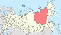
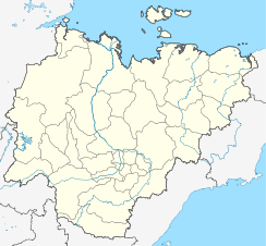
Location of the Sakha (Yakutia) Republic in RussiaCoordinates: 56°40′24″N 124°42′51″E / 56.67333°N 124.71417°ECoordinates: 56°40′24″N 124°42′51″E / 56.67333°N 124.71417°E Coat of arms Administrative status Country Russia Federal subject Sakha Republic Administrative center of —[citation needed] Statistics Area 93,000 km2 (36,000 sq mi)[citation needed] Population (2002 Census) 66,269 inhabitants[1] - Rank in 2002 238th Density 1 /km2 (2.6 /sq mi)[2] Founded 1975[citation needed] Postal code(s) 678960[citation needed] Dialing code(s) +7 41147[citation needed] Neryungri (Russian: Не́рюнгри; Sakha: Нүөрүҥгүрү, Nüörüŋgürü) is the second largest town in the Sakha Republic, Russia. Population: 66,269 (2002 Census);[1] 72,540 (1989 Census).[3]
Municipally, the town is incorporated as Neryungrinsky Municipal District (Нерюнгринский муниципальный район).
It was founded in 1975 due to the development of the nearby coal basin. The name "Neryungri" comes from the Evenk word for grayling.
It is the center of a large coal field discovered about 1970. It is on the Amur Yakutsk Mainline and the Lena Highway, 202 km by rail north of Tynda. Neraby, all in the coal basin, are Berkakit: 10 km south; Serebryany Bor: 8 km east with a thermal coal power plant; Chulman: 30 km north, with Chulman Airport; and a large open pit coal mine northwest across the Chulman River.
References
- ^ a b Федеральная служба государственной статистики (Federal State Statistics Service) (2004-05-21). "Численность населения России, субъектов Российской Федерации в составе федеральных округов, районов, городских поселений, сельских населённых пунктов – районных центров и сельских населённых пунктов с населением 3 тысячи и более человек (Population of Russia, its federal districts, federal subjects, districts, urban localities, rural localities—administrative centers, and rural localities with population of over 3,000)" (in Russian). Всероссийская перепись населения 2002 года (All-Russia Population Census of 2002). Federal State Statistics Service. http://www.perepis2002.ru/ct/doc/1_TOM_01_04.xls. Retrieved 2010-03-23.
- ^ The value of density was calculated automatically by dividing the 2002 Census population by the area specified in the infobox. Please note that this value may not be accurate as the area specified in the infobox does not necessarily correspond to the area of the entity proper or is reported for the same year as the population.
- ^ "Всесоюзная перепись населения 1989 г. Численность наличного населения союзных и автономных республик, автономных областей и округов, краёв, областей, районов, городских поселений и сёл-райцентров. (All Union Population Census of 1989. Present population of union and autonomous republics, autonomous oblasts and okrugs, krais, oblasts, districts, urban settlements, and villages serving as district administrative centers.)" (in Russian). Всесоюзная перепись населения 1989 года (All-Union Population Census of 1989). Demoscope Weekly (website of the Institute of Demographics of the State University—Higher School of Economics. 1989. http://demoscope.ru/weekly/ssp/rus89_reg.php. Retrieved 2010-03-23.
Athol Yates and NIcholas Zvegintzov, Siberian BAM Guide, 2001.
External links
- (Russian) Official website of Neryungrisky Municipal District
- (Russian) Unofficial website of Neryungri
Capital: Yakutsk  Aldan · Lensk · Mirny · Neryungri · Nyurba · Olyokminsk · Pokrovsk · Srednekolymsk · Tommot · Udachny · Verkhoyansk · Vilyuysk
 Categories:
- Cities and towns in the Sakha Republic
- Cities and towns built in the Soviet Union
- Populated places established in 1975
Wikimedia Foundation. 2010.


