- Dalmuir
-
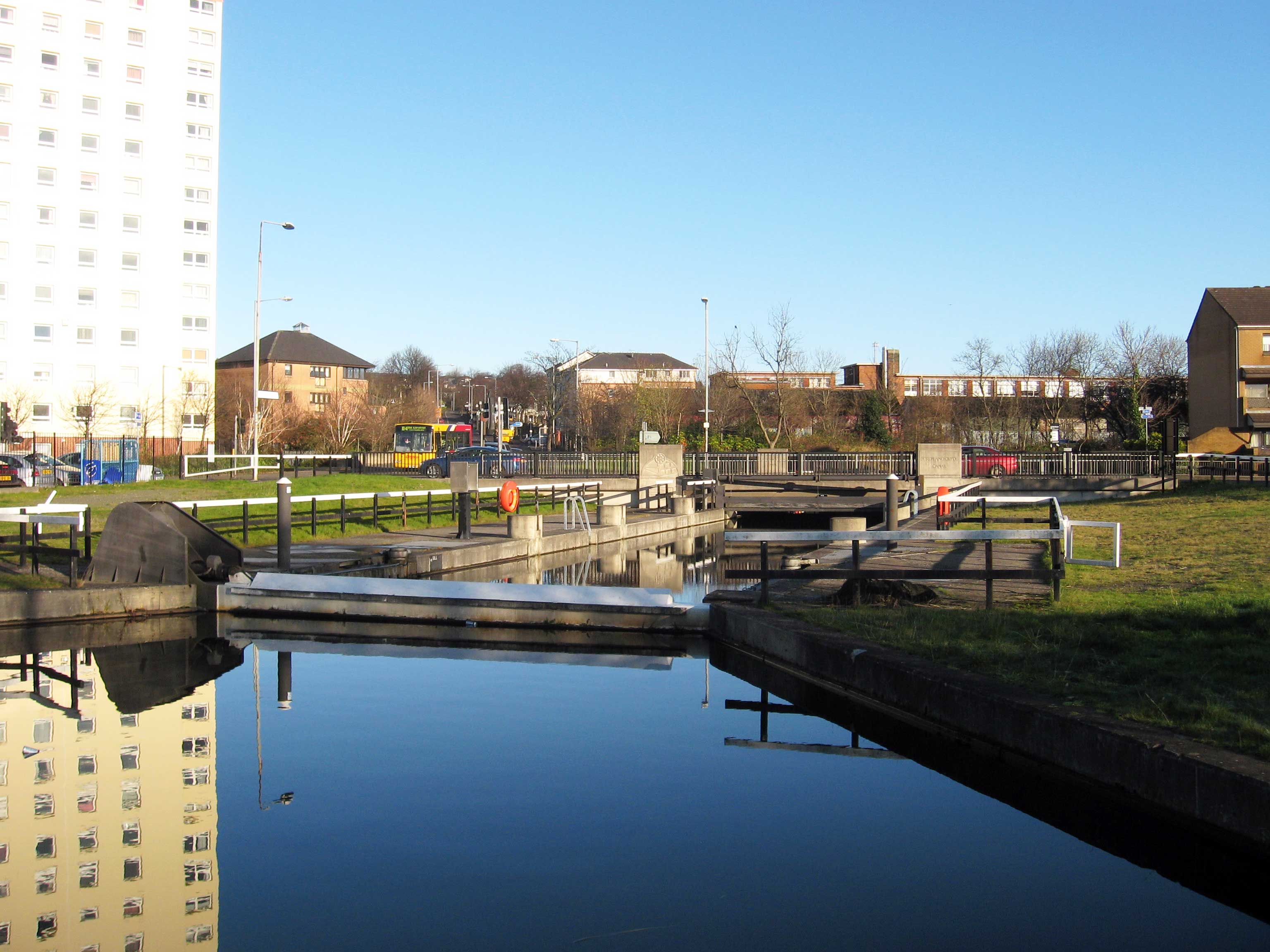
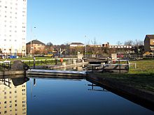 The Dalmuir drop lock is the first of its type, allowing boats on the Forth and Clyde Canal to go under the Dumbarton Road without stopping traffic.
'Dalmuir (Scottish Gaelic: Dail Mhoire) is an area on the western side of Clydebank, in West Dunbartonshire, Scotland.
Contents
Location
It is neighboured by the village of Old Kilpatrick, the Mountblow and Parkhall areas of Clydebank, as well as the town centre. It has a 5-platform railway station, Dalmuir railway station, on the North Clyde Line.
Its most well-known area is Dalmuir Park.
There are also a few pubs, including O'Kanes, and The Mountblow bar.
''==History== Before being annexed to the growing shipbuilding town of Clydebank, early Dalmuir was a town in its own right and host to Richard Collins' paper mill, which opened in 1747 on the banks of the Duntocher Burn.
The William Beardmore and Company shipbuilding and engineering works attracted a large population to settle in the area. Part of their former site has been developed for the Golden Jubilee Hospital and the accompanying Beardmore Hotel and Conference Centre. ''
Churches
Barclay Church Denomination Church of Scotland Administration Parish Dalmuir Presbytery Dumbarton Clergy Minister(s) Rev. Fiona E. Maxwell Dalmuir Barclay Church
Dalmuir Barclay Church is a congregation of the Church of Scotland, located in the Dalmuir area of Clydebank, a town in West Dunbartonshire, Scotland.
The first church was Dalmuir Parish Church in 1894. Initially, the congregation met in the old Masonic Hall but subsequently moved to a 500-seat hall (the "iron church") before moving again in 1903 to a new building on the corner of Dumbarton Road and Roberts Street. The next was Dalmuir West United Free Church, (later named Ross Memorial Church), which was established in 1906 and became Church of Scotland in 1929. It opened in 1915 but was destroyed during the Clydebank Blitz. A replacement was built in Kimberley Street in Mountblow in the early 1950s and renamed Dalmuir Overtoun. It united with Dalmuir Parish Church in 1976 and the old Parish Church building was acquired for the Roman Catholic Our Lady of Loretto Church. Dalmuir Overtoun then united with the Old Kilpatrick Barclay in 1990 to become Dalmuir Barclay Church and a new church was built close to the site of the original Ross Memorial on Dumbarton Road, now at 2 Durban Avenue.
St Stephen's Church Denomination Roman Catholic Website St Stephen's home page Administration Parish Dalmuir Diocese Diocese of Glasgow Clergy Priest(s) Fr. aiden martin === St Stephen's Church === St Stephen's Church is a Roman Catholic church, established in 1907. The original church was destroyed in the Clydebank Blitz and the magnificent new structure, with its prominent bell tower, which opened on the 28th of September 1958, was designed by the architect Thomas Cordiner.
Schools
- Our Lady of Loretto Catholic Primary School
- St. Stephen's Catholic Primary School
- Clydemuir Primary, non-denominational
- Dalmuir Primary, non-denominational
Categories:- West of Scotland geography stubs
- Villages in West Dunbartonshire
Wikimedia Foundation. 2010.