- Dalmuir railway station
-
Dalmuir 
Dail Mhoire 
The Yoker route platforms Location Place Dalmuir Local authority West Dunbartonshire Coordinates 55°54′43″N 4°25′37″W / 55.912°N 4.427°WCoordinates: 55°54′43″N 4°25′37″W / 55.912°N 4.427°W Operations Station code DMR Managed by First ScotRail Number of platforms 5 Live arrivals/departures and station information
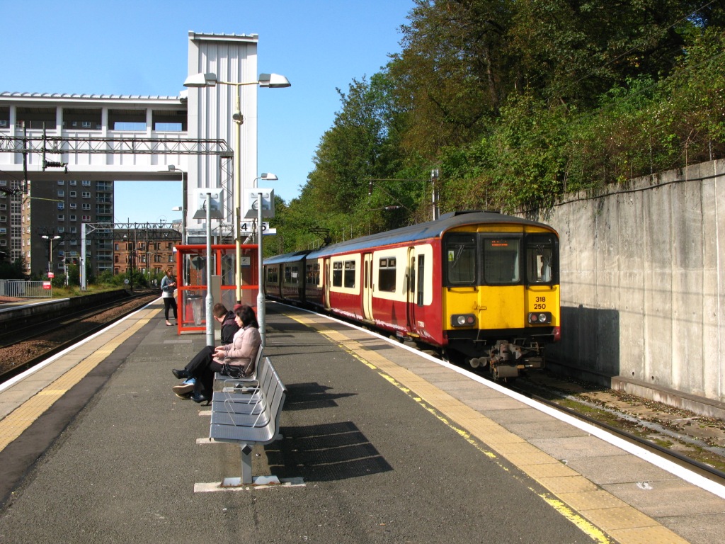
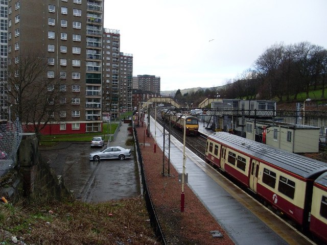
from National Rail EnquiriesAnnual rail passenger usage 2002/03 * 0.459 million 2004/05 * 0.536 million 2005/06 * 0.621 million 2006/07 * 0.623 million 2007/08 * 0.618 million 2008/09 * 0.888 million Passenger Transport Executive PTE SPT History Original company Glasgow, Dumbarton and Helensburgh Railway & Glasgow, Yoker and Clydebank Railway Pre-grouping North British Railway Post-grouping LNER National Rail - UK railway stations A B C D E F G H I J K L M N O P Q R S T U V W X Y Z * Annual passenger usage based on sales of tickets in stated financial year(s) which end or originate at Dalmuir from Office of Rail Regulation statistics. Please note: methodology may vary year on year. Dalmuir railway station is a railway station serving the Dalmuir area of Clydebank, West Dunbartonshire, Scotland. It is a large, five platform interchange between the Argyle Line, North Clyde Line and West Highland Line.
The station is very close to the Dalmuir drop lock on the Forth and Clyde Canal.
Contents
History
Station layout
There are four through platforms, two on the Yoker branch (on the former Glasgow, Yoker and Clydebank Railway), two on the Singer branch (on the former Glasgow, Dumbarton and Helensburgh Railway) and a bay platform from the Yoker branch constructed as part of the Argyle Line works in 1979. Trains terminating from the Singer branch reverse in a siding to the west of the station.
Services
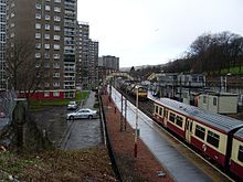 View from Duntocher Road
Passenger services are provided by First ScotRail on behalf of Strathclyde Partnership for Transport. Services provided at Dalmuir include terminating services, Helensburgh Central and Balloch; Eastbound include services via Glasgow Queen Street and Glasgow Central (Low Level).
Preceding station  National Rail
Following station Singer First ScotRail
Terminus Clydebank First ScotRail
Singer First ScotRail
Kilpatrick Clydebank First ScotRail
Glasgow Queen Street First ScotRail
West Highland LineDumbarton Central Westerton First ScotRail
Highland Caledonian SleeperHelensburgh Upper Historical railways Singer
Line and station openNorth British Railway
Kilpatrick
Line and station openSinger Works
Line partially open; station closedNorth British Railway
Clydebank
Line and station openNorth British Railway
Terminus References
- Awdry, Christopher (1990). Encyclopaedia of British Railway Companies. Sparkford: Patrick Stephens Ltd. ISBN 1-8526-0049-7. OCLC 19514063.
- Butt, R. V. J. (1995). The Directory of Railway Stations: details every public and private passenger station, halt, platform and stopping place, past and present (1st ed.). Sparkford: Patrick Stephens Ltd. ISBN 1-8526-0508-1. OCLC 60251199.
- Jowett, Alan (March 1989). Jowett's Railway Atlas of Great Britain and Ireland: From Pre-Grouping to the Present Day (1st ed.). Sparkford: Patrick Stephens Ltd. ISBN 1-8526-0086-1. OCLC 22311137.
- RAILSCOT on the Glasgow, Dumbarton and Helensburgh Railway
- RAILSCOT on the Glasgow, Yoker and Clydebank Railway
Categories:- Railway stations in West Dunbartonshire
- Former North British Railway stations
- Railway stations opened in 1897
- SPT railway stations
- Railway stations served by First ScotRail
- Scotland railway station stubs
Wikimedia Foundation. 2010.