- Anniesland railway station
Infobox UK station
name = Anniesland
other_name =
code = ANL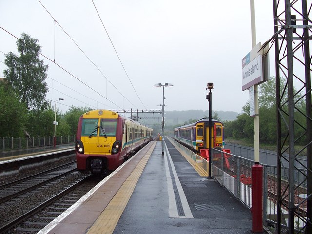
caption = Looking north with theMaryhill Line terminal platform on the right.
manager =First ScotRail
locale =Anniesland
borough =City of Glasgow
latitude = 55.889
longitude = -4.322
platforms = 3
pte = SPT
original =Stobcross Railway
pregroup =North British Railway
postgroup =London and North Eastern Railway
usage0203 = 0.526
usage0405 = 0.662
usage0506 = 0.775
usage0607 = 0.809
years = 20 October 1874
events = Station opened as Great Western Road
years1 = 9 January 1931
events1 = Station renamed AnnieslandAnniesland railway station is a
railway station that serves theAnniesland suburb ofGlasgow ,Scotland .The station is served by
First ScotRail as part of the SPT network.It is located on the
Argyle Line 6 km (3¾ miles) west of Glasgow Central (Low Level), on theNorth Clyde Line 7 km (4¼ miles) west of Glasgow Queen Street (Low Level), and is the terminus of theMaryhill Line 10 km (6¼ miles) away from Glasgow Queen Street (High Level).History
Opened by the
North British Railway , it became part of theLondon and North Eastern Railway during the Grouping of 1923. The station then passed on to theScottish Region of British Railways onnationalisation in 1948.When Sectorisation was introduced in the 1980's, the station was served by
ScotRail until the Privatisation of British Railways.ervices
There is a regular service daily from Anniesland to Glasgow Queen Street (Low Level) on the
North Clyde Line and to Glasgow Central (Low Level) on theArgyle Line .Destinations that are accessible from Anniesland are Balloch, Milngavie and
Dalmuir railway station westbound and Motherwell, Larkhall and Lanark on the Argyle Line and Airdrie and High Street (Glasgow) on the North Clyde Line eastbound.There is a half-hourly service from Anniesland on the
Maryhill Line to Glasgow Queen Street (High Level) via Maryhill Monday to Saturdays.rail line
next = Kelvindale
previous =
route =First ScotRail Maryhill Line
col = FF80C0rail line
next = Westerton
previous = Hyndland
route =First ScotRail Argyle Line
col = FF80C0rail line
next = Westerton
previous = Hyndland
route =First ScotRail North Clyde Line
col = FF80C0rail line
next = Maryhill
previous = Partickhill
route =North British Railway NBR light">
Stobcross Railway
col = NBR colour rail line
next = Westerton
previous = "connection to
Stobcross railway"
route =North British Railway NBR light">
Glasgow City and District Railway
col = NBR colour rail line
next = "connection to
Stobcross railway"
previous = Whiteinch Victoria Park
route =North British Railway NBR light">
Whiteinch Railway
col = NBR colour rail line
next = "connection to
Stobcross railway"
previous = Scotstounhill
route =North British Railway NBR light">
Glasgow, Yoker and Clydebank Railway
col = NBR colour
###@@@KEYEND@@@###ources
*
*
*
* [http://www.railbrit.co.uk/Glasgow_City_and_District_Railway/frame.htm RAILSCOT on Glasgow City and District Railway]
* [http://www.railbrit.co.uk/Glasgow_Yoker_and_Clydebank/frame.htm RAILSCOT on Glasgow, Yoker and Clydebank Railway]
* [http://www.railbrit.co.uk/Stobcross_Railway/frame.htm RAILSCOT on Stobcross Railway]
* [http://www.railbrit.co.uk/Whiteinch_Railway/frame.htm RAILSCOT on Whiteinch Railway]
Wikimedia Foundation. 2010.