- Clydebank railway station
-
Clydebank 
Location Place Clydebank Local authority West Dunbartonshire Coordinates 55°54′04″N 4°24′14″W / 55.901°N 4.404°WCoordinates: 55°54′04″N 4°24′14″W / 55.901°N 4.404°W Operations Station code CYK Managed by First ScotRail Number of platforms 2 Live arrivals/departures and station information
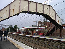
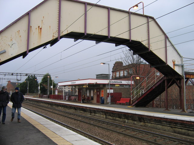
from National Rail EnquiriesAnnual rail passenger usage 2002/03 * 0.333 million 2004/05 * 0.345 million 2005/06 * 0.399 million 2006/07 * 0.389 million 2007/08 * 0.334 million 2008/09 * 0.441 million Passenger Transport Executive PTE SPT History Original company Glasgow, Yoker and Clydebank Railway Pre-grouping North British Railway Post-grouping LNER 1 December 1882 Opened[1][2] National Rail - UK railway stations A B C D E F G H I J K L M N O P Q R S T U V W X Y Z * Annual passenger usage based on sales of tickets in stated financial year(s) which end or originate at Clydebank from Office of Rail Regulation statistics. Please note: methodology may vary year on year. Clydebank railway station is a railway station serving the town of Clydebank in Scotland. It is located on the Argyle Line and the North Clyde Line. Passenger services are operated by First ScotRail on behalf of Strathclyde Partnership for Transport.
Contents
History
Services
2008
The station is staffed part-time and has two platforms on a high level. It is served by 4 to 6 trains per hour:
- Dalmuir to Lanark
- Dalmuir to Motherwell via Glasgow Central Low level
- Dalmuir to Springburn via Glasgow Queen Street Low level
- 1989 Drumgelloch station to Helensburgh Central (limited stop trains tend to only call in the evenings).
On a Sunday, trains stop every 30 minutes operating between Balloch and Motherwell.
Preceding station  National Rail
Following station Yoker First ScotRail
Dalmuir Yoker First ScotRail
Dalmuir Historical railways Yoker North British Railway
Dalmuir References
Notes
Sources
- Butt, R. V. J. (1995). The Directory of Railway Stations: details every public and private passenger station, halt, platform and stopping place, past and present (1st ed.). Sparkford: Patrick Stephens Ltd. ISBN 1-8526-0508-1. OCLC 60251199.
- Jowett, Alan (March 1989). Jowett's Railway Atlas of Great Britain and Ireland: From Pre-Grouping to the Present Day (1st ed.). Sparkford: Patrick Stephens Ltd. ISBN 1-8526-0086-1. OCLC 22311137.
- Jowett, Alan (2000). Jowett's Nationalised Railway Atlas (1st ed.). Penryn, Cornwall: Atlantic Transport Publishers. ISBN 0-9068-9999-0. OCLC 228266687.
- RAILSCOT on the Glasgow, Yoker and Clydebank Railway
Categories:- Railway stations in West Dunbartonshire
- Former North British Railway stations
- Railway stations opened in 1897
- Railway stations closed in 1917
- Railway stations opened in 1919
- SPT railway stations
- Railway stations served by First ScotRail
Wikimedia Foundation. 2010.