- Moyers, West Virginia
-
Moyers — Unincorporated community — Location within the state of West Virginia
 Moyers
Coordinates: 38°30′57″N 79°21′44″W / 38.51583°N 79.36222°WCoordinates: 38°30′57″N 79°21′44″W / 38.51583°N 79.36222°W Country United States State West Virginia County Pendleton Time zone Eastern (EST) (UTC-5) – Summer (DST) EDT (UTC-4) ZIP codes FIPS code GNIS feature ID Moyers is an unincorporated community in Pendleton County, West Virginia, USA. Moyers is located at the junction of County Routes 23 and 25.
Municipalities and communities of Pendleton County, West Virginia Town 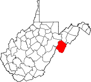
CDP Unincorporated
communitiesBrushy Run | Cave | Cherry Grove | Circleville | Dahmer | Deer Run | Dry Run | Entry | Fame | Fort Seybert | Harper | Judy Gap | Ketterman | Kline | Macksville | Miles | Mitchell | Moatstown | Monkeytown | Moyers | Mozer | Oak Flat | Oak Grove | Onego | Propstburg | Riverton | Ruddle | Seneca Rocks | Simoda | Sugar Grove | Teterton | Upper Tract | Zigler
Categories:- Potomac Highlands geography stubs
- Populated places in Pendleton County, West Virginia
- Unincorporated communities in West Virginia


Wikimedia Foundation. 2010.