- Dixon, New Mexico
-
 Dixon, New Mexico
Dixon is an unincorporated village located in Rio Arriba County in the U.S. state of New Mexico, on NM Highway 75, just east of NM Highway 68 in the north-central part of the state, at Latitude 36.20 & Longitude -105.89. The elevation of Dixon is 6028 feet (1837 meters) above sea level . It is on the banks of the Embudo River, a tributary of the Rio Grande, which it flows into two miles (3.2 km) down stream from Dixon. The population of around 1,500 is still predominately Hispanic, but many non-Hispanics have made their homes here since the mid 1960s. Here s an extensive collection of statistics about Dixon and its population, etc. .
The area was inhabited by Tiwa peoples from nearby Picuris Pueblo, then settled by Spanish colonists under the 1725 Embudo Land Grant. The original name was El Puerto del Embudo de Nuestro Señor San Antonio and the grant was made in 1725, to Francisco Martin, Lazaro Cordova and Juan Marquez. The acequias (irrigation canals) were the first public work project of any land grant, so they were started immediately after settlement, on Sept. 20, 1725 and there are 10 Historic Acequias with senior water rights on the Embudo River and one with junior water rights. On the Rio Grande there are two with senior rights and two with junior water rights.The aldea was known as San Antonio del Embudo until around 1900 when a post office was established and the name was changed to Dixon, reputedly to honor Collins Dixon, a school teacher who taught here in the late 19th century; one tradition has him being a Civil War army deserter; his descendents live around nearby Española.
Because of the temperate climate generated by the local topography and helped by the acequias (irrigation ditch system) set up by the Spanish around 1800, the Embudo Valley has become a significant fruit and grape growing area and the greater Dixon area boasts of several fine wineries, including the La Chiripada Winery and the Vivác Winery. About two miles (3 km) north of the town on NM Highway 75 rock and mineral collectors can visit the Harding Mine, a pegmatite mine donated to the University of New Mexico by Dr. Arthur Montgomery. Maps and release forms to visit the mine can be obtained at the University of New Mexico, Department of Earth and Planetary Sciences, or at the Dixon home of Gilbert Griego, mine caretaker, or at the Embudo Valley Library in Dixon.
The town is home to the largest population of organic farmers in the state, and is about 20 miles (30 km) southwest of Taos. Its zip code is 87527. The substantial number of artists and craft people living in the area led to the 1982 creation of the Dixon Studio Tour which annually draws many visitors during the two days in November that it occupies. There are several galleries in the area, including: Rift Gallery, Rare Earth Gallery and Metier Fine Handweaving and Craft. Annual summer stonecarving workshops are held at Southwest Stoneworks adjacent to Rift Gallery.
Dixon is home to the community supported Embudo Valley Library, radio station, KLDK-LP and the Dixon Community Food Co-op, and during the summer months the Dixon Farmer's Market, all of which serve the needs of the whole community. It also has a retreat center, at Mission Embudo, which offers space for workshops & retreats, as well as reasonably priced accommodation for visitors.
References
- Pearce, T.M., editor, New Mexico Place Names: A Geographical Dictionary, University of New Mexico Press, Albuquerque, NM 1965
- New Mexico Magazine - [1]
Coordinates: 36°11′55″N 105°53′19″W / 36.19861°N 105.88861°W
External links
Municipalities and communities of Rio Arriba County, New Mexico County seat: Tierra Amarilla City 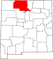
Village CDPs Alcalde | Chimayo‡ | Dulce | San Juan | Santa Clara Pueblo
Unincorporated
communitiesAbiquiú | Dixon | El Rito | Embudo | Hernandez | Navajo City | Ohkay Owingeh | Ojo Sarco | San Lorenzo | Tierra Amarilla | Truchas
Ghost towns Hopewell | Sublette
Indian reservation Footnotes ‡This populated place also has portions in an adjacent county or counties
Categories:- Unincorporated communities in New Mexico
- Populated places in Rio Arriba County, New Mexico


Wikimedia Foundation. 2010.